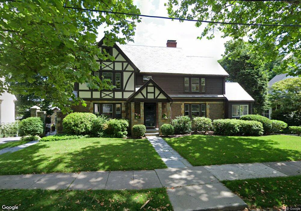
31 Alberta Rd Chestnut Hill, MA 02467
South Brookline NeighborhoodEstimated Value: $2,031,920 - $2,198,000
3
Beds
4
Baths
3,700
Sq Ft
$572/Sq Ft
Est. Value
About This Home
This home is located at 31 Alberta Rd, Chestnut Hill, MA 02467 and is currently estimated at $2,116,980, approximately $572 per square foot. 31 Alberta Rd is a home located in Norfolk County with nearby schools including Baker School, Dexter School, and Mount Alvernia Academy.
Ownership History
Date
Name
Owned For
Owner Type
Purchase Details
Closed on
Feb 24, 2006
Sold by
Gold Rosalyn B
Bought by
Lynch George W and Lynch Melissa H
Current Estimated Value
Home Financials for this Owner
Home Financials are based on the most recent Mortgage that was taken out on this home.
Original Mortgage
$750,000
Outstanding Balance
$423,869
Interest Rate
6.17%
Mortgage Type
Purchase Money Mortgage
Estimated Equity
$1,693,111
Create a Home Valuation Report for This Property
The Home Valuation Report is an in-depth analysis detailing your home's value as well as a comparison with similar homes in the area
Home Values in the Area
Average Home Value in this Area
Purchase History
| Date | Buyer | Sale Price | Title Company |
|---|---|---|---|
| Lynch George W | $975,000 | -- |
Source: Public Records
Mortgage History
| Date | Status | Borrower | Loan Amount |
|---|---|---|---|
| Open | Lynch George W | $750,000 |
Source: Public Records
Tax History Compared to Growth
Tax History
| Year | Tax Paid | Tax Assessment Tax Assessment Total Assessment is a certain percentage of the fair market value that is determined by local assessors to be the total taxable value of land and additions on the property. | Land | Improvement |
|---|---|---|---|---|
| 2025 | $18,875 | $1,912,400 | $775,600 | $1,136,800 |
| 2024 | $18,020 | $1,844,400 | $745,800 | $1,098,600 |
| 2023 | $17,759 | $1,781,200 | $604,800 | $1,176,400 |
| 2022 | $17,286 | $1,696,400 | $576,000 | $1,120,400 |
| 2021 | $15,904 | $1,622,900 | $553,800 | $1,069,100 |
| 2020 | $14,738 | $1,559,600 | $503,500 | $1,056,100 |
| 2019 | $13,917 | $1,485,300 | $479,500 | $1,005,800 |
| 2018 | $13,126 | $1,387,500 | $479,500 | $908,000 |
| 2017 | $13,066 | $1,322,500 | $452,300 | $870,200 |
| 2016 | $12,879 | $1,236,000 | $422,800 | $813,200 |
| 2015 | $12,336 | $1,155,100 | $395,100 | $760,000 |
| 2014 | $12,163 | $1,067,900 | $359,300 | $708,600 |
Source: Public Records
Map
Nearby Homes
- 1125 W Roxbury Pkwy
- 50 Bellingham Rd
- 72 Wallis Rd
- 91 Grove St
- 65 Lagrange St
- 83 Payson Rd
- 57 Broadlawn Park Unit 4B
- 44 Broadlawn Park Unit 22
- 64 Bryon Rd Unit 1
- 21 Westgate Rd Unit 6
- 42 Bryon Rd Unit 6
- 23 Westgate Rd Unit 6
- 138 Woodland Rd
- 10 Hackensack Terrace
- 206 Allandale Rd Unit 3C
- 109 Harwich Rd
- 232 Allandale Rd Unit 2D
- 303 Goddard Ave
- 14 Rolling Ln
- 701 Vfw Pkwy