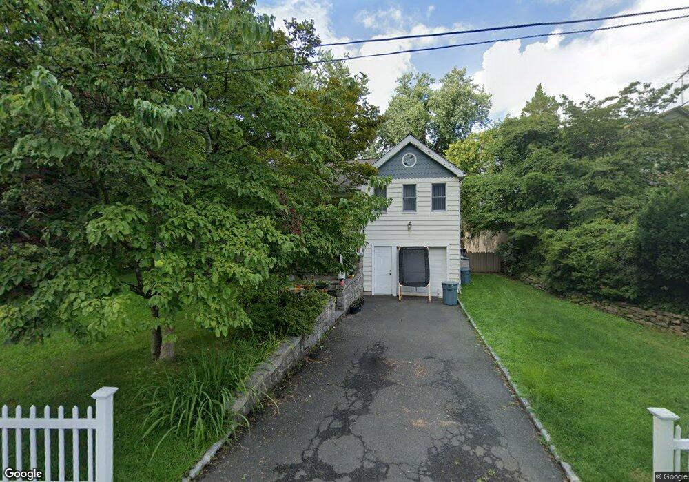
31 Brookside Ln Dobbs Ferry, NY 10522
Estimated Value: $971,000 - $1,157,000
Studio
--
Bath
2,291
Sq Ft
$478/Sq Ft
Est. Value
About This Home
This home is located at 31 Brookside Ln, Dobbs Ferry, NY 10522 and is currently estimated at $1,094,477, approximately $477 per square foot. 31 Brookside Ln is a home located in Westchester County with nearby schools including Springhurst Elementary School, Dobbs Ferry High School, and The Masters School.
Create a Home Valuation Report for This Property
The Home Valuation Report is an in-depth analysis detailing your home's value as well as a comparison with similar homes in the area
Home Values in the Area
Average Home Value in this Area
Tax History
| Year | Tax Paid | Tax Assessment Tax Assessment Total Assessment is a certain percentage of the fair market value that is determined by local assessors to be the total taxable value of land and additions on the property. | Land | Improvement |
|---|---|---|---|---|
| 2024 | $26,482 | $959,900 | $334,000 | $625,900 |
| 2023 | $24,783 | $847,500 | $298,000 | $549,500 |
| 2022 | $24,772 | $810,000 | $298,000 | $512,000 |
| 2021 | $19,574 | $800,600 | $318,100 | $482,500 |
| 2020 | $15,163 | $647,900 | $318,100 | $329,800 |
| 2019 | $20,884 | $647,900 | $318,100 | $329,800 |
| 2018 | $21,495 | $630,400 | $318,100 | $312,300 |
| 2017 | $2,640 | $607,100 | $318,100 | $289,000 |
| 2016 | $479,454 | $583,700 | $318,100 | $265,600 |
| 2015 | -- | $18,500 | $1,950 | $16,550 |
| 2014 | -- | $18,500 | $1,950 | $16,550 |
| 2013 | -- | $18,500 | $1,950 | $16,550 |
Source: Public Records
Map
Nearby Homes
- 0 Ashford Ave Unit KEY885130
- 16 Ogden Ave
- 0 Lyman Place Unit KEY923539
- 5 Forkland Ln
- 23 Bradley St
- 40 Northfield Ave
- 17 Manor House Dr Unit K 14
- 17 Manor House Dr Unit K13
- 14 Manor House Dr Unit G29
- 101 Beacon Hill Dr Unit 13
- 801 Hunters Run
- 70 Washington Ave
- 9 Round Hill Rd
- 118 Round Hill Rd
- 13 English Ln Unit B
- 110 Round Hill Rd Unit 77
- 41 Devoe St
- 16 Bramblebrook Rd
- 164 Washington Ave
- 520 Ashford Ave Unit 18
- 37 Brookside Ln
- 21 Brookside Ln
- 26 Hilldale Rd
- 39 Brookside Ln
- 22 Hilldale Rd
- 25 Briary Rd
- 18 Hilldale Rd
- 28 Brookside Ln
- 24 Brookside Ln
- 32 Brookside Ln
- 14 Hilldale Rd
- 15 Brookside Ln
- 36 Brookside Ln
- 20 Brookside Ln
- 11 Briary Rd
- 0 Hilldale Rd Unit 4607196
- 16 Brookside Ln
- 26 Briary Rd
- 10 Hilldale Rd
- 277 Ashford Ave
Your Personal Tour Guide
Ask me questions while you tour the home.