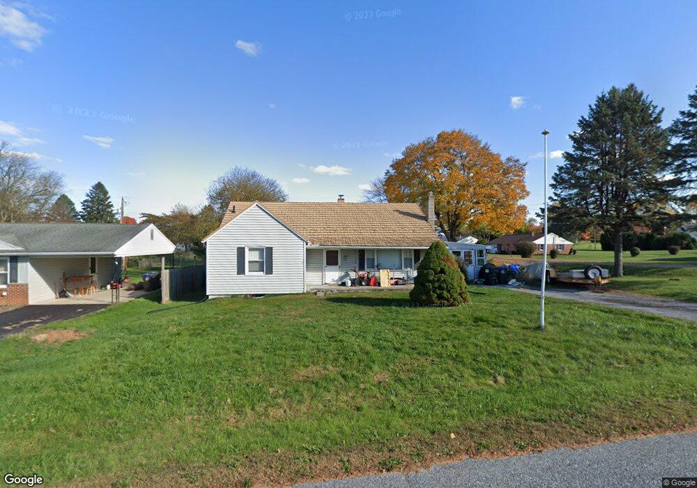
31 Carlton Ave Carlisle, PA 17013
Estimated Value: $142,000 - $240,000
2
Beds
1
Bath
1,272
Sq Ft
$166/Sq Ft
Est. Value
About This Home
This home is located at 31 Carlton Ave, Carlisle, PA 17013 and is currently estimated at $211,329, approximately $166 per square foot. 31 Carlton Ave is a home located in Cumberland County with nearby schools including W.G. Rice Elementary School, Yellow Breeches Middle School, and Boiling Springs High School.
Ownership History
Date
Name
Owned For
Owner Type
Purchase Details
Closed on
Dec 16, 2013
Sold by
Swank Jeffrey S and Swank Joanne C
Bought by
Swank Jeffrey S
Current Estimated Value
Purchase Details
Closed on
Nov 24, 2010
Sold by
Dorothy J
Bought by
Swank Jeffrey S
Home Financials for this Owner
Home Financials are based on the most recent Mortgage that was taken out on this home.
Original Mortgage
$109,155
Interest Rate
4.25%
Mortgage Type
New Conventional
Purchase Details
Closed on
May 26, 2004
Sold by
Rhoads Jane A
Bought by
Steele Dorothy J
Home Financials for this Owner
Home Financials are based on the most recent Mortgage that was taken out on this home.
Original Mortgage
$114,855
Interest Rate
5.88%
Mortgage Type
New Conventional
Create a Home Valuation Report for This Property
The Home Valuation Report is an in-depth analysis detailing your home's value as well as a comparison with similar homes in the area
Home Values in the Area
Average Home Value in this Area
Purchase History
| Date | Buyer | Sale Price | Title Company |
|---|---|---|---|
| Swank Jeffrey S | -- | -- | |
| Swank Jeffrey S | $115,900 | -- | |
| Steele Dorothy J | $120,900 | -- |
Source: Public Records
Mortgage History
| Date | Status | Borrower | Loan Amount |
|---|---|---|---|
| Previous Owner | Swank Jeffrey S | $109,155 | |
| Previous Owner | Steele Dorothy J | $114,855 |
Source: Public Records
Tax History Compared to Growth
Tax History
| Year | Tax Paid | Tax Assessment Tax Assessment Total Assessment is a certain percentage of the fair market value that is determined by local assessors to be the total taxable value of land and additions on the property. | Land | Improvement |
|---|---|---|---|---|
| 2025 | $2,433 | $142,900 | $39,700 | $103,200 |
| 2024 | $2,314 | $142,900 | $39,700 | $103,200 |
| 2023 | $2,155 | $142,900 | $39,700 | $103,200 |
| 2022 | $2,099 | $142,900 | $39,700 | $103,200 |
| 2021 | $2,009 | $142,900 | $39,700 | $103,200 |
| 2020 | $1,969 | $142,900 | $39,700 | $103,200 |
| 2019 | $1,932 | $142,900 | $39,700 | $103,200 |
| 2018 | $1,888 | $142,900 | $39,700 | $103,200 |
| 2017 | $1,738 | $142,900 | $39,700 | $103,200 |
| 2016 | -- | $142,900 | $39,700 | $103,200 |
| 2015 | -- | $142,900 | $39,700 | $103,200 |
| 2014 | -- | $142,900 | $39,700 | $103,200 |
Source: Public Records
Map
Nearby Homes
- 38 Kenwood Ave
- 1948 W Trindle Rd
- 315 James Rd
- 137 Sable Dr
- 121 Spruce St
- 27 S Spring Garden St
- 25 Army Heritage Dr
- 302 S Spring Garden St
- 0 E Baltimore St Unit PACB2048904
- Flynn Plan at Morgan's Crossing
- Richmond Plan at Morgan's Crossing
- 141 Army Heritage Dr Unit ANDERS
- 141 Army Heritage Dr Unit CARTER
- 141 Army Heritage Dr Unit MARLOW
- 141 Army Heritage Dr Unit DARBY
- 141 Army Heritage Dr Unit ANDOVER
- 141 Army Heritage Dr Unit ASHBY
- 141 Army Heritage Dr Unit CORBY
- 141 Army Heritage Dr Unit ELGIN
- 1020 Blackstone Run