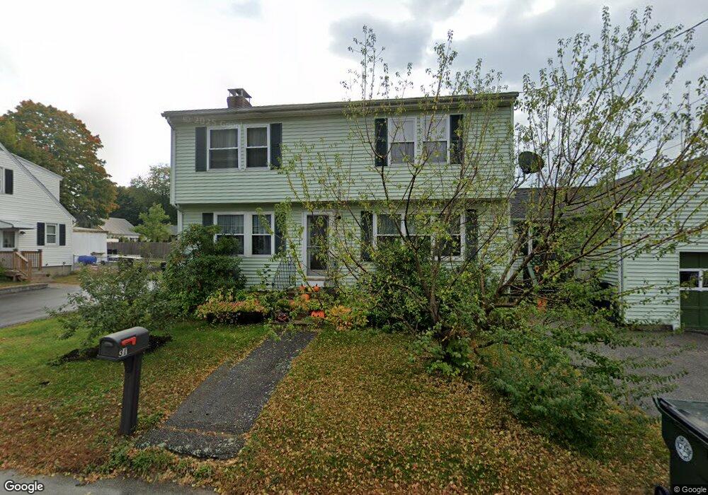
31 Dale St Manchester, NH 03103
Highlands NeighborhoodEstimated Value: $449,000 - $481,000
3
Beds
2
Baths
1,696
Sq Ft
$273/Sq Ft
Est. Value
About This Home
This home is located at 31 Dale St, Manchester, NH 03103 and is currently estimated at $463,369, approximately $273 per square foot. 31 Dale St is a home located in Hillsborough County with nearby schools including Highland-Goffes Falls School, Southside Middle School, and Manchester Memorial High School.
Ownership History
Date
Name
Owned For
Owner Type
Purchase Details
Closed on
Apr 22, 2009
Sold by
Anderson Kelly D and Anderson Pamela D
Bought by
Babin David and Babin Byron Amber
Current Estimated Value
Home Financials for this Owner
Home Financials are based on the most recent Mortgage that was taken out on this home.
Original Mortgage
$186,558
Interest Rate
4.93%
Mortgage Type
Purchase Money Mortgage
Purchase Details
Closed on
Aug 25, 2003
Sold by
Mcmahon Raymond J
Bought by
Anderson Kelly D and Anderson Pamela D
Home Financials for this Owner
Home Financials are based on the most recent Mortgage that was taken out on this home.
Original Mortgage
$204,300
Interest Rate
5.52%
Purchase Details
Closed on
Jun 2, 2003
Sold by
Morin Robert R
Bought by
Mcmahon Raymond J
Create a Home Valuation Report for This Property
The Home Valuation Report is an in-depth analysis detailing your home's value as well as a comparison with similar homes in the area
Home Values in the Area
Average Home Value in this Area
Purchase History
| Date | Buyer | Sale Price | Title Company |
|---|---|---|---|
| Babin David | $190,000 | -- | |
| Anderson Kelly D | $227,000 | -- | |
| Mcmahon Raymond J | $140,000 | -- |
Source: Public Records
Mortgage History
| Date | Status | Borrower | Loan Amount |
|---|---|---|---|
| Open | Mcmahon Raymond J | $185,157 | |
| Closed | Mcmahon Raymond J | $186,558 | |
| Previous Owner | Mcmahon Raymond J | $204,300 |
Source: Public Records
Tax History Compared to Growth
Tax History
| Year | Tax Paid | Tax Assessment Tax Assessment Total Assessment is a certain percentage of the fair market value that is determined by local assessors to be the total taxable value of land and additions on the property. | Land | Improvement |
|---|---|---|---|---|
| 2024 | $6,142 | $313,700 | $94,700 | $219,000 |
| 2023 | $5,916 | $313,700 | $94,700 | $219,000 |
| 2022 | $5,722 | $313,700 | $94,700 | $219,000 |
| 2021 | $5,546 | $313,700 | $94,700 | $219,000 |
| 2020 | $5,467 | $221,700 | $65,300 | $156,400 |
| 2019 | $5,392 | $221,700 | $65,300 | $156,400 |
| 2018 | $5,250 | $221,700 | $65,300 | $156,400 |
| 2017 | $5,170 | $221,700 | $65,300 | $156,400 |
| 2016 | $5,130 | $221,700 | $65,300 | $156,400 |
| 2015 | $5,019 | $214,100 | $65,300 | $148,800 |
| 2014 | $5,031 | $214,100 | $65,300 | $148,800 |
| 2013 | $4,854 | $214,100 | $65,300 | $148,800 |
Source: Public Records
Map
Nearby Homes
- 145 Fox St
- 67 Murphy St
- 545 Calef Rd Unit 26
- 106 Beech Hill Ave Unit 6
- 700 S Beech St
- 112 Riverdale Ave
- 109 Purchase St
- 161 Flint St
- 202 Mitchell St
- 35 W Mitchell St
- 60 W Elmwood Ave
- 412 W Mitchell St
- 87 Harrington Ave
- 29 Pebble Beach Dr
- 15 Spyglass Point Cir
- 20 Pebble Beach Dr Unit 22-89-20
- 80 Billings St
- 56 Robert Ct Unit H
- 33 W Elmhurst Ave Unit B
- 47 Rosedale Ave