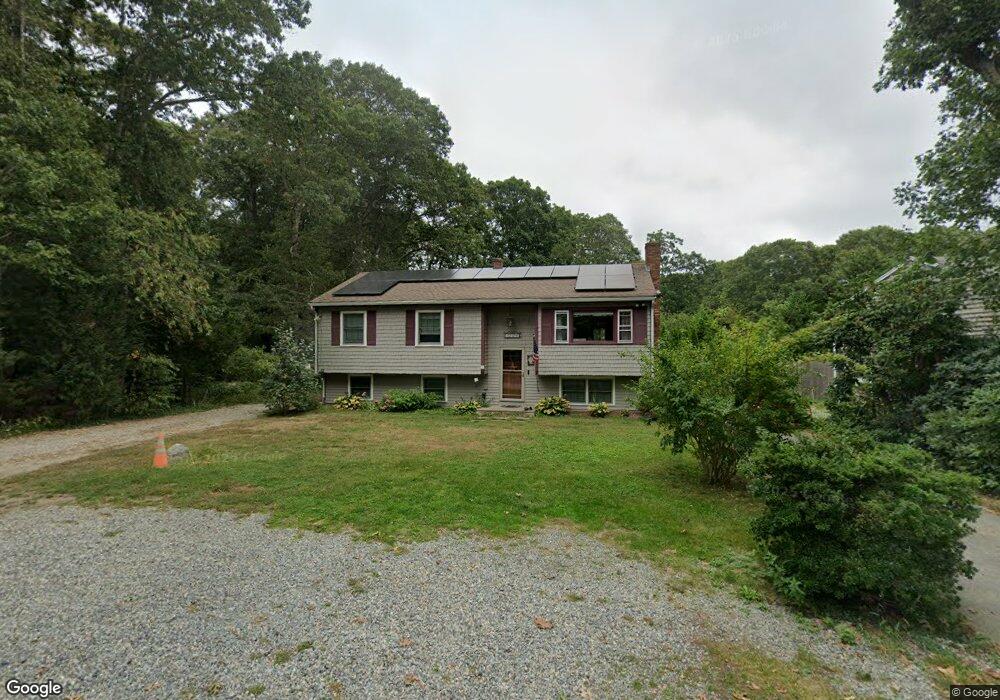
31 Deepwood Dr East Falmouth, MA 02536
Hatchville NeighborhoodEstimated Value: $558,000 - $625,000
3
Beds
1
Bath
1,501
Sq Ft
$396/Sq Ft
Est. Value
About This Home
This home is located at 31 Deepwood Dr, East Falmouth, MA 02536 and is currently estimated at $594,986, approximately $396 per square foot. 31 Deepwood Dr is a home located in Barnstable County with nearby schools including Mullen-Hall School, Morse Pond School, and Lawrence School.
Ownership History
Date
Name
Owned For
Owner Type
Purchase Details
Closed on
Jun 9, 2022
Sold by
Zaino Frank P and Zaino Rachel M
Bought by
Zj Ft and Zaino
Current Estimated Value
Purchase Details
Closed on
Jun 1, 1995
Sold by
Harris Richard A and Harris Dorothy M
Bought by
Zaino Frank P and Zaino Rachel M
Create a Home Valuation Report for This Property
The Home Valuation Report is an in-depth analysis detailing your home's value as well as a comparison with similar homes in the area
Home Values in the Area
Average Home Value in this Area
Purchase History
| Date | Buyer | Sale Price | Title Company |
|---|---|---|---|
| Zj Ft | -- | None Available | |
| Zj Ft | -- | None Available | |
| Zaino Frank P | $105,000 | -- | |
| Zaino Frank P | $105,000 | -- |
Source: Public Records
Mortgage History
| Date | Status | Borrower | Loan Amount |
|---|---|---|---|
| Previous Owner | Zaino Frank P | $237,569 | |
| Previous Owner | Zaino Frank P | $175,000 |
Source: Public Records
Tax History Compared to Growth
Tax History
| Year | Tax Paid | Tax Assessment Tax Assessment Total Assessment is a certain percentage of the fair market value that is determined by local assessors to be the total taxable value of land and additions on the property. | Land | Improvement |
|---|---|---|---|---|
| 2025 | $3,136 | $534,200 | $144,300 | $389,900 |
| 2024 | $3,102 | $494,000 | $136,700 | $357,300 |
| 2023 | $2,782 | $402,000 | $136,700 | $265,300 |
| 2022 | $2,820 | $350,300 | $103,000 | $247,300 |
| 2021 | $2,701 | $317,800 | $98,600 | $219,200 |
| 2020 | $2,653 | $308,800 | $89,600 | $219,200 |
| 2019 | $2,402 | $280,600 | $89,600 | $191,000 |
| 2018 | $2,408 | $277,700 | $89,600 | $188,100 |
| 2017 | $2,309 | $270,700 | $89,600 | $181,100 |
| 2016 | $2,266 | $270,700 | $89,600 | $181,100 |
| 2015 | $2,217 | $270,700 | $89,600 | $181,100 |
| 2014 | $2,230 | $273,600 | $94,300 | $179,300 |
Source: Public Records
Map
Nearby Homes
- 68 Deepwood Dr
- 17 Pinewood Dr
- 25 Harris Hill Rd
- 70 Meredith Dr
- 100 Tanglewood Dr
- 59 Whitecaps Dr
- 590 Sandwich Rd
- 66 Braxton Rd
- 32 Jamie Ln
- 12 Rock Hollow Dr
- 273 Sandwich Rd
- 149 Brick Kiln Rd
- 130 Old Barnstable Rd
- 33 John Parker Rd
- 12 Beach Plum Path
- 3 Viber Ln
- 35 Old Barnstable Rd
- 25 Percival Rd
- 49 Broken Bow Ln
- 27 Deepwood Dr
- 23 Deepwood Dr
- 25 Deepwood Dr
- 41 Deepwood Dr
- 28 Clearwater Dr
- 32 Clearwater Dr
- 34 Deepwood Dr
- 17 Deepwood Dr
- 40 Deepwood Dr
- 45 Deepwood Dr
- 24 Deepwood Dr
- 21 Greenwood St
- 38 Clearwater Dr
- 15 Deepwood Dr
- 24 Clearwater Dr
- 22 Deepwood Dr
- 49 Deepwood Dr
- 48 Deepwood Dr
- 18 Deepwood Dr
- 42 Clearwater Dr