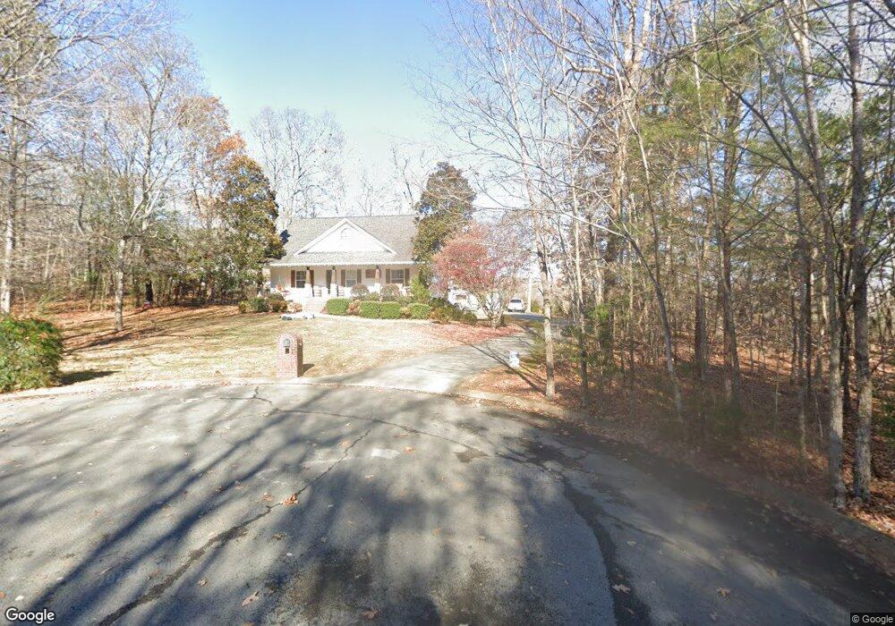
31 Emily St Unit 52 Dunlap, TN 37327
Estimated Value: $409,621 - $504,000
3
Beds
3
Baths
2,583
Sq Ft
$177/Sq Ft
Est. Value
About This Home
This home is located at 31 Emily St Unit 52, Dunlap, TN 37327 and is currently estimated at $456,905, approximately $176 per square foot. 31 Emily St Unit 52 is a home located in Sequatchie County with nearby schools including Griffith Elementary School, Sequatchie County Middle School, and Sequatchie County High School.
Ownership History
Date
Name
Owned For
Owner Type
Purchase Details
Closed on
Feb 22, 2019
Sold by
Broughton Rebecca Ann
Bought by
Broughton Johnny A
Current Estimated Value
Purchase Details
Closed on
May 5, 2017
Sold by
Dildine Jason M
Bought by
Broughton Johnny and Broughton Rebecca
Home Financials for this Owner
Home Financials are based on the most recent Mortgage that was taken out on this home.
Original Mortgage
$231,800
Outstanding Balance
$192,770
Interest Rate
4.1%
Mortgage Type
New Conventional
Estimated Equity
$264,135
Purchase Details
Closed on
Jul 9, 2002
Sold by
Sprouse Larry R
Bought by
Dildine Jason M and Dildine Jessica
Purchase Details
Closed on
Sep 7, 1990
Bought by
Mills Dennis Sprouse Larry R
Create a Home Valuation Report for This Property
The Home Valuation Report is an in-depth analysis detailing your home's value as well as a comparison with similar homes in the area
Home Values in the Area
Average Home Value in this Area
Purchase History
| Date | Buyer | Sale Price | Title Company |
|---|---|---|---|
| Broughton Johnny A | -- | None Available | |
| Broughton Johnny | $244,000 | -- | |
| Dildine Jason M | $18,000 | -- | |
| Mills Dennis Sprouse Larry R | $840,000 | -- |
Source: Public Records
Mortgage History
| Date | Status | Borrower | Loan Amount |
|---|---|---|---|
| Open | Broughton Johnny | $231,800 |
Source: Public Records
Tax History Compared to Growth
Tax History
| Year | Tax Paid | Tax Assessment Tax Assessment Total Assessment is a certain percentage of the fair market value that is determined by local assessors to be the total taxable value of land and additions on the property. | Land | Improvement |
|---|---|---|---|---|
| 2024 | $1,746 | $95,075 | $8,750 | $86,325 |
| 2023 | $1,746 | $95,075 | $8,750 | $86,325 |
| 2022 | $1,438 | $58,875 | $7,800 | $51,075 |
| 2021 | $1,438 | $58,875 | $7,800 | $51,075 |
| 2020 | $1,438 | $58,875 | $7,800 | $51,075 |
| 2019 | $1,438 | $58,875 | $7,800 | $51,075 |
| 2018 | $1,438 | $58,875 | $7,800 | $51,075 |
| 2017 | $1,403 | $57,450 | $7,800 | $49,650 |
| 2016 | $1,218 | $47,400 | $7,800 | $39,600 |
| 2015 | $1,218 | $47,400 | $7,800 | $39,600 |
| 2014 | $1,218 | $47,400 | $7,800 | $39,600 |
Source: Public Records
Map
Nearby Homes
- 235 Big Cedar Dr
- 76 Big Cedar Dr
- 30 Big Cedar Dr
- 0 Madison Dr Unit 1510956
- 0 Bill Pope Dr
- 1 Old Highway 28
- 19 Lower Brow Rd
- 16 Old State Hwy 28
- 0 Old Highway 28
- 500 Old Highway 28
- 91 Hidden View Dr
- 91 Lightning Ln
- 361 River Dr
- 100 River Dr
- 125 River Dr
- 124 River Dr
- 121 River Dr
- 63 River Dr
- 51 River Dr
- 0 Farmview Way Unit RTC2915893
- 31 Emily St
- 8 Kathy Ct
- 32 Kathy Ct
- 32 Kathy Ct
- 20 Kathy Ct
- 259 Big Cedar Dr
- 124 Big Cedar Dr
- 259 Big Cedar Dr
- 301 Big Cedar Dr
- 374 Big Cedar Dr
- 223 Big Cedar Dr
- 135 Big Cedar Dr
- 374 Big Cedar Dr
- 329 Big Cedar Dr
- 0 Big Cear Dr
- 37 Blue Sewanee Rd
- 106 Big Cedar Dr
- 105 Big Cedar Dr
- 70 Big Cedar Dr
- 1000 Big Cedar Dr