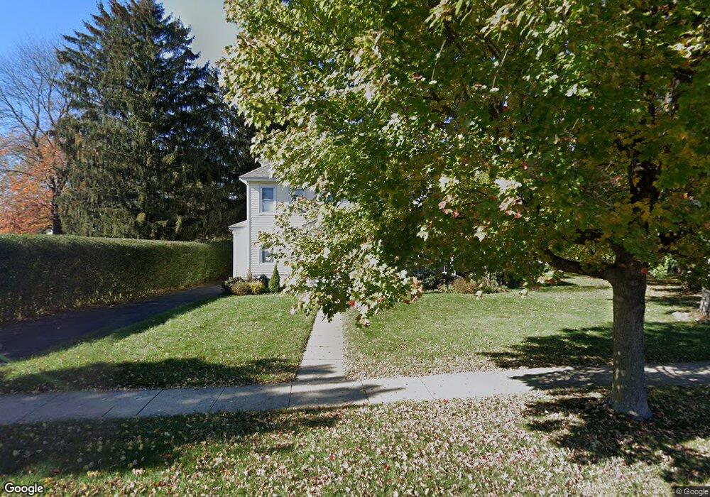
31 Eyland Ave Succasunna, NJ 07876
Estimated Value: $504,409 - $605,000
--
Bed
--
Bath
1,828
Sq Ft
$300/Sq Ft
Est. Value
About This Home
This home is located at 31 Eyland Ave, Succasunna, NJ 07876 and is currently estimated at $549,102, approximately $300 per square foot. 31 Eyland Ave is a home located in Morris County with nearby schools including Eisenhower Middle School, Lincoln Roosevelt Elementary School, and Roxbury High School.
Ownership History
Date
Name
Owned For
Owner Type
Purchase Details
Closed on
Sep 7, 2021
Sold by
Doonan John P and Doonan Rosemarie G
Bought by
Doonan John P and Doonan Rosemarie G
Current Estimated Value
Purchase Details
Closed on
Oct 29, 1999
Sold by
Wright John L and Wright Doreen H
Bought by
Yates Robert A and Yates Linda D
Purchase Details
Closed on
Oct 15, 1998
Sold by
Federal Home Loan Mortgage Corporation
Bought by
Doonan John P
Home Financials for this Owner
Home Financials are based on the most recent Mortgage that was taken out on this home.
Original Mortgage
$157,998
Interest Rate
6.74%
Mortgage Type
VA
Purchase Details
Closed on
Jul 2, 1998
Sold by
Miller Robert V and Gibson Kathleen L
Bought by
Federal Home Loan Mortgage Corporation
Create a Home Valuation Report for This Property
The Home Valuation Report is an in-depth analysis detailing your home's value as well as a comparison with similar homes in the area
Home Values in the Area
Average Home Value in this Area
Purchase History
| Date | Buyer | Sale Price | Title Company |
|---|---|---|---|
| Doonan John P | -- | None Available | |
| Doonan John P | -- | Heymann Ronald S | |
| Township Of Roxbury | -- | None Available | |
| Yates Robert A | $84,000 | -- | |
| Doonan John P | $154,900 | -- | |
| Federal Home Loan Mortgage Corporation | -- | -- |
Source: Public Records
Mortgage History
| Date | Status | Borrower | Loan Amount |
|---|---|---|---|
| Previous Owner | Doonan John P | $157,998 |
Source: Public Records
Tax History Compared to Growth
Tax History
| Year | Tax Paid | Tax Assessment Tax Assessment Total Assessment is a certain percentage of the fair market value that is determined by local assessors to be the total taxable value of land and additions on the property. | Land | Improvement |
|---|---|---|---|---|
| 2025 | $9,248 | $336,400 | $101,800 | $234,600 |
| 2024 | $9,103 | $336,400 | $101,800 | $234,600 |
| 2023 | $9,103 | $336,400 | $101,800 | $234,600 |
| 2022 | $10,278 | $336,400 | $101,800 | $234,600 |
| 2021 | $10,278 | $399,700 | $165,100 | $234,600 |
| 2020 | $10,508 | $399,700 | $165,100 | $234,600 |
| 2019 | $10,312 | $399,700 | $165,100 | $234,600 |
| 2018 | $8,698 | $201,800 | $100,300 | $101,500 |
| 2017 | $8,651 | $201,800 | $100,300 | $101,500 |
| 2016 | $8,482 | $201,800 | $100,300 | $101,500 |
| 2015 | $8,022 | $201,800 | $100,300 | $101,500 |
| 2014 | $7,891 | $201,800 | $100,300 | $101,500 |
Source: Public Records
Map
Nearby Homes
- 29 Mapledale Ave
- 1 Mekeel Dr
- 51 Main St Succ
- 54 Mapledale Ave
- 34 Hunter St
- 1581 Sussex Turnpike
- 111 Main St Succ
- 60 Kenvil Ave
- 33 N Hillside Ave
- 1128 New Jersey 10
- 1 Gail Dr
- 11 Unneberg Ave
- 117 Woods Edge Dr
- 17 Unneberg Ave
- 7 Corwin St
- 219 Woods Edge Dr Unit 219
- 209 Woods Edge Dr Unit 209
- 94 Woods Edge Dr
- 148 Eyland Ave
- 1 High St