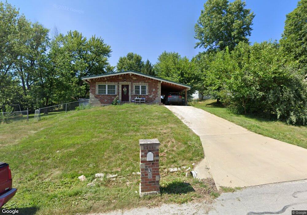
31 Forest Ln O Fallon, MO 63366
Estimated Value: $243,465 - $287,000
3
Beds
2
Baths
1,026
Sq Ft
$262/Sq Ft
Est. Value
About This Home
This home is located at 31 Forest Ln, O Fallon, MO 63366 and is currently estimated at $268,866, approximately $262 per square foot. 31 Forest Ln is a home located in St. Charles County with nearby schools including Green Tree Elementary School, Wentzville South Middle School, and Timberland High School.
Ownership History
Date
Name
Owned For
Owner Type
Purchase Details
Closed on
Sep 23, 2016
Sold by
Martin Glen A
Bought by
Brucker Brothers Llc
Current Estimated Value
Home Financials for this Owner
Home Financials are based on the most recent Mortgage that was taken out on this home.
Original Mortgage
$110,235
Outstanding Balance
$88,051
Interest Rate
3.43%
Mortgage Type
Future Advance Clause Open End Mortgage
Estimated Equity
$180,815
Purchase Details
Closed on
Dec 30, 2013
Sold by
Martin John D and Martin Rita Louise
Bought by
Martin Glen A
Create a Home Valuation Report for This Property
The Home Valuation Report is an in-depth analysis detailing your home's value as well as a comparison with similar homes in the area
Home Values in the Area
Average Home Value in this Area
Purchase History
| Date | Buyer | Sale Price | Title Company |
|---|---|---|---|
| Brucker Brothers Llc | $103,000 | Us Title | |
| Martin Glen A | $85,000 | None Available |
Source: Public Records
Mortgage History
| Date | Status | Borrower | Loan Amount |
|---|---|---|---|
| Open | Brucker Brothers Llc | $110,235 |
Source: Public Records
Tax History
| Year | Tax Paid | Tax Assessment Tax Assessment Total Assessment is a certain percentage of the fair market value that is determined by local assessors to be the total taxable value of land and additions on the property. | Land | Improvement |
|---|---|---|---|---|
| 2025 | $2,219 | $36,597 | -- | -- |
| 2023 | $2,218 | $33,588 | -- | -- |
| 2022 | $1,921 | $27,023 | $0 | $0 |
| 2021 | $1,920 | $27,023 | $0 | $0 |
| 2020 | $1,792 | $24,579 | $0 | $0 |
| 2019 | $1,664 | $24,579 | $0 | $0 |
| 2018 | $1,502 | $21,100 | $0 | $0 |
| 2017 | $1,495 | $21,100 | $0 | $0 |
| 2016 | $1,199 | $16,746 | $0 | $0 |
| 2015 | $1,169 | $16,746 | $0 | $0 |
| 2014 | $1,106 | $16,219 | $0 | $0 |
Source: Public Records
Map
Nearby Homes
- 807 Briarwood Ct
- 827 Edgewood Dr
- 617 Lakeview Rd
- 2 Royal Dr
- 904 Palmer Ct Unit 4
- 903 Palmer Ct Unit 3
- 922 Ampere Place
- 22 Holloway Dr
- 1011 Fairways Dr
- 35 Monterey Cypress Dr Unit 2
- 9 Woodview Dr
- 1467 Cochise Dr
- 1459 Cochise Dr
- 1100 Seine Dr
- 37 Ravens Pointe
- 15 Eagles Way Ln
- 1373 Sunburst Dr
- 322 Royal Dornoch Ct
- 6 Sailor Ct
- 612 Thicket Ln