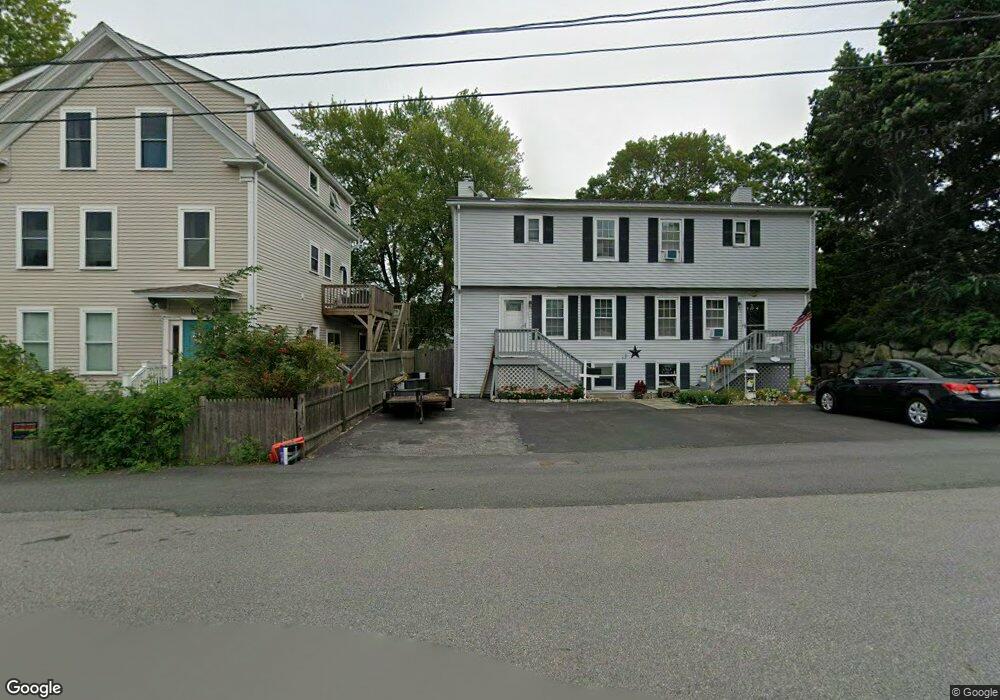
31 Grove St Unit 1 Gloucester, MA 01930
Central Gloucester NeighborhoodEstimated Value: $458,380 - $510,000
3
Beds
2
Baths
1,342
Sq Ft
$360/Sq Ft
Est. Value
About This Home
This home is located at 31 Grove St Unit 1, Gloucester, MA 01930 and is currently estimated at $483,095, approximately $359 per square foot. 31 Grove St Unit 1 is a home located in Essex County with nearby schools including Plum Cove School, Ralph B O'maley Middle School, and Gloucester High School.
Ownership History
Date
Name
Owned For
Owner Type
Purchase Details
Closed on
Feb 20, 2019
Sold by
Harmon Michael E
Bought by
Michael E Harmon T
Current Estimated Value
Purchase Details
Closed on
Sep 19, 2018
Sold by
Bagaco Delia M and Morrissey Zachary
Bought by
Harmon Michael E
Home Financials for this Owner
Home Financials are based on the most recent Mortgage that was taken out on this home.
Original Mortgage
$230,000
Interest Rate
3.88%
Mortgage Type
Adjustable Rate Mortgage/ARM
Purchase Details
Closed on
Jan 29, 2009
Sold by
Us Bank Na Tr
Bought by
Bagaco Delia M and Bagaco Delia N
Home Financials for this Owner
Home Financials are based on the most recent Mortgage that was taken out on this home.
Original Mortgage
$10,000
Interest Rate
5.26%
Purchase Details
Closed on
Sep 30, 2008
Sold by
Mcnutt Scott B
Bought by
Wells Fargo Bk
Create a Home Valuation Report for This Property
The Home Valuation Report is an in-depth analysis detailing your home's value as well as a comparison with similar homes in the area
Home Values in the Area
Average Home Value in this Area
Purchase History
| Date | Buyer | Sale Price | Title Company |
|---|---|---|---|
| Michael E Harmon T | -- | -- | |
| Harmon Michael E | $288,000 | -- | |
| Bagaco Delia M | $186,000 | -- | |
| Us Bank Na Tr | -- | -- | |
| Wells Fargo Bk | $138,000 | -- |
Source: Public Records
Mortgage History
| Date | Status | Borrower | Loan Amount |
|---|---|---|---|
| Previous Owner | Harmon Michael E | $230,000 | |
| Previous Owner | Wells Fargo Bk | $170,000 | |
| Previous Owner | Wells Fargo Bk | $10,000 |
Source: Public Records
Tax History Compared to Growth
Tax History
| Year | Tax Paid | Tax Assessment Tax Assessment Total Assessment is a certain percentage of the fair market value that is determined by local assessors to be the total taxable value of land and additions on the property. | Land | Improvement |
|---|---|---|---|---|
| 2025 | $3,571 | $367,000 | $0 | $367,000 |
| 2024 | $3,571 | $367,000 | $0 | $367,000 |
| 2023 | $3,431 | $324,000 | $0 | $324,000 |
| 2022 | $3,447 | $293,900 | $0 | $293,900 |
| 2021 | $3,482 | $279,900 | $0 | $279,900 |
| 2020 | $3,438 | $278,800 | $0 | $278,800 |
| 2019 | $3,282 | $258,600 | $0 | $258,600 |
| 2018 | $3,102 | $239,900 | $0 | $239,900 |
| 2017 | $2,935 | $222,500 | $0 | $222,500 |
| 2016 | $2,825 | $207,600 | $0 | $207,600 |
| 2015 | $2,774 | $203,200 | $0 | $203,200 |
Source: Public Records
Map
Nearby Homes
- 78 Grove St
- 8 Arthur St
- 34 Cleveland St
- 185 Washington St
- 13 1/2 Cleveland St
- 6 Beauport Ave
- 40 Sargent St
- 12 Harold Ave
- 24 Millett St
- 1 Alpine Ct
- 85 Centennial Ave
- 13 Maplewood Ave
- 45B Warner St
- 18 Cherry St
- 9 Foster St Unit 1
- 9 Foster St Unit 2
- 8 Summer St Unit 103
- 273 Washington St Unit 2
- 15 Columbia St
- 5 Washington Square
- 29 Grove St
- 31 Grove St
- 33 Grove St
- 33 Grove St Unit 2
- 108 Maplewood Ave
- 106 Maplewood Ave
- 52 Grove St
- 48 Grove St
- 104 Maplewood Ave
- 102 Maplewood Ave
- 112 Maplewood Ave
- 112 Maplewood Ave Unit 1,1
- 100 Maplewood Ave
- 44 Grove St
- 98 Maplewood Ave
- 4 Acacia St
- 56 Grove St
- 3 Acacia St
- 42 Grove St
- 58 Grove St