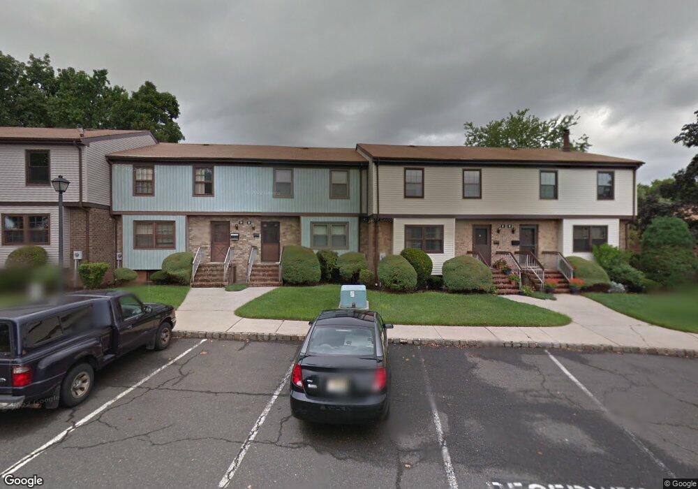
31 Highview Dr Unit 31 Woodbridge, NJ 07095
Estimated Value: $379,125 - $568,000
3
Beds
3
Baths
1,000
Sq Ft
$491/Sq Ft
Est. Value
About This Home
This home is located at 31 Highview Dr Unit 31, Woodbridge, NJ 07095 and is currently estimated at $491,281, approximately $491 per square foot. 31 Highview Dr Unit 31 is a home located in Middlesex County with nearby schools including Ford Avenue Elementary School, Fords Middle School, and Woodbridge High School.
Ownership History
Date
Name
Owned For
Owner Type
Purchase Details
Closed on
Apr 13, 2010
Sold by
Attal Rajesh and Attal Ruchi
Bought by
Sabri Anjum J and Anjum Danish
Current Estimated Value
Home Financials for this Owner
Home Financials are based on the most recent Mortgage that was taken out on this home.
Original Mortgage
$241,600
Interest Rate
5.03%
Mortgage Type
New Conventional
Purchase Details
Closed on
Dec 18, 2002
Sold by
Venkataram Arjun
Bought by
Attal Rajesh and Attal Ruchi
Home Financials for this Owner
Home Financials are based on the most recent Mortgage that was taken out on this home.
Original Mortgage
$183,750
Interest Rate
6.02%
Purchase Details
Closed on
Oct 18, 1993
Sold by
Jaffee David
Bought by
Ward Randall and Ward Susan
Home Financials for this Owner
Home Financials are based on the most recent Mortgage that was taken out on this home.
Original Mortgage
$122,000
Interest Rate
6.86%
Create a Home Valuation Report for This Property
The Home Valuation Report is an in-depth analysis detailing your home's value as well as a comparison with similar homes in the area
Home Values in the Area
Average Home Value in this Area
Purchase History
| Date | Buyer | Sale Price | Title Company |
|---|---|---|---|
| Sabri Anjum J | $305,000 | None Available | |
| Attal Rajesh | $241,000 | -- | |
| Ward Randall | $129,000 | -- |
Source: Public Records
Mortgage History
| Date | Status | Borrower | Loan Amount |
|---|---|---|---|
| Previous Owner | Sabri Anjum J | $241,600 | |
| Previous Owner | Attal Rajesh | $183,750 | |
| Previous Owner | Ward Randall | $122,000 |
Source: Public Records
Tax History Compared to Growth
Tax History
| Year | Tax Paid | Tax Assessment Tax Assessment Total Assessment is a certain percentage of the fair market value that is determined by local assessors to be the total taxable value of land and additions on the property. | Land | Improvement |
|---|---|---|---|---|
| 2025 | $9,745 | $72,000 | $8,000 | $64,000 |
| 2024 | $9,504 | $72,000 | $8,000 | $64,000 |
| 2023 | $9,504 | $72,000 | $8,000 | $64,000 |
| 2022 | $8,925 | $72,000 | $8,000 | $64,000 |
| 2021 | $8,542 | $72,000 | $8,000 | $64,000 |
| 2020 | $8,542 | $72,000 | $8,000 | $64,000 |
| 2019 | $8,325 | $72,000 | $8,000 | $64,000 |
| 2018 | $8,106 | $72,000 | $8,000 | $64,000 |
| 2017 | $7,943 | $72,000 | $8,000 | $64,000 |
| 2016 | $7,867 | $72,000 | $8,000 | $64,000 |
| 2015 | $7,713 | $72,000 | $8,000 | $64,000 |
| 2014 | $7,529 | $72,000 | $8,000 | $64,000 |
Source: Public Records
Map
Nearby Homes
- 124 Howell Ave
- 10 Bell Ave
- 14 Bell Ave
- 54 Parsler Place
- 3 Heritage Ln
- 46 Parsler Place
- 96 Wick Dr
- 32 Kilfoyle Ave
- 93 Remmey St
- 124 Beverly Hill Terrace Unit J
- 124-J Beverly Hill Terrace Unit J
- 135 Beverly Hill Terrace Unit B
- 680 Main St
- 206 Sharon Garden Ct
- 340 Sharon Garden Ct
- 401 Sharon Garden Ct Unit 401
- 324 Sharon Ct
- 324 Sharon Garden Ct Unit 324
- 615 Sharon Garden Ct
- 206 Arlington Dr
- 32 Highview Dr
- 30 Highview Dr
- 29 Highview Dr
- 28 Highview Dr
- 27 Highview Dr
- 33 Highview Dr
- 34 Highview Dr
- 46 Highview Dr
- 47 Highview Dr
- 45 Highview Dr
- 48 Highview Dr
- 39 Highview Dr
- 40 Highview Dr
- 35 Highview Dr
- 35 Highview Dr Unit 35
- 41 Highview Dr
- 44 Highview Dr
- 36 Highview Dr
- 42 Highview Dr
- 43 Highview Dr