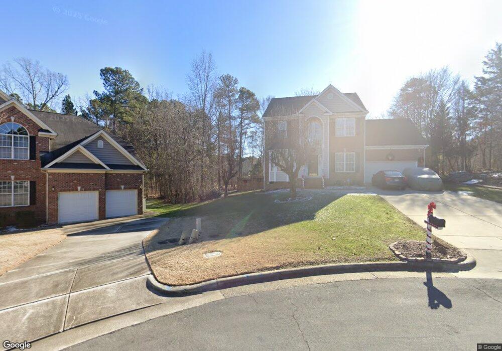
31 Lakehurst Ct Durham, NC 27713
South Durham NeighborhoodEstimated Value: $647,306 - $678,000
4
Beds
3
Baths
3,032
Sq Ft
$218/Sq Ft
Est. Value
About This Home
This home is located at 31 Lakehurst Ct, Durham, NC 27713 and is currently estimated at $661,327, approximately $218 per square foot. 31 Lakehurst Ct is a home located in Durham County with nearby schools including Lowe's Grove Middle, Hillside High School, and Kestrel Heights School.
Ownership History
Date
Name
Owned For
Owner Type
Purchase Details
Closed on
May 23, 2000
Sold by
Douglas Tutich and Elizabeth Amy
Bought by
Mccray Henry Lewis and Mccray Shelby Hill
Current Estimated Value
Home Financials for this Owner
Home Financials are based on the most recent Mortgage that was taken out on this home.
Original Mortgage
$162,000
Interest Rate
8.24%
Purchase Details
Closed on
Nov 10, 1998
Sold by
Centex Homes
Bought by
Tutich Douglas and Tutich Amy Elizabeth
Home Financials for this Owner
Home Financials are based on the most recent Mortgage that was taken out on this home.
Original Mortgage
$186,500
Interest Rate
6.58%
Create a Home Valuation Report for This Property
The Home Valuation Report is an in-depth analysis detailing your home's value as well as a comparison with similar homes in the area
Home Values in the Area
Average Home Value in this Area
Purchase History
| Date | Buyer | Sale Price | Title Company |
|---|---|---|---|
| Mccray Henry Lewis | $240,000 | -- | |
| Tutich Douglas | $233,500 | -- |
Source: Public Records
Mortgage History
| Date | Status | Borrower | Loan Amount |
|---|---|---|---|
| Previous Owner | Mccray Henry Lewis | $162,000 | |
| Previous Owner | Tutich Douglas | $186,500 |
Source: Public Records
Tax History
| Year | Tax Paid | Tax Assessment Tax Assessment Total Assessment is a certain percentage of the fair market value that is determined by local assessors to be the total taxable value of land and additions on the property. | Land | Improvement |
|---|---|---|---|---|
| 2025 | $6,033 | $608,618 | $175,075 | $433,543 |
| 2024 | $4,690 | $336,219 | $81,785 | $254,434 |
| 2023 | $4,404 | $336,219 | $81,785 | $254,434 |
| 2022 | $4,303 | $336,219 | $81,785 | $254,434 |
| 2021 | $4,283 | $336,219 | $81,785 | $254,434 |
| 2020 | $4,182 | $336,219 | $81,785 | $254,434 |
| 2019 | $4,182 | $336,219 | $81,785 | $254,434 |
| 2018 | $4,655 | $343,178 | $48,327 | $294,851 |
| 2017 | $4,621 | $343,178 | $48,327 | $294,851 |
| 2016 | $4,465 | $343,178 | $48,327 | $294,851 |
| 2015 | $4,010 | $289,710 | $68,306 | $221,404 |
| 2014 | $4,010 | $289,710 | $68,306 | $221,404 |
Source: Public Records
Map
Nearby Homes
- 1 Haycox Ct
- 7 Monteith Ct
- 1425 Cherob Ln
- 1448 Cherob Ln
- 211 Cool Spring Rd
- 109 Settlers Mill Ln
- 903 Limerick Ln
- 1021 Pondfield Way
- 4517 Grandale Dr
- 7 Scenic Ct
- 43 Redbud Ct
- 1010 Sturbridge Dr
- 111 Wenonah Way
- 8115 Massey Chapel Rd
- 204 S Bend Dr
- 4 Green Springs Ct
- 124 Wicklow Ln
- 6353 Grandale Dr
- 5504 Pelham Rd
- 7502 Hedfield Way
- 29 Lakehurst Ct
- 708 Martry Rd
- 710 Martry Rd
- 27 Lakehurst Ct
- 8429 Herndon Rd
- 8413 Herndon Rd
- 7412 Herndon Rd
- 7412 Herndon Rd Unit 1
- 6628 Herndon Rd
- 6708 Herndon Rd
- 6624 Herndon Rd
- 706 Martry Rd
- 25 Lakehurst Ct
- 704 Martry Rd
- 23 Lakehurst Ct
- 7420 Herndon Rd
- 707 Martry Rd
- 705 Adeline Ct
- 702 Martry Rd
- 801 Martry Rd
Your Personal Tour Guide
Ask me questions while you tour the home.