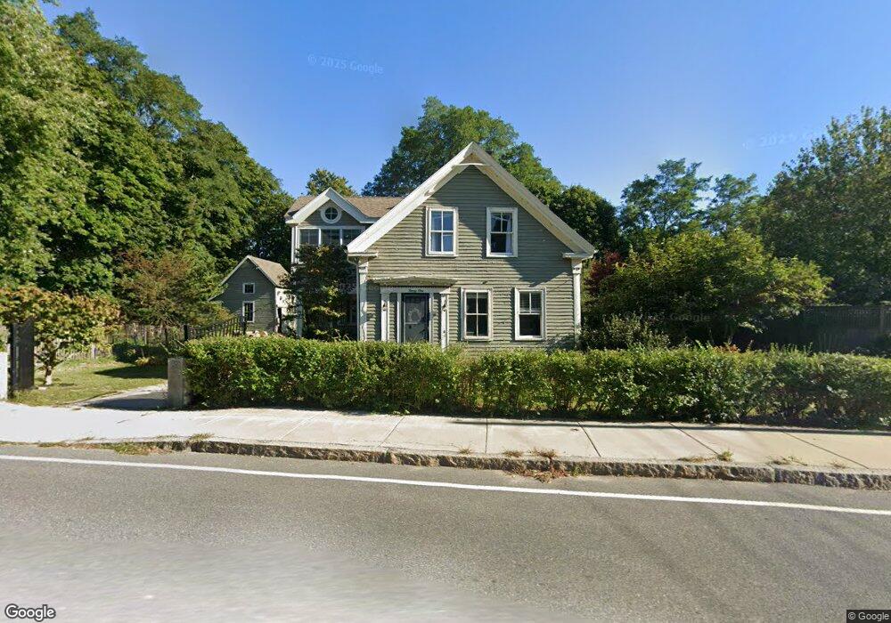
31 Langsford St Gloucester, MA 01930
Estimated Value: $886,040 - $1,124,000
3
Beds
1
Bath
1,600
Sq Ft
$630/Sq Ft
Est. Value
About This Home
This home is located at 31 Langsford St, Gloucester, MA 01930 and is currently estimated at $1,008,510, approximately $630 per square foot. 31 Langsford St is a home located in Essex County with nearby schools including Plum Cove School, Ralph B O'maley Middle School, and Gloucester High School.
Ownership History
Date
Name
Owned For
Owner Type
Purchase Details
Closed on
May 30, 2018
Sold by
Mahoney Mitchell J and Mahoney Patrick M
Bought by
Mahoney Ft
Current Estimated Value
Purchase Details
Closed on
Jun 30, 2011
Sold by
Shea Robert J and Andrejko Anne
Bought by
Rettig Rebecca E and Mahoney Mitchell J
Home Financials for this Owner
Home Financials are based on the most recent Mortgage that was taken out on this home.
Original Mortgage
$279,200
Interest Rate
4.62%
Mortgage Type
Purchase Money Mortgage
Purchase Details
Closed on
Apr 29, 2002
Sold by
Coull Phillip B and Coull Janette H
Bought by
Shea Robert J and Andrejko Anne
Create a Home Valuation Report for This Property
The Home Valuation Report is an in-depth analysis detailing your home's value as well as a comparison with similar homes in the area
Home Values in the Area
Average Home Value in this Area
Purchase History
| Date | Buyer | Sale Price | Title Company |
|---|---|---|---|
| Mahoney Ft | -- | -- | |
| Rettig Rebecca E | $349,900 | -- | |
| Shea Robert J | $333,000 | -- |
Source: Public Records
Mortgage History
| Date | Status | Borrower | Loan Amount |
|---|---|---|---|
| Previous Owner | Shea Robert J | $279,200 | |
| Previous Owner | Shea Robert J | $50,000 | |
| Previous Owner | Shea Robert J | $264,000 |
Source: Public Records
Tax History Compared to Growth
Tax History
| Year | Tax Paid | Tax Assessment Tax Assessment Total Assessment is a certain percentage of the fair market value that is determined by local assessors to be the total taxable value of land and additions on the property. | Land | Improvement |
|---|---|---|---|---|
| 2025 | $7,164 | $737,000 | $291,600 | $445,400 |
| 2024 | $7,036 | $723,100 | $277,700 | $445,400 |
| 2023 | $6,522 | $615,900 | $247,900 | $368,000 |
| 2022 | $6,417 | $547,100 | $210,700 | $336,400 |
| 2021 | $6,337 | $509,400 | $191,600 | $317,800 |
| 2020 | $6,280 | $509,300 | $191,600 | $317,700 |
| 2019 | $5,944 | $468,400 | $191,600 | $276,800 |
| 2018 | $5,587 | $432,100 | $191,600 | $240,500 |
| 2017 | $4,853 | $367,900 | $182,400 | $185,500 |
| 2016 | $4,676 | $343,600 | $182,900 | $160,700 |
| 2015 | $4,539 | $332,500 | $182,900 | $149,600 |
Source: Public Records
Map
Nearby Homes
- 26 Coggeshall Rd
- 43 High St Unit B
- 48 Rowley Shore
- 25 Stockholm Ave
- 13 Phillips Ave
- 165 Granite St
- 2 Boulder Top
- 18 Granite St
- 13 Rowe Point
- 15 Granite St
- 5R Smith St Unit 2
- 20 Railroad Ave
- 672 Washington St
- 2 Mount Pleasant St Unit 3
- 5 Marshall Ln
- 27 Hodgkins Rd
- 4 Norwood Ave
- 57 Mt Pleasant St Unit 2B
- 226 Atlantic St
- 34R Summer St
- 39 Langsford St
- 37 Langsford St
- 37 Langsford St Unit B
- 37 Langsford St Unit A
- 14 Mclellan St
- 29A Langsford St
- 29 Langsford St
- 17 Mclellan St
- 27 Langsford St
- 42 Langsford St
- 41 Langsford St
- 25 Langsford St
- 2 Ships Bell Rd
- 43 Langsford St
- 13 Mclellan St
- 44 Langsford St
- 3 Ships Bell Rd
- 23 Langsford St
- 4 Wishart Rd
- 45 Langsford St