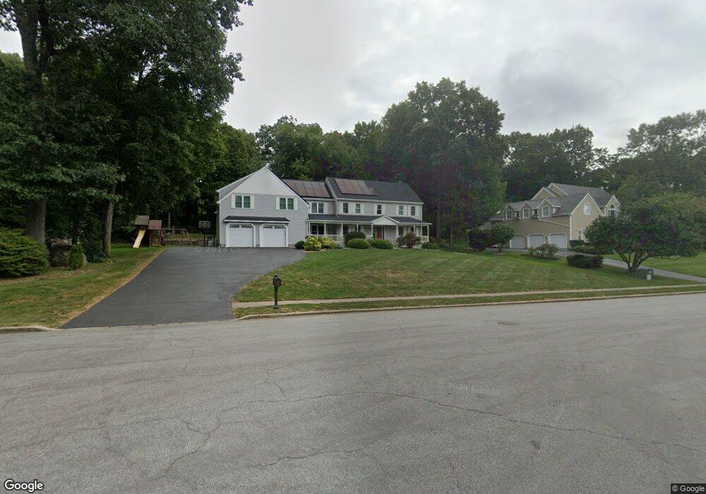
31 N Pond Rd Cheshire, CT 06410
Estimated Value: $861,000 - $982,000
4
Beds
3
Baths
4,212
Sq Ft
$218/Sq Ft
Est. Value
About This Home
This home is located at 31 N Pond Rd, Cheshire, CT 06410 and is currently estimated at $916,255, approximately $217 per square foot. 31 N Pond Rd is a home located in New Haven County with nearby schools including Darcey School, Chapman School, and Dodd Middle School.
Ownership History
Date
Name
Owned For
Owner Type
Purchase Details
Closed on
Jun 27, 1997
Sold by
Levin Adam H and Levin Emily R
Bought by
Sirois Paul J and Sirois Michelle
Current Estimated Value
Purchase Details
Closed on
Aug 22, 1990
Sold by
Heritage Hills Inc
Bought by
Levin Adam
Create a Home Valuation Report for This Property
The Home Valuation Report is an in-depth analysis detailing your home's value as well as a comparison with similar homes in the area
Home Values in the Area
Average Home Value in this Area
Purchase History
| Date | Buyer | Sale Price | Title Company |
|---|---|---|---|
| Sirois Paul J | $355,000 | -- | |
| Sirois Paul J | $355,000 | -- | |
| Levin Adam | $319,358 | -- |
Source: Public Records
Mortgage History
| Date | Status | Borrower | Loan Amount |
|---|---|---|---|
| Open | Levin Adam | $300,000 | |
| Closed | Levin Adam | $124,000 | |
| Closed | Levin Adam | $200,000 |
Source: Public Records
Tax History
| Year | Tax Paid | Tax Assessment Tax Assessment Total Assessment is a certain percentage of the fair market value that is determined by local assessors to be the total taxable value of land and additions on the property. | Land | Improvement |
|---|---|---|---|---|
| 2025 | $14,406 | $484,400 | $86,870 | $397,530 |
| 2024 | $13,302 | $484,400 | $86,870 | $397,530 |
| 2023 | $12,301 | $350,550 | $86,860 | $263,690 |
| 2022 | $12,031 | $350,550 | $86,860 | $263,690 |
| 2021 | $11,821 | $350,550 | $86,860 | $263,690 |
| 2020 | $11,645 | $350,550 | $86,860 | $263,690 |
| 2019 | $11,645 | $350,550 | $86,860 | $263,690 |
| 2018 | $11,748 | $360,140 | $87,510 | $272,630 |
| 2017 | $11,503 | $360,140 | $87,510 | $272,630 |
| 2016 | $11,053 | $360,140 | $87,510 | $272,630 |
| 2015 | $11,053 | $360,140 | $87,510 | $272,630 |
| 2014 | $10,894 | $360,140 | $87,510 | $272,630 |
Source: Public Records
Map
Nearby Homes
- 23 N Pond Rd
- 194 Debbie Dr
- 173 Cynrose Place
- 661 Allen Ave
- 174 Westfort Dr
- 105 Riverside Dr
- 274 Riverside Dr
- 155 Eaton Ave
- 133 Stevenson Rd
- 25 Andrews St
- 418 Meriden Waterbury Turnpike
- 97 Race Brook Rd
- 50 Smithfield Ave
- 914 W Main St
- 461 Meriden Waterbury Turnpike
- 171 Oregon Rd
- 50 Fairfax Ave
- 63 Spice Hill Dr
- 295 & 305 (Lot 103 & Oregon St
- 151 Victoria Dr
- 29 N Pond Rd
- 27 N Pond Rd
- 28 N Pond Rd
- 1568 Allen Ct
- 26 N Pond Rd
- 65 Trout Brook Rd
- 24 N Pond Rd
- 22 N Pond Rd
- 70 Trout Brook Rd
- 63 Trout Brook Rd
- 20 N Pond Rd
- 68 Trout Brook Rd
- 19 Suffield Ct
- 61 Trout Brook Rd
- 23 Suffield Ct
- 66 Trout Brook Rd
- 18 N Pond Rd
- 64 Trout Brook Rd
- 1522 Allen Ct
- 19 N Pond Rd
Your Personal Tour Guide
Ask me questions while you tour the home.