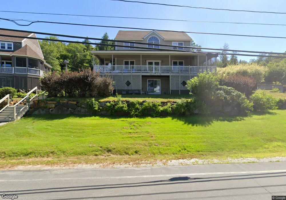
31 Rent Rd Bristol, NH 03222
Estimated Value: $715,823 - $988,000
3
Beds
3
Baths
2,346
Sq Ft
$369/Sq Ft
Est. Value
About This Home
This home is located at 31 Rent Rd, Bristol, NH 03222 and is currently estimated at $866,456, approximately $369 per square foot. 31 Rent Rd is a home with nearby schools including Bristol Elementary School.
Ownership History
Date
Name
Owned For
Owner Type
Purchase Details
Closed on
Jul 30, 2015
Sold by
Mildred A Rent Ret
Bought by
Deplma 2Nd Anthony V and Depalma Lisa G
Current Estimated Value
Home Financials for this Owner
Home Financials are based on the most recent Mortgage that was taken out on this home.
Original Mortgage
$278,400
Outstanding Balance
$218,512
Interest Rate
3.97%
Mortgage Type
New Conventional
Estimated Equity
$647,944
Create a Home Valuation Report for This Property
The Home Valuation Report is an in-depth analysis detailing your home's value as well as a comparison with similar homes in the area
Home Values in the Area
Average Home Value in this Area
Purchase History
| Date | Buyer | Sale Price | Title Company |
|---|---|---|---|
| Deplma 2Nd Anthony V | $388,933 | -- |
Source: Public Records
Mortgage History
| Date | Status | Borrower | Loan Amount |
|---|---|---|---|
| Open | Deplma 2Nd Anthony V | $278,400 |
Source: Public Records
Tax History Compared to Growth
Tax History
| Year | Tax Paid | Tax Assessment Tax Assessment Total Assessment is a certain percentage of the fair market value that is determined by local assessors to be the total taxable value of land and additions on the property. | Land | Improvement |
|---|---|---|---|---|
| 2024 | $11,567 | $489,700 | $259,600 | $230,100 |
| 2023 | $11,141 | $489,700 | $259,600 | $230,100 |
| 2022 | $10,050 | $478,800 | $259,600 | $219,200 |
| 2021 | $9,677 | $478,800 | $259,600 | $219,200 |
| 2020 | $10,442 | $504,700 | $285,500 | $219,200 |
| 2019 | $8,573 | $376,000 | $176,600 | $199,400 |
| 2018 | $8,197 | $376,000 | $176,600 | $199,400 |
| 2017 | $8,321 | $376,000 | $176,600 | $199,400 |
| 2016 | $7,753 | $376,000 | $176,600 | $199,400 |
| 2015 | $6,971 | $346,300 | $134,700 | $211,600 |
| 2014 | $6,971 | $346,300 | $134,700 | $211,600 |
| 2013 | $6,988 | $346,300 | $134,700 | $211,600 |
Source: Public Records
Map
Nearby Homes
- 26 Don Gerry Rd
- 383 Wulamat Rd
- 199 Cottage City Rd
- 40 Adams Rd
- 94 Mandi Ln
- Lot 7 Hall Rd
- 29 Daniels Rd
- 333 Lake St
- 114 Ledgewood Terrace
- 862 Mayhew Turnpike Unit 1
- 135 Pleasant St
- 30 Beech St Unit 4B
- 30 Beech St Unit 4C
- 125 Verrill Rd
- 00 Peaked Hill Rd Unit 7.1, 7.2, 7.3, 7.4,
- 80 Patten Rd
- 4 Birchwood Dr Unit A
- 301 Perkins Hill Rd
- 497 W Shore Rd
- 00 Ledgewood Cir Unit 7
- 199 W Shore Rd
- 207 W Shore Rd
- 23 Rent Rd
- 39 Rent Rd
- 197 W Shore Rd
- 200 W Shore Rd
- 19 W Shore Rd Unit 8,2
- 209 W Shore Rd
- 13 Rent Rd
- 189 W Shore Rd Unit 187
- 189 W Shore Rd Unit 189 Big House
- 189 W Shore Rd Unit 189 Cottage
- 189 W Shore Rd Unit 185
- 18 Rent Rd
- 208 W Shore Rd
- 208 W Shore Rd Unit 5
- 208 W Shore Rd Unit 4
- 208 W Shore Rd Unit 3
- 43 Manor Estates Dr
- 208 # 5 West Shore