31 Stearns Rd Brookline, MA 02446
Coolidge Corner NeighborhoodEstimated Value: $2,721,000 - $3,652,000
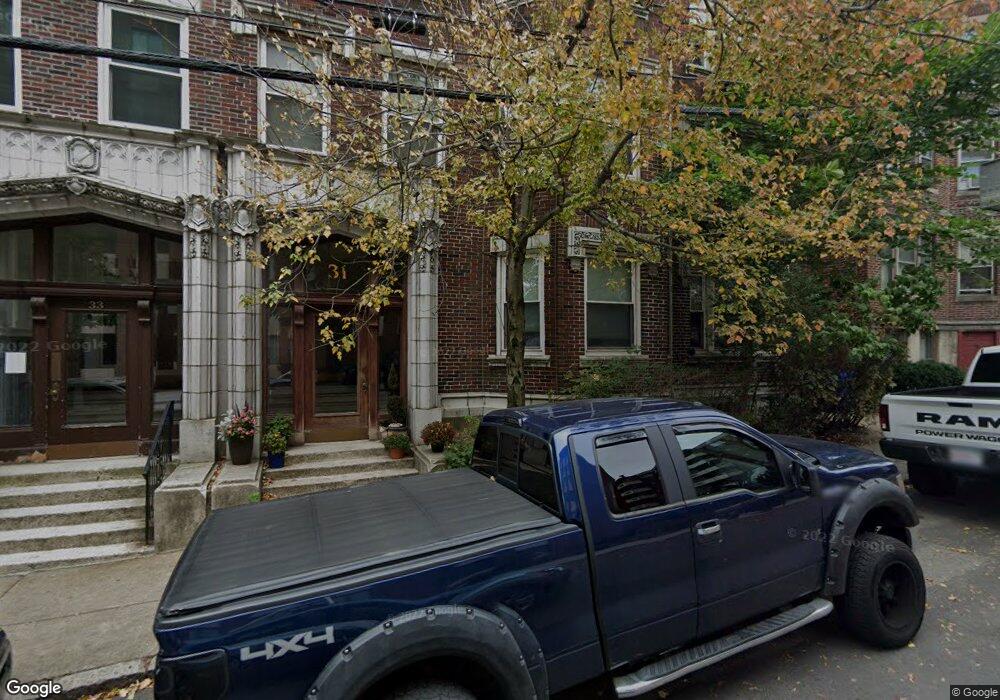
About This Home
AVAILABLE 12/01/2025!
NO BROKERAGE FEE!
- Huge 3-bed in highly-desirable Brookline location (Coolidge Corner)
- Hardwood floors throughout
- Brick accent walls
- Open-concept living arrangement
- Large windows letting in ample natural light
- Professional building (no undergrads)
- Parking available for rent
- Cat-friendly (no dogs)
- Common laundry in building
- High ceilings
- Ample kitchen storage
First Month's Rent: $4,500.00
Last Month's Rent: $4,500.00
Security Deposit: $2,250.00
Lock & Key Fee: $0.00
Brokerage Fee: $0.00
Total: $11,250.00
Move-in costs may be negotiable for well-qualified applicants.
Additional fees (non-mandatory):
Cat Rent: $50/mo.
Dog Rent: N/A - no dogs
Parking Fee: $250/mo. (limited availability)
Move-in costs may be negotiable for well-qualified applicants.
The information in this listing may have been gathered from third-party sources including the owner and/or public records. Listings are subject to errors and omissions. Encore Realty disclaims any and all representations or warranties as to the accuracy of this information. Encore Realty is an Equal Housing Opportunity Agency. Photos may not always be of the actual apartment. At times, sample images are used to make a general representation. By clicking on our ad, you are requesting to hire Blue Stream Real Estate dba Encore Realty and its agents unless explicitly stated otherwise.
Home Values in the Area
Average Home Value in this Area
Property History
| Date | Event | Price | List to Sale | Price per Sq Ft |
|---|---|---|---|---|
| 02/10/2025 02/10/25 | Off Market | $4,500 | -- | -- |
| 01/17/2025 01/17/25 | For Rent | -- | -- | -- |
| 10/08/2024 10/08/24 | Off Market | $3,300 | -- | -- |
| 10/08/2024 10/08/24 | Off Market | $4,500 | -- | -- |
| 10/01/2024 10/01/24 | For Rent | $4,500 | +36.4% | -- |
| 02/29/2024 02/29/24 | For Rent | $3,300 | -- | -- |
Tax History Compared to Growth
Tax History
| Year | Tax Paid | Tax Assessment Tax Assessment Total Assessment is a certain percentage of the fair market value that is determined by local assessors to be the total taxable value of land and additions on the property. | Land | Improvement |
|---|---|---|---|---|
| 2025 | $24,795 | $2,512,200 | $1,032,100 | $1,480,100 |
| 2024 | $24,850 | $2,543,500 | $989,400 | $1,554,100 |
| 2023 | $23,731 | $2,380,200 | $803,700 | $1,576,500 |
| 2022 | $23,099 | $2,266,800 | $765,400 | $1,501,400 |
| 2021 | $21,360 | $2,179,600 | $736,000 | $1,443,600 |
| 2020 | $20,155 | $2,132,800 | $659,000 | $1,473,800 |
| 2019 | $19,032 | $2,031,200 | $627,600 | $1,403,600 |
| 2018 | $17,316 | $1,830,400 | $476,800 | $1,353,600 |
| 2017 | $16,745 | $1,694,800 | $449,800 | $1,245,000 |
| 2016 | $16,055 | $1,540,800 | $420,400 | $1,120,400 |
| 2015 | $14,521 | $1,359,600 | $351,800 | $1,007,800 |
| 2014 | $14,903 | $1,308,400 | $325,800 | $982,600 |
Map
- 30 Stearns Rd Unit 302
- 98 Saint Paul St Unit A1
- 45 Longwood Ave Unit 812
- 45 Longwood Ave Unit PHA
- 60 Longwood Ave Unit 307
- 60 Longwood Ave Unit 403
- 57 Saint Paul St Unit 19
- 50 Longwood Ave Unit 611
- 65 Francis St Unit 65
- 65 Francis St
- 123 Sewall Ave Unit LC
- 151 Longwood Ave Unit 1
- 119 Park St Unit 7
- 120 Brook St Unit 1
- 106 Brook St
- 24 Auburn St Unit 1
- 24 Auburn St Unit 2
- 24 Auburn St Unit 3
- 5 Auburn Ct Unit 1
- 15 James St Unit 2
- 31 Stearns Rd
- 31 Stearns Rd Unit 4
- 31 Stearns Rd Unit 11-1
- 31 Stearns Rd Unit 6
- 31 Stearns Rd Unit 1
- 31 Stearns Rd Unit 2
- 31 Stearns Rd Unit 3
- 33 Stearns Rd Unit 3B
- 33 Stearns Rd Unit stearns rd brookline
- 33 Stearns Rd Unit 1
- 33 Stearns Rd
- 33 Stearns Rd Unit 6
- 33 Stearns Rd Unit 3
- 33 Stearns Rd Unit 3A
- 33 Stearns Rd Unit 3D
- 33 Stearns Rd Unit 2A
- 33 Stearns Rd Unit A
- 33 Stearns Rd Unit 3A
- 33 Stearns Rd
- 27 Stearns Rd Unit 2