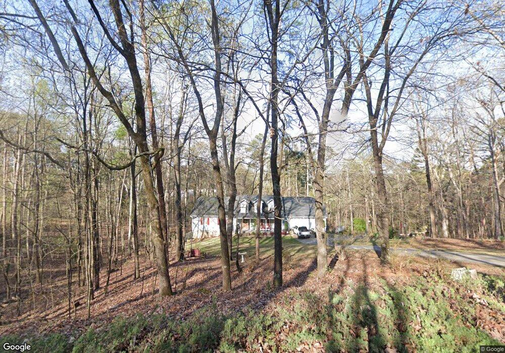
31 The Trail SE Lindale, GA 30147
Estimated Value: $320,000 - $362,000
--
Bed
--
Bath
2,156
Sq Ft
$158/Sq Ft
Est. Value
About This Home
This home is located at 31 The Trail SE, Lindale, GA 30147 and is currently estimated at $340,881, approximately $158 per square foot. 31 The Trail SE is a home located in Floyd County with nearby schools including Pepperell Middle School and Pepperell High School.
Ownership History
Date
Name
Owned For
Owner Type
Purchase Details
Closed on
Aug 7, 1998
Sold by
Winters Gene W
Bought by
Church Mary E
Current Estimated Value
Purchase Details
Closed on
Jan 2, 1998
Sold by
Winters Gene W and Mitchell Mark E
Bought by
Winters Gene W
Purchase Details
Closed on
Jun 13, 1996
Sold by
Montgomery Greg
Bought by
Winters Gene W and Mitchell Mark E
Purchase Details
Closed on
Mar 29, 1996
Sold by
Munchak Theodore J
Bought by
Montgomery Greg
Purchase Details
Closed on
Sep 30, 1995
Bought by
P and R
Purchase Details
Closed on
Jan 27, 1970
Bought by
Munchak Theodore J
Create a Home Valuation Report for This Property
The Home Valuation Report is an in-depth analysis detailing your home's value as well as a comparison with similar homes in the area
Home Values in the Area
Average Home Value in this Area
Purchase History
| Date | Buyer | Sale Price | Title Company |
|---|---|---|---|
| Church Mary E | $152,500 | -- | |
| Winters Gene W | $10,000 | -- | |
| Winters Gene W | $118,000 | -- | |
| Montgomery Greg | $104,400 | -- | |
| P | -- | -- | |
| Munchak Theodore J | -- | -- |
Source: Public Records
Tax History Compared to Growth
Tax History
| Year | Tax Paid | Tax Assessment Tax Assessment Total Assessment is a certain percentage of the fair market value that is determined by local assessors to be the total taxable value of land and additions on the property. | Land | Improvement |
|---|---|---|---|---|
| 2024 | $2,674 | $137,412 | $11,286 | $126,126 |
| 2023 | $2,416 | $115,446 | $10,260 | $105,186 |
| 2022 | $2,703 | $97,933 | $8,532 | $89,401 |
| 2021 | $2,525 | $85,993 | $7,782 | $78,211 |
| 2020 | $2,471 | $82,323 | $6,766 | $75,557 |
| 2019 | $2,385 | $79,646 | $6,766 | $72,880 |
| 2018 | $2,313 | $76,524 | $6,444 | $70,080 |
| 2017 | $2,186 | $72,181 | $5,967 | $66,214 |
| 2016 | $2,192 | $71,480 | $5,960 | $65,520 |
| 2015 | $2,130 | $72,240 | $5,960 | $66,280 |
| 2014 | $2,130 | $70,809 | $5,960 | $64,849 |
Source: Public Records
Map
Nearby Homes
- 26 The Trail SE
- 0 Booze Mountain Rd Unit 10580353
- 407 Blackberry Ln SE
- 184 Conns Lake Extension
- 514 Booze Mountain Rd SE
- 27 Hughes Dairy Rd SE
- 81 Hughes Dairy Rd
- 792 Park Ave SE
- 185 Marion Dairy Rd SE
- 1380 Old Cedartown Rd SE
- 612 Eden Valley Rd SE
- 65 Vanns Valley Rd SW
- 0 Vanns Valley Rd SW Unit 10534224
- 0 Vanns Valley Rd SW Unit 7589183
- 13 N Terrace Ave SE
- 305 Grove Ave SE
- 0 S Edenfield Ridge Dr SE
- 202 Park Ave SE
- 0 College View Dr SW Unit 7648701
- 0 College View Dr SW Unit 7645215
- 31 The Trail SE
- 29 The Trail SE
- 0 The Trail SE Unit 7500806
- 0 The Trail SE Unit 7425640
- 0 The Trail SE Unit 7259732
- 0 The Trail SE Unit 7206943
- 0 The Trail SE Unit 8376784
- 0 The Trail SE Unit 8251227
- 0 The Trail SE Unit 7616795
- 0 The Trail SE Unit 7610305
- 0 The Trail SE Unit 7144012
- 0 The Trail SE Unit 9015941
- 0 The Trail SE Unit 8765712
- 0 The Trail SE Unit 6830302
- 0 The Trail SE Unit 8915434
- 30 The Trail SE
- 27 The Trail SE
- 32 The Trail SE
- 35 The Trail SE
- 25 The Trail SE