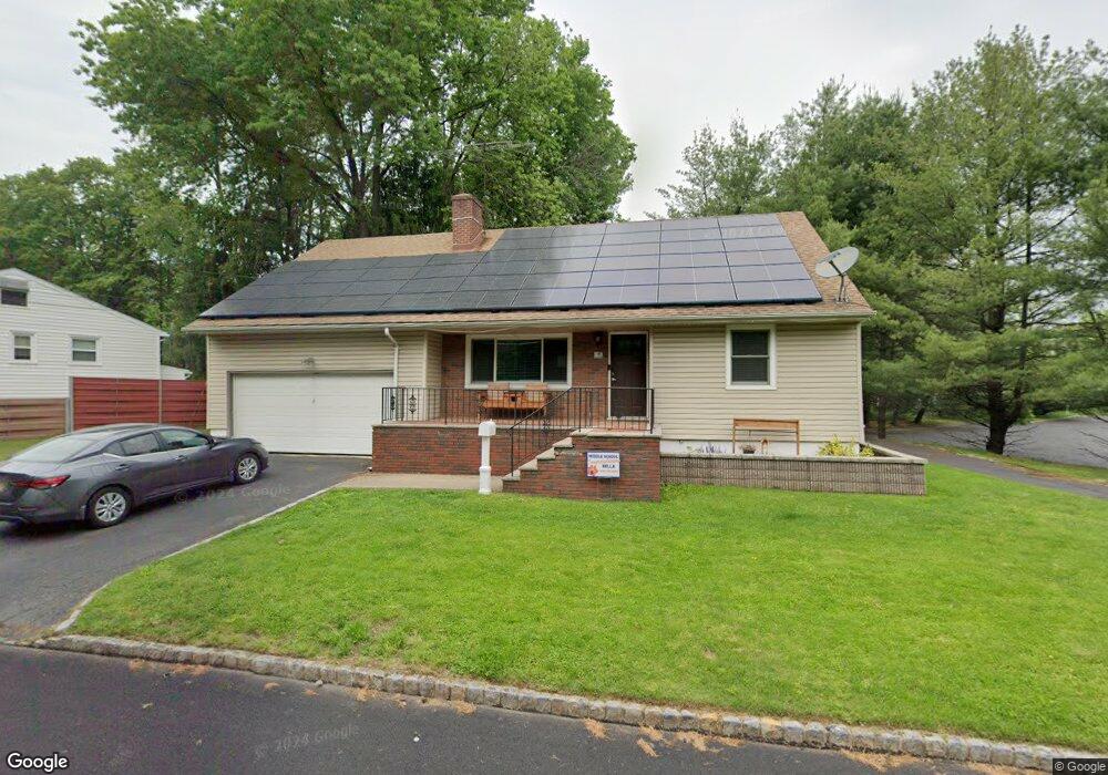
31 Tulip Rd Springfield, NJ 07081
Estimated Value: $722,209 - $918,000
Studio
--
Bath
2,537
Sq Ft
$309/Sq Ft
Est. Value
About This Home
This home is located at 31 Tulip Rd, Springfield, NJ 07081 and is currently estimated at $782,802, approximately $308 per square foot. 31 Tulip Rd is a home located in Union County with nearby schools including Jonathan Dayton High School, St James The Apostle School, and The Winston School.
Ownership History
Date
Name
Owned For
Owner Type
Purchase Details
Closed on
Aug 31, 2005
Sold by
Carrano Lena M
Bought by
Pintado Jordan and Pintado Charlene
Current Estimated Value
Home Financials for this Owner
Home Financials are based on the most recent Mortgage that was taken out on this home.
Original Mortgage
$354,400
Outstanding Balance
$187,724
Interest Rate
5.79%
Mortgage Type
New Conventional
Estimated Equity
$595,078
Purchase Details
Closed on
Aug 5, 1998
Sold by
Carrano Joseph F and Carrano Lena M
Bought by
Carrano Lena M and Carrano Joseph F
Create a Home Valuation Report for This Property
The Home Valuation Report is an in-depth analysis detailing your home's value as well as a comparison with similar homes in the area
Home Values in the Area
Average Home Value in this Area
Purchase History
| Date | Buyer | Sale Price | Title Company |
|---|---|---|---|
| Pintado Jordan | $443,000 | -- | |
| Carrano Lena M | -- | -- |
Source: Public Records
Mortgage History
| Date | Status | Borrower | Loan Amount |
|---|---|---|---|
| Open | Pintado Jordan | $354,400 |
Source: Public Records
Tax History
| Year | Tax Paid | Tax Assessment Tax Assessment Total Assessment is a certain percentage of the fair market value that is determined by local assessors to be the total taxable value of land and additions on the property. | Land | Improvement |
|---|---|---|---|---|
| 2025 | $12,552 | $528,500 | $228,200 | $300,300 |
| 2024 | $12,346 | $528,500 | $228,200 | $300,300 |
| 2023 | $12,346 | $528,500 | $228,200 | $300,300 |
| 2022 | $11,463 | $528,500 | $228,200 | $300,300 |
| 2021 | $11,331 | $152,200 | $59,700 | $92,500 |
| 2020 | $11,155 | $152,200 | $59,700 | $92,500 |
| 2019 | $11,004 | $152,200 | $59,700 | $92,500 |
| 2018 | $10,806 | $152,200 | $59,700 | $92,500 |
| 2017 | $10,509 | $152,200 | $59,700 | $92,500 |
| 2016 | $10,305 | $152,200 | $59,700 | $92,500 |
| 2015 | $10,185 | $152,200 | $59,700 | $92,500 |
| 2014 | $9,993 | $152,200 | $59,700 | $92,500 |
Source: Public Records
Map
Nearby Homes
- 28 Molter Ave
- 66 Springbrook Rd
- 29 Keeler St
- 24 Brook St
- 5B Troy Dr Unit 1
- 1A Troy Dr Unit A
- 21A Troy Dr
- 16 Tooker Ave
- 4A Troy Dr Unit 27
- 46 Elmwood Place
- 10A Troy Dr Unit 10A
- 57C Troy Dr
- 190 Morris Ave Unit 3B
- 45 Ocean St Unit B
- 2 S Audlen Terrace
- 14 Eton Place
- 119 Wellington Ave
- 8 Claremont Dr
- 19A Ocean St Unit A
- 298 Main St
Your Personal Tour Guide
Ask me questions while you tour the home.