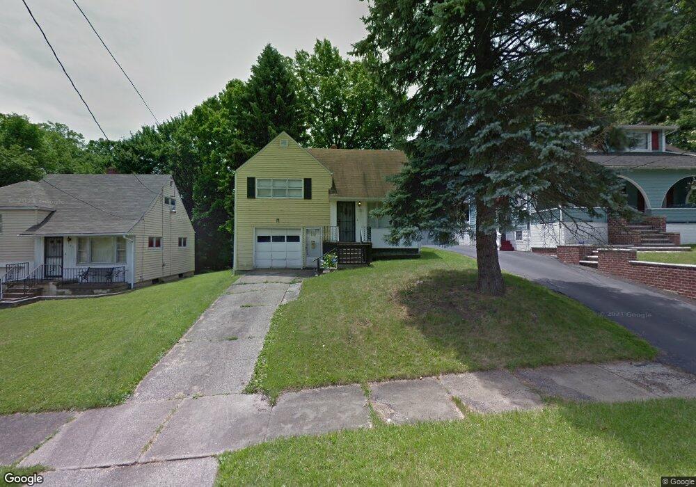
31 W Dennick Ave Youngstown, OH 44505
North Heights NeighborhoodEstimated Value: $49,000 - $66,000
3
Beds
1
Bath
1,040
Sq Ft
$56/Sq Ft
Est. Value
About This Home
This home is located at 31 W Dennick Ave, Youngstown, OH 44505 and is currently estimated at $58,581, approximately $56 per square foot. 31 W Dennick Ave is a home located in Mahoning County with nearby schools including Harding Elementary School, East High School, and Youngstown Preparatory Academy.
Ownership History
Date
Name
Owned For
Owner Type
Purchase Details
Closed on
Oct 27, 1998
Sold by
Bank Of America Natl Trust & Svgs Assn
Bought by
Ingram Lorenzo and Ingram Kacynthia R
Current Estimated Value
Purchase Details
Closed on
Nov 3, 1997
Sold by
Chance Philip A and Bednar Chester A
Bought by
Bank Of America Natl Trust & Svgs Assn
Purchase Details
Closed on
Feb 11, 1992
Bought by
Bednar Chester A and J R
Create a Home Valuation Report for This Property
The Home Valuation Report is an in-depth analysis detailing your home's value as well as a comparison with similar homes in the area
Home Values in the Area
Average Home Value in this Area
Purchase History
| Date | Buyer | Sale Price | Title Company |
|---|---|---|---|
| Ingram Lorenzo | $12,200 | -- | |
| Bank Of America Natl Trust & Svgs Assn | $15,000 | -- | |
| Bednar Chester A | -- | -- |
Source: Public Records
Mortgage History
| Date | Status | Borrower | Loan Amount |
|---|---|---|---|
| Closed | Ingram Lorenzo | $0 |
Source: Public Records
Tax History Compared to Growth
Tax History
| Year | Tax Paid | Tax Assessment Tax Assessment Total Assessment is a certain percentage of the fair market value that is determined by local assessors to be the total taxable value of land and additions on the property. | Land | Improvement |
|---|---|---|---|---|
| 2024 | $327 | $6,640 | $640 | $6,000 |
| 2023 | $324 | $6,640 | $640 | $6,000 |
| 2022 | $231 | $3,620 | $640 | $2,980 |
| 2021 | $231 | $3,620 | $640 | $2,980 |
| 2020 | $232 | $3,620 | $640 | $2,980 |
| 2019 | $238 | $3,300 | $640 | $2,660 |
| 2018 | $240 | $3,300 | $640 | $2,660 |
| 2017 | $237 | $3,300 | $640 | $2,660 |
| 2016 | $336 | $5,050 | $640 | $4,410 |
| 2015 | $330 | $5,050 | $640 | $4,410 |
| 2014 | $327 | $5,050 | $640 | $4,410 |
| 2013 | $323 | $5,050 | $640 | $4,410 |
Source: Public Records
Map
Nearby Homes
- 2428 Wydesteel Ave
- 2417 Elm St Unit 419
- 52 Florist Ave
- 2016-2018 Cordova Ave
- 1580 Florencedale Ave
- 1707 Ohio Ave
- 1859 Selma Ave
- 2310 Selma Ave
- 1867 Coronado Ave
- 237 Norwood Ave
- 216 Lora Ave
- 234 Lora Ave
- 238 Lora Ave
- 2260 Coronado Ave
- 227 Lora Ave
- 402 Tod Ln
- 229-231 Lora Ave
- 1442-1446 Ohio Ave
- 1841 Goleta Ave
- 2220 Goleta Ave
- 27 W Dennick Ave
- 39 W Dennick Ave
- 47 W Dennick Ave
- 38 Lauderdale Ave
- 46 Lauderdale Ave
- 20 W Dennick Ave
- 32 Lauderdale Ave
- 50 Lauderdale Ave
- 34 W Dennick Ave
- 38 W Dennick Ave
- 30 W Dennick Ave
- 42 W Dennick Ave
- 2237 Kensington Ave
- 42 Lauderdale Ave
- 58 Lauderdale Ave
- 2215 Kensington Ave
- 46 W Dennick Ave
- 2219 Kensington Ave
- 2230 Logan Ave
- 28 Lauderdale Ave