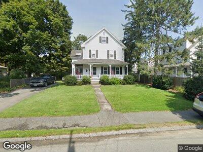
31 Winthrop St Concord, MA 01742
West Concord NeighborhoodEstimated Value: $1,074,000 - $1,258,211
3
Beds
2
Baths
2,152
Sq Ft
$531/Sq Ft
Est. Value
About This Home
This home is located at 31 Winthrop St, Concord, MA 01742 and is currently estimated at $1,143,303, approximately $531 per square foot. 31 Winthrop St is a home located in Middlesex County with nearby schools including Thoreau Elementary School, Concord Middle School, and Concord Carlisle High School.
Ownership History
Date
Name
Owned For
Owner Type
Purchase Details
Closed on
Mar 1, 1981
Bought by
Fulton Peter J and Fulton Ellen M
Current Estimated Value
Create a Home Valuation Report for This Property
The Home Valuation Report is an in-depth analysis detailing your home's value as well as a comparison with similar homes in the area
Home Values in the Area
Average Home Value in this Area
Purchase History
| Date | Buyer | Sale Price | Title Company |
|---|---|---|---|
| Fulton Peter J | $72,000 | -- |
Source: Public Records
Mortgage History
| Date | Status | Borrower | Loan Amount |
|---|---|---|---|
| Open | Fulton Ellen M | $510,000 | |
| Closed | Fulton Ellen M | $80,000 | |
| Closed | Fulton Ellen M | $600,000 | |
| Closed | Fulton Ellen M | $180,000 | |
| Closed | Fulton Peter J | $150,000 | |
| Closed | Fulton Ellen M | $80,000 | |
| Closed | Fulton Ellen M | $100,000 | |
| Closed | Fulton Peter J | $60,000 |
Source: Public Records
Tax History Compared to Growth
Tax History
| Year | Tax Paid | Tax Assessment Tax Assessment Total Assessment is a certain percentage of the fair market value that is determined by local assessors to be the total taxable value of land and additions on the property. | Land | Improvement |
|---|---|---|---|---|
| 2025 | $129 | $970,900 | $404,900 | $566,000 |
| 2024 | $12,464 | $949,300 | $404,900 | $544,400 |
| 2023 | $10,571 | $815,700 | $368,100 | $447,600 |
| 2022 | $11,588 | $785,100 | $294,500 | $490,600 |
| 2021 | $10,772 | $731,800 | $294,500 | $437,300 |
| 2020 | $10,419 | $732,200 | $294,500 | $437,700 |
| 2019 | $9,993 | $704,200 | $304,200 | $400,000 |
| 2018 | $8,616 | $637,500 | $279,300 | $358,200 |
| 2017 | $8,826 | $627,300 | $259,300 | $368,000 |
| 2016 | $8,395 | $603,100 | $259,300 | $343,800 |
| 2015 | $7,852 | $549,500 | $240,100 | $309,400 |
Source: Public Records
Map
Nearby Homes
- 50 Sunnyside Ln
- 17 Derby St
- 17A Laws Brook Rd Unit A
- 57 Central St
- 21 Concord Greene Unit 1
- 70 McCallar Ln
- 10 Wright Rd
- 18 Concord Greene Unit 6
- 138 Baker Ave
- 27 Concord Greene Unit 1
- 23 Shirley St
- 66 Old Stow Rd
- 325 Old Marlboro Rd
- 54 Staffordshire Ln Unit C
- 565 Elm St
- 19 S Meadow Ridge
- 23 Wright Farm Unit 23
- 23 Wright Farm
- 95 Bayberry Rd
- 65 Summit St
- 31 Winthrop St
- 41 Winthrop St Unit 41
- 39 Winthrop St
- 21 Winthrop St
- 21 Winthrop St Unit 1
- 30 Winthrop St
- 20 Winthrop St
- 238 Commonwealth Ave Unit 1
- 238 Commonwealth Ave Unit 4
- 238 Commonwealth Ave
- 246 Commonwealth Ave
- 252 Commonwealth Ave
- 226 Commonwealth Ave
- 260 Commonwealth Ave
- 218 Commonwealth Ave
- 254 Commonwealth Ave Unit 254
- 210 Commonwealth Ave
- 272 Commonwealth Ave
- 56 Winthrop St Unit 1-3
- 56 Winthrop St Unit 1-2