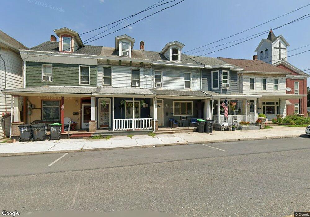
310 Bridge St Weissport, PA 18235
Estimated Value: $146,433 - $185,000
3
Beds
1
Bath
1,880
Sq Ft
$86/Sq Ft
Est. Value
About This Home
This home is located at 310 Bridge St, Weissport, PA 18235 and is currently estimated at $162,608, approximately $86 per square foot. 310 Bridge St is a home located in Carbon County with nearby schools including Lehighton Area High School, Sts. Peter & Paul School, and Valley Ridge Academy.
Ownership History
Date
Name
Owned For
Owner Type
Purchase Details
Closed on
Aug 30, 2019
Sold by
Hai Perevez
Bought by
Wakim Eddie and Wakim Hala
Current Estimated Value
Purchase Details
Closed on
Apr 29, 2019
Sold by
Citimortgage Inc
Bought by
Pervez Hai
Purchase Details
Closed on
Jan 19, 2017
Sold by
The Secretary Of Housing & Urban Develop
Bought by
Citimortgage Inc
Purchase Details
Closed on
Aug 16, 2016
Sold by
Citimortgage Inc
Bought by
Secretary Of Housing & Urban Development
Purchase Details
Closed on
Mar 27, 2015
Sold by
Pancoast Catherine
Bought by
Citimortgage Inc
Purchase Details
Closed on
Mar 31, 2005
Sold by
Gower Roger and Gower Paula M
Bought by
Pancoast Catherine
Home Financials for this Owner
Home Financials are based on the most recent Mortgage that was taken out on this home.
Original Mortgage
$54,865
Interest Rate
5.61%
Mortgage Type
FHA
Create a Home Valuation Report for This Property
The Home Valuation Report is an in-depth analysis detailing your home's value as well as a comparison with similar homes in the area
Home Values in the Area
Average Home Value in this Area
Purchase History
| Date | Buyer | Sale Price | Title Company |
|---|---|---|---|
| Wakim Eddie | $28,000 | Carbon Search & Settlement | |
| Pervez Hai | $4,000 | Servicelink Llc | |
| Citimortgage Inc | $50,085 | None Available | |
| Secretary Of Housing & Urban Development | -- | Attorney | |
| Citimortgage Inc | $1,153 | None Available | |
| Pancoast Catherine | $55,300 | None Available |
Source: Public Records
Mortgage History
| Date | Status | Borrower | Loan Amount |
|---|---|---|---|
| Previous Owner | Pancoast Catherine | $54,865 |
Source: Public Records
Tax History Compared to Growth
Tax History
| Year | Tax Paid | Tax Assessment Tax Assessment Total Assessment is a certain percentage of the fair market value that is determined by local assessors to be the total taxable value of land and additions on the property. | Land | Improvement |
|---|---|---|---|---|
| 2025 | $2,191 | $26,500 | $5,500 | $21,000 |
| 2024 | $2,111 | $26,500 | $5,500 | $21,000 |
| 2023 | $1,890 | $26,500 | $5,500 | $21,000 |
| 2022 | $2,091 | $26,500 | $5,500 | $21,000 |
| 2021 | $1,995 | $26,500 | $5,500 | $21,000 |
| 2020 | $1,949 | $26,500 | $5,500 | $21,000 |
| 2019 | $1,856 | $26,500 | $5,500 | $21,000 |
| 2018 | $1,829 | $26,500 | $5,500 | $21,000 |
| 2017 | $1,829 | $26,500 | $5,500 | $21,000 |
| 2016 | -- | $26,500 | $5,500 | $21,000 |
| 2015 | -- | $26,500 | $5,500 | $21,000 |
| 2014 | -- | $26,500 | $5,500 | $21,000 |
Source: Public Records
Map
Nearby Homes
- 142 Bankway St
- 25 Stedman Ave
- 438 White St
- 12 2nd Ave
- 0 Fairyland Rd Unit PM-136987
- 236 S 2nd St
- 230 S 2nd St
- 201 Fairview St
- 361 Court St Unit REAR
- 361 Court St
- 193 S 4th St
- 193 S 4th St Unit 191-193
- 117 N 4th St
- 231 Coal St
- 344 Ochre St
- 230 Carbon St
- 410 S 8th St
- 470 N 8th St
- 286-113 Lower Nis Hollow Dr
- 286-126 Lower Nis Hollow Dr