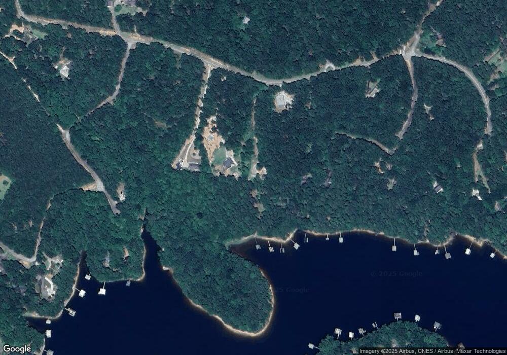
310 Currahee Ridge Rd Toccoa, GA 30577
Estimated Value: $179,000 - $399,000
--
Bed
--
Bath
--
Sq Ft
1.01
Acres
About This Home
This home is located at 310 Currahee Ridge Rd, Toccoa, GA 30577 and is currently estimated at $266,145. 310 Currahee Ridge Rd is a home with nearby schools including Stephens County High School.
Ownership History
Date
Name
Owned For
Owner Type
Purchase Details
Closed on
Dec 9, 2021
Sold by
Crumley Jimmy Eugene
Bought by
Durant John C and Durant Andrea
Current Estimated Value
Purchase Details
Closed on
Jan 28, 2020
Sold by
Dill Wayne F
Bought by
Crumley Jimmy Eugene
Home Financials for this Owner
Home Financials are based on the most recent Mortgage that was taken out on this home.
Original Mortgage
$80,000
Interest Rate
3.72%
Mortgage Type
New Conventional
Purchase Details
Closed on
Apr 24, 2013
Sold by
Chandran Samuel
Bought by
Dill Wayne F and Dill Pamela L
Purchase Details
Closed on
Jun 14, 2004
Bought by
Samuel Chandran and Samuel Maria
Purchase Details
Closed on
Jan 1, 1993
Bought by
<Buyer Info Not Present>
Create a Home Valuation Report for This Property
The Home Valuation Report is an in-depth analysis detailing your home's value as well as a comparison with similar homes in the area
Home Values in the Area
Average Home Value in this Area
Purchase History
| Date | Buyer | Sale Price | Title Company |
|---|---|---|---|
| Durant John C | $145,000 | -- | |
| Crumley Jimmy Eugene | $100,000 | -- | |
| Dill Wayne F | $90,630 | -- | |
| Samuel Chandran | $90,000 | -- | |
| <Buyer Info Not Present> | $25,000 | -- |
Source: Public Records
Mortgage History
| Date | Status | Borrower | Loan Amount |
|---|---|---|---|
| Previous Owner | Crumley Jimmy Eugene | $80,000 |
Source: Public Records
Tax History Compared to Growth
Tax History
| Year | Tax Paid | Tax Assessment Tax Assessment Total Assessment is a certain percentage of the fair market value that is determined by local assessors to be the total taxable value of land and additions on the property. | Land | Improvement |
|---|---|---|---|---|
| 2024 | $1,444 | $47,412 | $42,880 | $4,532 |
| 2023 | $1,444 | $47,412 | $42,880 | $4,532 |
| 2022 | $1,411 | $47,412 | $42,880 | $4,532 |
| 2021 | $1,468 | $46,956 | $42,201 | $4,755 |
| 2020 | $1,483 | $46,956 | $42,201 | $4,755 |
| 2019 | $1,491 | $47,005 | $42,201 | $4,804 |
| 2018 | $1,491 | $47,005 | $42,201 | $4,804 |
| 2017 | $1,514 | $47,005 | $42,201 | $4,804 |
| 2016 | $1,367 | $43,103 | $42,200 | $902 |
| 2015 | $1,431 | $43,103 | $42,200 | $902 |
| 2014 | $1,224 | $43,103 | $42,201 | $902 |
| 2013 | -- | $43,103 | $42,200 | $902 |
Source: Public Records
Map
Nearby Homes
- 245 Currahee Place
- 88 Currahee Place
- 455 Chase Landing Rd
- 347 River Trail
- 679 Suttles Rd
- 0 Cheyenne Trail Unit 10633853
- 604 Mckinney Way
- 238 Jenkins Mill Dr
- 53 Raven Ct
- 120 Ridgemore Cir
- 3 Lost Forest Dr
- 0 Oliver Rd Unit 20284767
- 0 Oliver Rd Unit 1550308
- 23 Wren Ct
- Lot 6 Lost Forest Dr
- 9B Lost Forest Dr
- 0 Lost Forest Dr
- 02 Wood Valley Dr
- 0 Wildwood Trail
- 223 Brookside Dr
- 326 Currahee Ridge Rd Unit DOCK
- 346 Currahee Ridge Rd
- 288 Currahee Ridge Rd
- 128 Tranquility Ln
- 73 Tranquility Ln
- 0 Currahee Ridge Unit 2616925
- 0 Currahee Ridge Unit LOT 26 3089802
- 0 Currahee Ridge Unit 28C,28D,29 7075978
- 0 Currahee Ridge Unit LOT 26 7186725
- 0 Currahee Ridge Unit 26 7393794
- 28B Currahee Ridge Rd
- 28 Currahee Ridge Rd
- 0 Currahee Ridge Unit 3072713
- 0 Currahee Ridge Rd Unit 7252356
- 0 Currahee Ridge Rd Unit 8426561
- 0 Currahee Ridge Rd Unit 7585207
- 0 Currahee Ridge Rd Unit 8380115
- 0 Currahee Ridge Unit 8859660
- 0 Currahee Ridge Unit 3161622
- 0 Currahee Ridge Unit 7089021
