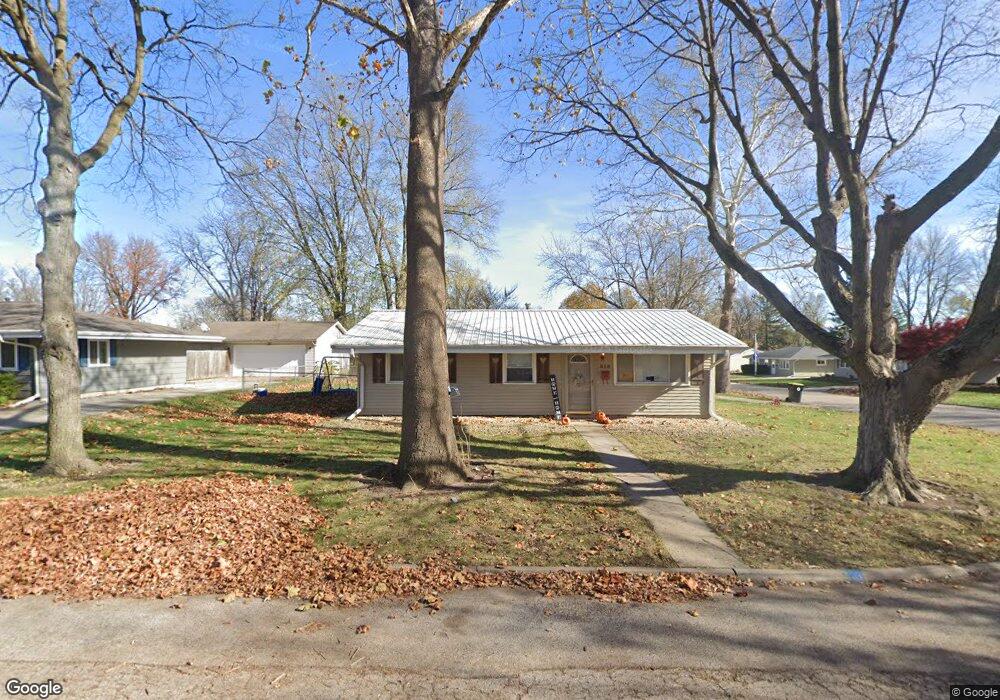
310 Daisy Ln Normal, IL 61761
Kingsridge NeighborhoodEstimated Value: $169,000 - $186,000
3
Beds
1
Bath
1,004
Sq Ft
$176/Sq Ft
Est. Value
About This Home
This home is located at 310 Daisy Ln, Normal, IL 61761 and is currently estimated at $176,495, approximately $175 per square foot. 310 Daisy Ln is a home located in McLean County with nearby schools including Oakdale Elementary School, Kingsley Junior High School, and Normal Community West High School.
Ownership History
Date
Name
Owned For
Owner Type
Purchase Details
Closed on
Sep 23, 2008
Sold by
Lugo Hector S and Lugo Katherine M
Bought by
Whitwood Dale
Current Estimated Value
Purchase Details
Closed on
Jul 24, 2006
Sold by
Goeckner Ronald J and Goeckner Rebecca S
Bought by
Lugo Hector and Lugo Katherine M
Home Financials for this Owner
Home Financials are based on the most recent Mortgage that was taken out on this home.
Original Mortgage
$106,727
Interest Rate
6.73%
Create a Home Valuation Report for This Property
The Home Valuation Report is an in-depth analysis detailing your home's value as well as a comparison with similar homes in the area
Home Values in the Area
Average Home Value in this Area
Purchase History
| Date | Buyer | Sale Price | Title Company |
|---|---|---|---|
| Whitwood Dale | $112,000 | Frontier Title Co | |
| Lugo Hector | $108,000 | None Available |
Source: Public Records
Mortgage History
| Date | Status | Borrower | Loan Amount |
|---|---|---|---|
| Previous Owner | Lugo Hector | $106,727 |
Source: Public Records
Tax History
| Year | Tax Paid | Tax Assessment Tax Assessment Total Assessment is a certain percentage of the fair market value that is determined by local assessors to be the total taxable value of land and additions on the property. | Land | Improvement |
|---|---|---|---|---|
| 2024 | $3,422 | $47,095 | $13,938 | $33,157 |
| 2022 | $3,422 | $38,097 | $11,275 | $26,822 |
| 2021 | $3,306 | $35,944 | $10,638 | $25,306 |
| 2020 | $3,287 | $35,570 | $10,527 | $25,043 |
| 2019 | $3,176 | $35,378 | $10,470 | $24,908 |
| 2018 | $3,141 | $35,003 | $10,359 | $24,644 |
| 2017 | $3,029 | $35,003 | $10,359 | $24,644 |
| 2016 | $2,996 | $35,003 | $10,359 | $24,644 |
| 2015 | $2,914 | $34,182 | $10,116 | $24,066 |
| 2014 | $2,878 | $34,182 | $10,116 | $24,066 |
| 2013 | -- | $34,182 | $10,116 | $24,066 |
Source: Public Records
Map
Nearby Homes
- 112 S Cottage Ave
- 1305 Kingsridge Ct Unit C
- 102 Nottingham Chase
- 301 Oakdale Ave
- 813 Highpoint Rd
- 1607 Hovey Ave
- 816 W College Ave
- 811 W College Ave
- 1108 Hovey Ave
- 112 College Park Ct
- 804 Osage St
- 206 N Grove St
- 1015 Primrose Ln
- 1004 Hovey Ave
- Lot 8 Emeline St
- 1215 Wall St
- 2112 Parker Ave
- 200 Felmley Dr
- 307 N Cottage Ave
- 303 Jo Ann Ct
Your Personal Tour Guide
Ask me questions while you tour the home.