Estimated Value: $94,063 - $130,000
Studio
--
Bath
1,176
Sq Ft
$100/Sq Ft
Est. Value
About This Home
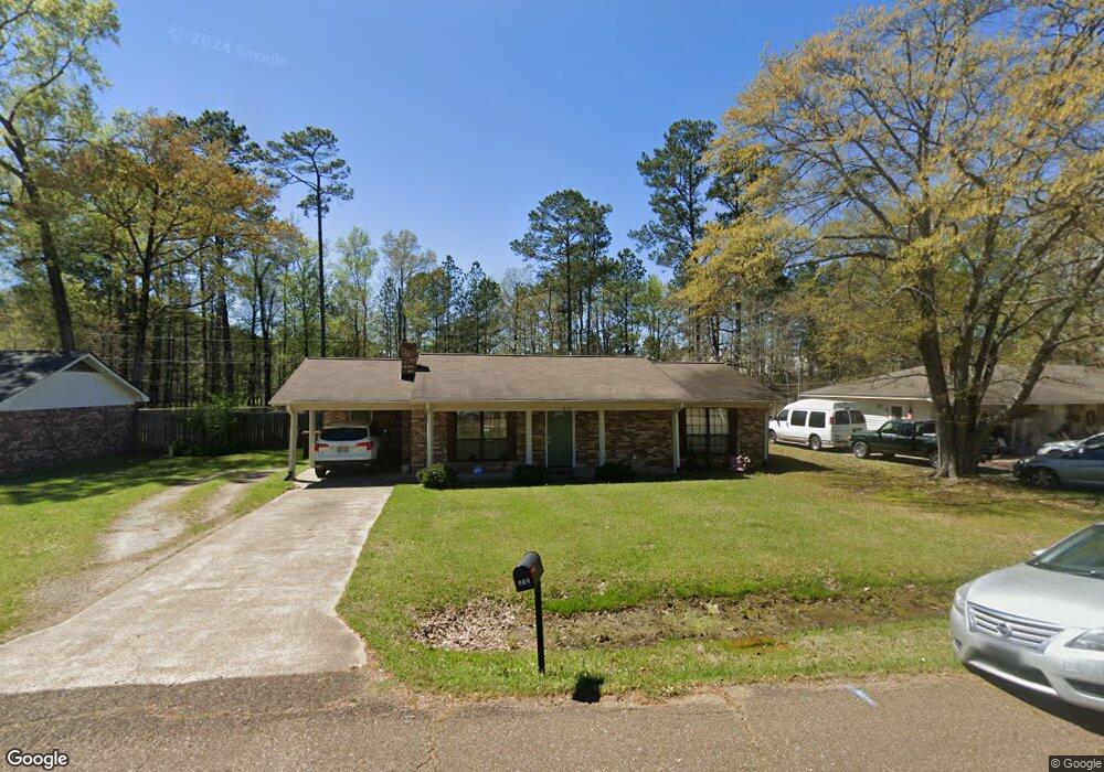
This home is located at 310 David St, Amory, MS 38821 and is currently estimated at $117,266, approximately $99 per square foot. 310 David St is a home located in Monroe County with nearby schools including West Amory Elementary, East Amory Elementary, and Amory Middle School.
Ownership History
Date
Name
Owned For
Owner Type
Purchase Details
Closed on
Jan 25, 2021
Bought by
Sanders Caelin
Current Estimated Value
Purchase Details
Closed on
Aug 29, 2019
Bought by
Thompson Jessica R
Home Financials for this Owner
Home Financials are based on the most recent Mortgage that was taken out on this home.
Original Mortgage
$98,181
Interest Rate
3.7%
Mortgage Type
New Conventional
Purchase Details
Closed on
Jun 13, 2017
Sold by
Justice Tommy
Bought by
Mcneese Anna Marie
Home Financials for this Owner
Home Financials are based on the most recent Mortgage that was taken out on this home.
Original Mortgage
$89,898
Interest Rate
4.02%
Mortgage Type
New Conventional
Purchase Details
Closed on
Aug 31, 2016
Sold by
Dobbs Della Mae
Bought by
Justice Tommy
Home Financials for this Owner
Home Financials are based on the most recent Mortgage that was taken out on this home.
Original Mortgage
$32,958
Interest Rate
3.43%
Mortgage Type
Purchase Money Mortgage
Create a Home Valuation Report for This Property
The Home Valuation Report is an in-depth analysis detailing your home's value as well as a comparison with similar homes in the area
Home Values in the Area
Average Home Value in this Area
Purchase History
| Date | Buyer | Sale Price | Title Company |
|---|---|---|---|
| Sanders Caelin | $107,972 | -- | |
| Thompson Jessica R | $32,000 | -- | |
| Mcneese Anna Marie | -- | None Available | |
| Justice Tommy | -- | -- |
Source: Public Records
Mortgage History
| Date | Status | Borrower | Loan Amount |
|---|---|---|---|
| Previous Owner | Thompson Jessica R | $98,181 | |
| Previous Owner | Mcneese Anna Marie | $89,898 | |
| Previous Owner | Justice Tommy | $32,958 |
Source: Public Records
Tax History
| Year | Tax Paid | Tax Assessment Tax Assessment Total Assessment is a certain percentage of the fair market value that is determined by local assessors to be the total taxable value of land and additions on the property. | Land | Improvement |
|---|---|---|---|---|
| 2025 | $972 | $5,883 | $0 | $0 |
| 2024 | $7 | $5,314 | $0 | $0 |
| 2023 | $646 | $5,314 | $0 | $0 |
| 2022 | $625 | $5,314 | $0 | $0 |
| 2021 | $650 | $5,314 | $0 | $0 |
| 2020 | $654 | $5,377 | $0 | $0 |
| 2019 | $656 | $5,377 | $0 | $0 |
| 2018 | $629 | $5,377 | $0 | $0 |
| 2017 | $1,181 | $8,066 | $0 | $0 |
| 2016 | $1,878 | $8,075 | $0 | $0 |
| 2015 | -- | $5,383 | $0 | $0 |
| 2014 | -- | $5,383 | $0 | $0 |
Source: Public Records
Map
Nearby Homes
- 407 Cainwood St
- 1321 Hatley Rd
- 309 Kenwood Dr
- 401 Tschudi Rd
- 60039 Hatley Rd
- 0 Parkview St
- 0 Tschudi Rd
- 0 Glenn Dr
- 308 Easthaven Dr N
- 603 Burdine St
- 60470 Cotton Gin Port Rd
- 5 Emily Ln
- 1105 Kendall St
- 1009 Poplar St
- 1006 Walnut St
- 818 Walnut St
- 115 Colonial St
- 60343 Cotton Gin Port Rd
- 808 Mulberry St
- 1306 Concord Ave
Your Personal Tour Guide
Ask me questions while you tour the home.