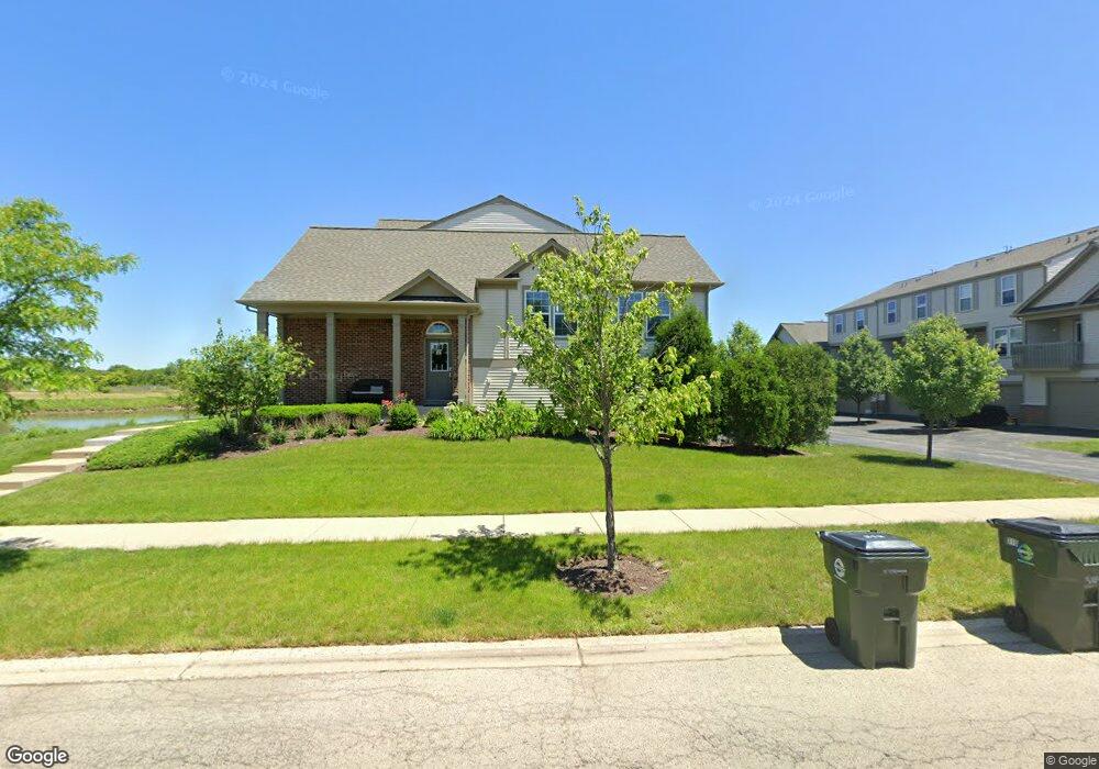
310 Devoe Dr Oswego, IL 60543
North Oswego NeighborhoodEstimated Value: $305,000 - $315,000
2
Beds
3
Baths
1,173
Sq Ft
$263/Sq Ft
Est. Value
About This Home
This home is located at 310 Devoe Dr, Oswego, IL 60543 and is currently estimated at $308,199, approximately $262 per square foot. 310 Devoe Dr is a home located in Kendall County with nearby schools including Southbury Elementary School, Murphy Junior High School, and Oswego East High School.
Ownership History
Date
Name
Owned For
Owner Type
Purchase Details
Closed on
Jan 31, 2020
Sold by
Jallouqa Said
Bought by
Long James C
Current Estimated Value
Home Financials for this Owner
Home Financials are based on the most recent Mortgage that was taken out on this home.
Original Mortgage
$134,175
Outstanding Balance
$120,224
Interest Rate
4.25%
Mortgage Type
New Conventional
Estimated Equity
$187,975
Purchase Details
Closed on
Nov 7, 2014
Sold by
Pulte Home Corporation
Bought by
Jallouqa Said
Home Financials for this Owner
Home Financials are based on the most recent Mortgage that was taken out on this home.
Original Mortgage
$144,800
Interest Rate
3.25%
Mortgage Type
Purchase Money Mortgage
Create a Home Valuation Report for This Property
The Home Valuation Report is an in-depth analysis detailing your home's value as well as a comparison with similar homes in the area
Home Values in the Area
Average Home Value in this Area
Purchase History
| Date | Buyer | Sale Price | Title Company |
|---|---|---|---|
| Long James C | $179,000 | Old Republic Title | |
| Jallouqa Said | $181,000 | Pgp Title |
Source: Public Records
Mortgage History
| Date | Status | Borrower | Loan Amount |
|---|---|---|---|
| Open | Long James C | $134,175 | |
| Previous Owner | Jallouqa Said | $144,800 |
Source: Public Records
Tax History
| Year | Tax Paid | Tax Assessment Tax Assessment Total Assessment is a certain percentage of the fair market value that is determined by local assessors to be the total taxable value of land and additions on the property. | Land | Improvement |
|---|---|---|---|---|
| 2024 | $7,295 | $90,646 | $15,670 | $74,976 |
| 2023 | $6,585 | $80,217 | $13,867 | $66,350 |
| 2022 | $6,585 | $72,924 | $12,606 | $60,318 |
| 2021 | $5,580 | $59,633 | $11,999 | $47,634 |
| 2020 | $5,068 | $59,633 | $11,999 | $47,634 |
| 2019 | $6,257 | $71,188 | $11,999 | $59,189 |
| 2018 | $5,453 | $62,334 | $10,497 | $51,837 |
| 2017 | $5,274 | $57,451 | $9,675 | $47,776 |
| 2016 | $4,909 | $53,195 | $8,958 | $44,237 |
| 2015 | $4,718 | $49,254 | $8,294 | $40,960 |
| 2014 | -- | $0 | $0 | $0 |
Source: Public Records
Map
Nearby Homes
- 240 Devoe Dr
- 608 Hawley Dr Unit 4342
- 464 Valentine Way
- 460 Valentine Way
- 3017 Lundquist Dr
- 2322 Pagosa Springs Dr
- 605 Murdock Place
- 241 Cooney Way
- 353 Danforth Dr
- 234 Cooney Way
- 393 Danforth Dr
- 601 Murdock Place
- 391 Danforth Dr
- 602 Murdock Place
- 714 Erwin St
- 347 Danforth Dr
- 339 Danforth Dr
- 1893 Indian Hill Ln Unit 4053
- 1851 Indian Hill Ln Unit 4083
- 1823 Indian Hill Ln Unit 4102
- 310 Devoe Dr Unit 231
- 312 Devoe Dr
- 314 Devoe Dr Unit 233
- 314 Devoe Dr
- 316 Devoe Dr
- 600 Devoe Dr Unit 346
- 630 Devoe Dr Unit 364
- 318 Devoe Dr
- 302 Devoe Dr
- 300 Devoe Dr Unit 225
- 300 Devoe Dr
- 304 Devoe Dr Unit 223
- 304 Devoe Dr
- 306 Devoe Dr
- 308 Devoe Dr Unit 205
- 308 Devoe Dr
- 309 Devoe Dr Unit 4305
- 307 Devoe Dr Unit 4304
- 303 Devoe Dr Unit 4302
Your Personal Tour Guide
Ask me questions while you tour the home.