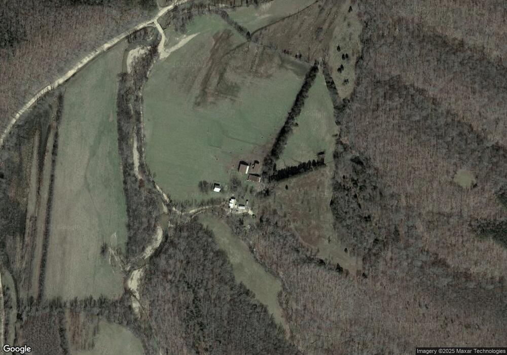
310 Dewey Wright Rd Centerville, TN 37033
Estimated Value: $321,000 - $505,000
Studio
1
Bath
1,456
Sq Ft
$283/Sq Ft
Est. Value
About This Home
This home is located at 310 Dewey Wright Rd, Centerville, TN 37033 and is currently estimated at $411,702, approximately $282 per square foot. 310 Dewey Wright Rd is a home located in Hickman County with nearby schools including Centerville Elementary School, Centerville Intermediate School, and Hickman County Middle School.
Ownership History
Date
Name
Owned For
Owner Type
Purchase Details
Closed on
Nov 29, 2011
Sold by
Monroe Robert
Bought by
Shough Charles R and Shough Shona S
Current Estimated Value
Home Financials for this Owner
Home Financials are based on the most recent Mortgage that was taken out on this home.
Original Mortgage
$67,150
Interest Rate
4.06%
Mortgage Type
Cash
Purchase Details
Closed on
Oct 6, 2006
Sold by
Wright Jackson Linda Gail
Bought by
Monroe Robert A
Home Financials for this Owner
Home Financials are based on the most recent Mortgage that was taken out on this home.
Original Mortgage
$97,731
Interest Rate
6.45%
Mortgage Type
Cash
Create a Home Valuation Report for This Property
The Home Valuation Report is an in-depth analysis detailing your home's value as well as a comparison with similar homes in the area
Purchase History
| Date | Buyer | Sale Price | Title Company |
|---|---|---|---|
| Shough Charles R | $266,000 | -- | |
| Monroe Robert A | $94,827 | -- |
Source: Public Records
Mortgage History
| Date | Status | Borrower | Loan Amount |
|---|---|---|---|
| Closed | Shough Charles R | $67,150 | |
| Previous Owner | Monroe Robert A | $97,731 |
Source: Public Records
Tax History
| Year | Tax Paid | Tax Assessment Tax Assessment Total Assessment is a certain percentage of the fair market value that is determined by local assessors to be the total taxable value of land and additions on the property. | Land | Improvement |
|---|---|---|---|---|
| 2025 | $1,894 | $48,000 | -- | -- |
| 2024 | $1,120 | $48,000 | -- | -- |
| 2023 | $1,120 | $48,000 | $0 | $0 |
| 2022 | $1,120 | $48,000 | $0 | $0 |
| 2021 | $1,014 | $36,200 | $0 | $0 |
| 2020 | $1,014 | $36,200 | $0 | $0 |
| 2019 | $1,025 | $36,200 | $0 | $0 |
| 2018 | $1,014 | $36,200 | $0 | $0 |
| 2017 | $964 | $32,800 | $0 | $0 |
| 2016 | $772 | $26,275 | $0 | $0 |
| 2014 | $668 | $26,311 | $0 | $0 |
Source: Public Records
Map
Nearby Homes
- 450 Lowe Branch Rd
- 2024 Trace Creek Rd
- 0 Kennedy Ln Unit 25965361
- 0 Kennedy Ln Unit RTC3073486
- 0 Fire Tower Rd Unit RTC3051285
- 0 Highway 438 Unit 25510456
- 0 Firetower Rd Unit RTC3068595
- 0 Firetower Rd Unit 5
- 0 Firetower Rd Unit 2
- 0 Firetower Rd Unit 3
- 0 Firetower Rd Unit RTC3051325
- 0 Firetower Rd Unit 4
- 0 Firetower Rd Unit RTC3051309
- 168 Three Springs Rd
- 1524 Highway 50
- 7024 Taylor Creek Loop
- 1369 Tanner Hollow Rd
- 2243 Bear Camp Rd
- 3794 Sulphur Creek Rd
- 1148 Stoltz Rd
- 742 Sulphur Creek Rd
- 836 Sulphur Creek Rd
- 601 Lowe Branch Rd
- 594 Sulphur Creek Rd
- 1040 Sulphur Creek Rd
- 586 Sulphur Creek Rd
- 10314 Mill Hollow Rd
- 597 Lowe Branch Rd
- 0 Lowe Branch Rd
- 603 Lowe Branch Rd
- 1085 Backside Beaverdam Rd
- 556 Lowe Branch Rd
- 540 Lowe Branch Rd
- 584 Lowe Branch Rd
- 625 Lowe Branch Rd
- 533 Lowe Branch Rd
- 628 Lowe Branch Rd
- 524 Sulphur Creek Rd
- 1048 Sulphur Creek Rd
- 959 Backside Beaverdam Rd
Your Personal Tour Guide
Ask me questions while you tour the home.
