Estimated Value: $211,000 - $274,964
About This Home
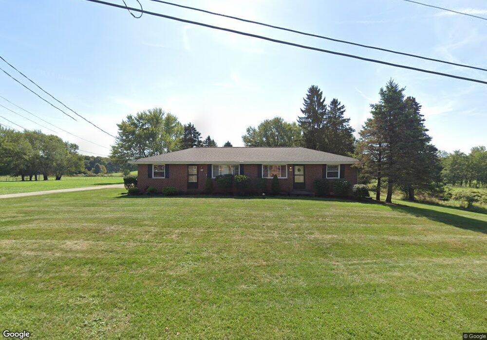
This home is located at 310 Johnson Rd, Kent, OH 44240 and is currently estimated at $247,241, approximately $145 per square foot. 310 Johnson Rd is a home located in Portage County with nearby schools including Stow-Munroe Falls High School and St Patrick Elementary School.
Ownership History
We collect this data history from publicly available records. To have your information removed, we recommend requesting removal directly through your county’s website.
Purchase Details
Purchase Details
Purchase Details
Home Values in the Area
Average Home Value in this Area
Purchase History
We collect this data history from publicly available records. To have your information removed, we recommend requesting removal directly through your county’s website.
| Date | Buyer | Sale Price | Title Company |
|---|---|---|---|
| -- | None Available | ||
| -- | None Available | ||
| -- | -- |
Tax History
We collect this data history from publicly available records. To have your information removed, we recommend requesting removal directly through your county’s website.
| Year | Tax Paid | Tax Assessment Tax Assessment Total Assessment is a certain percentage of the fair market value that is determined by local assessors to be the total taxable value of land and additions on the property. | Land | Improvement |
|---|---|---|---|---|
| 2025 | $4,779 | $87,220 | $13,860 | $73,360 |
| 2024 | $4,708 | $87,220 | $13,860 | $73,360 |
| 2023 | $3,327 | $58,100 | $13,860 | $44,240 |
| 2022 | $3,606 | $58,100 | $13,860 | $44,240 |
| 2021 | $3,235 | $58,100 | $13,860 | $44,240 |
| 2020 | $3,004 | $52,680 | $13,860 | $38,820 |
| 2019 | $3,063 | $52,680 | $13,860 | $38,820 |
| 2018 | $2,915 | $51,940 | $13,860 | $38,080 |
| 2017 | $2,915 | $51,940 | $13,860 | $38,080 |
| 2016 | $2,991 | $51,940 | $13,860 | $38,080 |
| 2015 | $2,899 | $51,940 | $13,860 | $38,080 |
| 2014 | $2,832 | $50,470 | $13,860 | $36,610 |
| 2013 | $2,787 | $50,470 | $13,860 | $36,610 |
Map
- 1180 Windward Ln
- 1132 Windward Ln
- 1103 Adrian Ave
- 1295 Shady Lakes Dr
- 4549 Bunker Ln
- 1312 Sunset Way Cir
- 3176 Wexford Blvd
- 897 Stonewater Dr Unit 40
- 3023 Stockbridge Dr
- 4764 Young Rd
- 2940 Progress Park Dr
- 4215 Quail Hollow Cir
- 1271 Carol Dr
- 759 Admore Dr
- 1262 Carol Dr
- 1314 Denise Dr
- 511 Suzanne Dr
- 612 Cuyahoga St
- 601 Fairchild Ave
- 537 Rockwell St
- 268 Johnson Rd
- 348 Johnson Rd
- 248 Johnson Rd
- 380 Johnson Rd
- 394 Johnson Rd
- 389 Johnson Rd
- 400 Johnson Rd
- 0 Johnson Rd
- 399 Johnson Rd
- 217 Johnson Rd
- 1181 Windward Ln
- 1511 Whitewood Dr
- 1523 Whitewood Dr
- 1517 Whitewood Dr
- 1175 Windward Ln
- 1169 Windward Ln
- 1163 Windward Ln
- 1157 Windward Ln
- 1145 Windward Ln
- 424 Johnson Rd
Ask me questions while you tour the home.