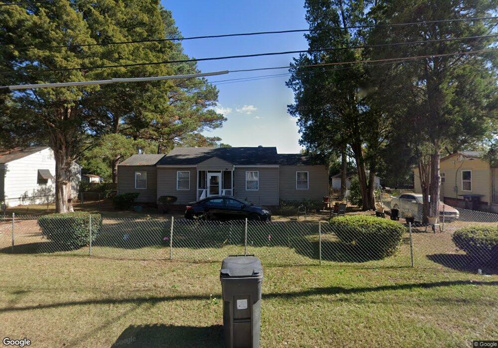
310 Memory Dr Augusta, GA 30906
Richmond Hill NeighborhoodEstimated Value: $80,448 - $120,000
3
Beds
1
Bath
1,157
Sq Ft
$88/Sq Ft
Est. Value
About This Home
This home is located at 310 Memory Dr, Augusta, GA 30906 and is currently estimated at $102,112, approximately $88 per square foot. 310 Memory Dr is a home located in Richmond County with nearby schools including Wilkinson Gardens Elementary School, Murphey Middle School, and Johnson Magnet.
Ownership History
Date
Name
Owned For
Owner Type
Purchase Details
Closed on
Apr 18, 2006
Sold by
Williams Donald
Bought by
Star Bright Properties Llc
Current Estimated Value
Purchase Details
Closed on
Mar 3, 2005
Sold by
Bauer Lynda
Bought by
Williams Donald
Purchase Details
Closed on
Jan 31, 2005
Sold by
Attaway Edna Eugenia Byrd and White Margene A
Bought by
Bauer Lynda
Purchase Details
Closed on
Mar 23, 1994
Sold by
Attaway Lee Roy and Attaway Est
Bought by
Attaway Edna Eugenia Byrd
Purchase Details
Closed on
Mar 14, 1994
Sold by
Attaway Edna Eugeni
Bought by
White Margene A
Create a Home Valuation Report for This Property
The Home Valuation Report is an in-depth analysis detailing your home's value as well as a comparison with similar homes in the area
Home Values in the Area
Average Home Value in this Area
Purchase History
| Date | Buyer | Sale Price | Title Company |
|---|---|---|---|
| Star Bright Properties Llc | -- | None Available | |
| Star Bright Properties Llc | -- | -- | |
| Williams Donald | $33,000 | -- | |
| Bauer Lynda | $10,100 | -- | |
| Attaway Edna Eugenia Byrd | -- | -- | |
| White Margene A | -- | -- |
Source: Public Records
Tax History
| Year | Tax Paid | Tax Assessment Tax Assessment Total Assessment is a certain percentage of the fair market value that is determined by local assessors to be the total taxable value of land and additions on the property. | Land | Improvement |
|---|---|---|---|---|
| 2025 | $1,141 | $24,988 | $2,800 | $22,188 |
| 2024 | $1,141 | $23,440 | $2,800 | $20,640 |
| 2023 | $1,032 | $20,444 | $2,800 | $17,644 |
| 2022 | $942 | $19,531 | $2,800 | $16,731 |
| 2021 | $790 | $12,832 | $2,800 | $10,032 |
| 2020 | $782 | $12,832 | $2,800 | $10,032 |
| 2019 | $870 | $14,680 | $2,800 | $11,880 |
| 2018 | $874 | $14,680 | $2,800 | $11,880 |
| 2017 | $820 | $14,680 | $2,800 | $11,880 |
| 2016 | $821 | $14,680 | $2,800 | $11,880 |
| 2015 | $825 | $14,680 | $2,800 | $11,880 |
| 2014 | $825 | $14,680 | $2,800 | $11,880 |
Source: Public Records
Map
Nearby Homes
- 212 Barrow Dr
- 1964 Barnes Rd
- 1929 Tubman Home Rd
- 114 Calvary Dr
- 2025 Olive Rd
- 1921 3rd Ave
- 2424 Bream Ave
- 2216 Sullivan Rd
- 2321 Old Savannah Rd
- 1915 1st Ave
- 2137 Gatewood Dr
- 2469 Reese Ave
- 2440 Peach Orchard Rd
- 959 14th Ave
- 2475 Reese Ave
- 2235 Dyer St
- 2437 Mike Padgett Hwy
- 1137 14th Ave
- 2226 Raleigh Dr
- 2106 Roosevelt Dr
- 308 Memory Dr
- 312 Memory Dr
- 1956 Lionel St
- 306 Memory Dr
- 314 Memory Dr
- 1958 Lionel St
- 1903 Lazenby Dr
- 302 Memory Dr
- 1955 Lionel St
- 311 Memory Dr
- 313 Memory Dr
- 309 Memory Dr
- 1960 Lionel St
- 1957 Lionel St
- 315 Memory Dr
- 307 Memory Dr
- 1909 Lazenby Dr
- 1962 Lionel St
- 1962 Lionel St Unit A
- 1962 Lionel St Unit B
Your Personal Tour Guide
Ask me questions while you tour the home.