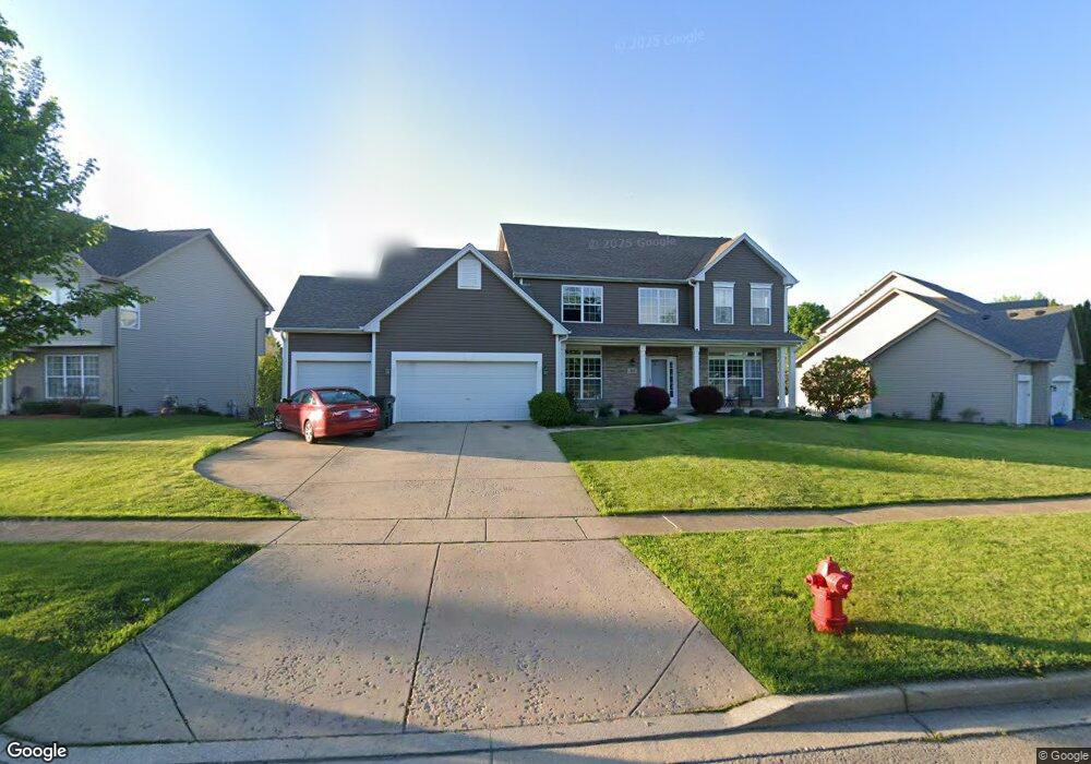
310 Millstream Ln Oswego, IL 60543
Northwest Oswego NeighborhoodEstimated Value: $426,000 - $496,000
4
Beds
3
Baths
2,728
Sq Ft
$171/Sq Ft
Est. Value
About This Home
This home is located at 310 Millstream Ln, Oswego, IL 60543 and is currently estimated at $465,646, approximately $170 per square foot. 310 Millstream Ln is a home located in Kendall County with nearby schools including Fox Chase Elementary School, Traughber Junior High School, and Oswego High School.
Ownership History
Date
Name
Owned For
Owner Type
Purchase Details
Closed on
Aug 29, 2002
Sold by
The Old Second National Bank Of Aurora
Bought by
Nickel Eric and Nickel Holly M
Current Estimated Value
Home Financials for this Owner
Home Financials are based on the most recent Mortgage that was taken out on this home.
Original Mortgage
$242,487
Interest Rate
6.23%
Create a Home Valuation Report for This Property
The Home Valuation Report is an in-depth analysis detailing your home's value as well as a comparison with similar homes in the area
Home Values in the Area
Average Home Value in this Area
Purchase History
| Date | Buyer | Sale Price | Title Company |
|---|---|---|---|
| Nickel Eric | $269,500 | Ticor Title Insurance Compan |
Source: Public Records
Mortgage History
| Date | Status | Borrower | Loan Amount |
|---|---|---|---|
| Previous Owner | Nickel Eric | $242,487 |
Source: Public Records
Tax History
| Year | Tax Paid | Tax Assessment Tax Assessment Total Assessment is a certain percentage of the fair market value that is determined by local assessors to be the total taxable value of land and additions on the property. | Land | Improvement |
|---|---|---|---|---|
| 2024 | $11,040 | $137,194 | $33,152 | $104,042 |
| 2023 | $9,793 | $119,299 | $28,828 | $90,471 |
| 2022 | $9,793 | $108,453 | $26,207 | $82,246 |
| 2021 | $9,757 | $104,282 | $25,199 | $79,083 |
| 2020 | $9,384 | $99,316 | $23,999 | $75,317 |
| 2019 | $9,757 | $101,646 | $23,999 | $77,647 |
| 2018 | $9,850 | $101,320 | $24,377 | $76,943 |
| 2017 | $9,573 | $93,382 | $22,467 | $70,915 |
| 2016 | $9,206 | $88,514 | $21,296 | $67,218 |
| 2015 | $9,024 | $82,724 | $19,903 | $62,821 |
| 2014 | -- | $80,314 | $19,323 | $60,991 |
| 2013 | -- | $84,541 | $20,340 | $64,201 |
Source: Public Records
Map
Nearby Homes
- 505 Parkland Ct
- 125 Presidential Blvd Unit 3248
- 187 Eisenhower Dr
- 123 Fox Chase Dr S
- 404 Beaver Ct Unit 3
- 130 W Harvest Ct
- 2240 State Route 31
- 303 Fox Chase Dr N
- 316 Ash Grove Ln
- 2110 State Route 31
- 238 Cooney Way
- 239 Cooney Way
- 403 Tanya Ln
- 343 Danforth Dr
- 713 Erwin St
- 251 Cooney Way
- 236 Cooney Way
- 237 Cooney Way
- 114 Riverview Ct
- 135 River Mist Dr Unit 2
- 312 Millstream Ln
- 308 Millstream Ln
- 306 Millstream Ln
- 314 Millstream Ln
- 407 Stonewater Ln
- 409 Stonewater Ln Unit 1
- 313 Millstream Ln
- 316 Millstream Ln Unit 1
- 304 Millstream Ln
- 411 Stonewater Ln
- 315 Millstream Ln
- 315 Taft Dr
- 318 Millstream Ln
- 302 Millstream Ln
- 413 Stonewater Ln
- 313 Taft Dr
- 317 Millstream Ln Unit 1
- 101 Eisenhower Dr
- 408 Stonewater Ln Unit 1
- 410 Stonewater Ln
Your Personal Tour Guide
Ask me questions while you tour the home.