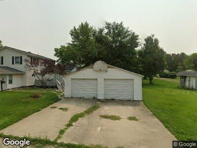
310 N Howe St Latham, IL 62543
Estimated Value: $106,000 - $144,000
4
Beds
2
Baths
1,700
Sq Ft
$76/Sq Ft
Est. Value
About This Home
This home is located at 310 N Howe St, Latham, IL 62543 and is currently estimated at $129,292, approximately $76 per square foot. 310 N Howe St is a home located in Logan County with nearby schools including Warrensburg-Latham Elementary School, Warrensburg-Latham Middle School, and Warrensburg-Latham High School.
Ownership History
Date
Name
Owned For
Owner Type
Purchase Details
Closed on
Dec 15, 2023
Sold by
Colebar Gloria J
Bought by
Short Mark E
Current Estimated Value
Home Financials for this Owner
Home Financials are based on the most recent Mortgage that was taken out on this home.
Original Mortgage
$123,190
Outstanding Balance
$121,732
Interest Rate
7.76%
Mortgage Type
New Conventional
Estimated Equity
$7,560
Purchase Details
Closed on
Nov 18, 2023
Sold by
Manahan Jacqueline Colebar and Colebar Wesley
Bought by
Colebar Gloria J
Home Financials for this Owner
Home Financials are based on the most recent Mortgage that was taken out on this home.
Original Mortgage
$123,190
Outstanding Balance
$121,732
Interest Rate
7.76%
Mortgage Type
New Conventional
Estimated Equity
$7,560
Create a Home Valuation Report for This Property
The Home Valuation Report is an in-depth analysis detailing your home's value as well as a comparison with similar homes in the area
Home Values in the Area
Average Home Value in this Area
Purchase History
| Date | Buyer | Sale Price | Title Company |
|---|---|---|---|
| Short Mark E | $127,000 | None Available | |
| Colebar Gloria J | -- | None Available |
Source: Public Records
Mortgage History
| Date | Status | Borrower | Loan Amount |
|---|---|---|---|
| Open | Short Mark E | $123,190 | |
| Previous Owner | Colebar Clayton A | $66,000 |
Source: Public Records
Tax History Compared to Growth
Tax History
| Year | Tax Paid | Tax Assessment Tax Assessment Total Assessment is a certain percentage of the fair market value that is determined by local assessors to be the total taxable value of land and additions on the property. | Land | Improvement |
|---|---|---|---|---|
| 2024 | $2,462 | $45,270 | $2,820 | $42,450 |
| 2023 | $2,250 | $41,720 | $2,600 | $39,120 |
| 2022 | $1,282 | $38,630 | $2,410 | $36,220 |
| 2021 | $1,296 | $37,150 | $2,320 | $34,830 |
| 2020 | $1,303 | $36,610 | $2,290 | $34,320 |
| 2019 | $2,113 | $36,610 | $2,290 | $34,320 |
| 2018 | $1,282 | $36,610 | $2,290 | $34,320 |
| 2017 | $2,125 | $36,610 | $2,290 | $34,320 |
| 2016 | $2,089 | $36,650 | $2,290 | $34,360 |
| 2015 | $1,331 | $27,520 | $1,980 | $25,540 |
| 2014 | $1,331 | $27,520 | $1,980 | $25,540 |
| 2013 | $1,331 | $25,960 | $1,870 | $24,090 |
| 2012 | $1,331 | $25,870 | $1,860 | $24,010 |
Source: Public Records
Map
Nearby Homes
- 261 E 4th St
- 785 2400th Ave
- 64 1725th Ave
- 17 Mcintyre St
- 622 E Main St
- 10864 Cornish Rd
- 0 Us Bypass 20 Unit MRD12016238
- 0 Us Bypass 20 Unit 202305188
- 113 N Mason St
- 118 S Park St
- 0 Julia Ct
- 177 W Montgomery St
- 414 5th St
- 418 4th St Unit 1
- 13505 W Long Point Rd
- 275 N Camp St
- 1650 Schellabarger Rd
- 205 N Camp St
- 0 W Harristown Blvd Unit 6251050
- 164 Shadow Ridge Blvd