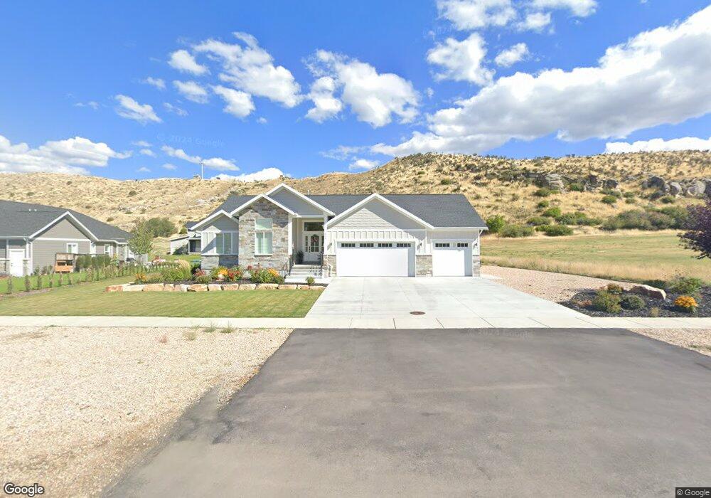
310 N Main St Unit 10 Coalville, UT 84017
Estimated Value: $781,000 - $880,806
--
Bed
--
Bath
1,587
Sq Ft
$520/Sq Ft
Est. Value
About This Home
This home is located at 310 N Main St Unit 10, Coalville, UT 84017 and is currently estimated at $824,452, approximately $519 per square foot. 310 N Main St Unit 10 is a home located in Summit County with nearby schools including North Summit Middle School, North Summit Elementary School, and North Summit High School.
Ownership History
Date
Name
Owned For
Owner Type
Purchase Details
Closed on
Mar 29, 2021
Sold by
Sargent Cade and Sargent Amber
Bought by
Rodriguez Jose Ruben and Rodriguez Maria D
Current Estimated Value
Home Financials for this Owner
Home Financials are based on the most recent Mortgage that was taken out on this home.
Original Mortgage
$488,656
Outstanding Balance
$439,766
Interest Rate
2.8%
Mortgage Type
New Conventional
Estimated Equity
$384,686
Purchase Details
Closed on
Sep 9, 2020
Sold by
Black Wiwllow Capital Group Llc
Bought by
Sargent Cade and Sargent Amber
Home Financials for this Owner
Home Financials are based on the most recent Mortgage that was taken out on this home.
Original Mortgage
$313,523
Interest Rate
2.9%
Mortgage Type
Construction
Purchase Details
Closed on
Jan 21, 2020
Sold by
Adkins John William and Adkins Michelle S
Bought by
Black Willow Capital Group Llc
Create a Home Valuation Report for This Property
The Home Valuation Report is an in-depth analysis detailing your home's value as well as a comparison with similar homes in the area
Home Values in the Area
Average Home Value in this Area
Purchase History
| Date | Buyer | Sale Price | Title Company |
|---|---|---|---|
| Rodriguez Jose Ruben | -- | Summit Escrow & Title | |
| Sargent Cade | -- | American Secure Title Layton | |
| Black Willow Capital Group Llc | -- | None Available |
Source: Public Records
Mortgage History
| Date | Status | Borrower | Loan Amount |
|---|---|---|---|
| Open | Rodriguez Jose Ruben | $488,656 | |
| Previous Owner | Sargent Cade | $313,523 |
Source: Public Records
Tax History Compared to Growth
Tax History
| Year | Tax Paid | Tax Assessment Tax Assessment Total Assessment is a certain percentage of the fair market value that is determined by local assessors to be the total taxable value of land and additions on the property. | Land | Improvement |
|---|---|---|---|---|
| 2024 | $2,928 | $452,547 | $133,650 | $318,897 |
| 2023 | $2,928 | $452,547 | $133,650 | $318,897 |
| 2022 | $2,074 | $316,964 | $70,400 | $246,564 |
| 2021 | $1,747 | $208,711 | $74,000 | $134,711 |
| 2020 | $1,166 | $128,000 | $128,000 | $0 |
| 2019 | $1,343 | $128,000 | $128,000 | $0 |
| 2018 | $0 | $0 | $0 | $0 |
Source: Public Records
Map
Nearby Homes
- 16 W 200 N
- 246 E 100 N
- 350 500 E
- 0 N Industrial Park Rd Unit 12504107
- 82 S Main St
- 71 N 425 E
- 345 E 100 S
- 296 Mackenzie Ln Unit 20
- 489 Border Station Rd
- 265 S Old Farm Ln E Unit 18
- 320 Old Farm Ln
- 749 Village View Dr
- 749 Village View Dr Unit 65
- 283 Mackenzie Ln Unit 15
- 267 Mackenzie Ln Unit 17
- 0 No Situs Address Unit 12402836
- 574 Village View Dr Unit 7
- 574 Village View Dr
- 1069 Sego Ct Unit 21
- 364 N Cedar Point Ln Unit CHOL-1
- 310 N Main St
- 14 E Black Willow Dr Unit 9
- 10 E Black Willow Dr Unit 11
- 10 E Black Willow Dr
- 24 E Black Willow Dr
- 24 E Black Willow Dr Unit 8
- 11 E Black Willow Dr Unit 12
- 295 N Main St
- 339 N Main St
- 301 N Main St
- 17 E Black Willow Dr
- 17 E Black Willow Dr Unit 16
- 32 E Black Willow Dr
- 32 E Black Willow Dr Unit 7
- 12 E Black Willow Dr Unit 13
- 12 E Black Willow Dr
- 33 E Black Willow Dr
- 33 E Black Willow Dr Unit 15
- 347 N Main St
- 38 E Black Willow Dr Unit 6