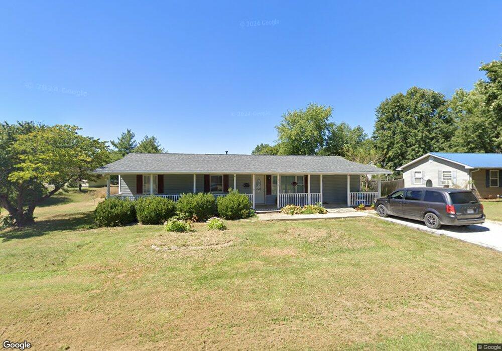
310 S 16th St Bowling Green, MO 63334
Estimated Value: $192,000 - $236,000
3
Beds
3
Baths
2,500
Sq Ft
$85/Sq Ft
Est. Value
About This Home
This home is located at 310 S 16th St, Bowling Green, MO 63334 and is currently estimated at $211,260, approximately $84 per square foot. 310 S 16th St is a home located in Pike County with nearby schools including Bowling Green High School and St. Clement School.
Ownership History
Date
Name
Owned For
Owner Type
Purchase Details
Closed on
Jun 30, 2023
Sold by
Dwyer Robert Earl
Bought by
Howland Meagan M
Current Estimated Value
Home Financials for this Owner
Home Financials are based on the most recent Mortgage that was taken out on this home.
Original Mortgage
$112,917
Outstanding Balance
$110,017
Interest Rate
6.39%
Mortgage Type
FHA
Estimated Equity
$101,243
Purchase Details
Closed on
Jan 30, 2023
Sold by
Dwyer Jessica Kay
Bought by
Dwyer Robert Earl
Purchase Details
Closed on
Sep 16, 2013
Sold by
Mcllroy William C
Bought by
Dwyer Robert Earl and Dwyer Jessica Kay
Create a Home Valuation Report for This Property
The Home Valuation Report is an in-depth analysis detailing your home's value as well as a comparison with similar homes in the area
Home Values in the Area
Average Home Value in this Area
Purchase History
| Date | Buyer | Sale Price | Title Company |
|---|---|---|---|
| Howland Meagan M | -- | None Listed On Document | |
| Dwyer Robert Earl | -- | -- | |
| Dwyer Robert Earl | -- | -- |
Source: Public Records
Mortgage History
| Date | Status | Borrower | Loan Amount |
|---|---|---|---|
| Open | Howland Meagan M | $112,917 |
Source: Public Records
Tax History Compared to Growth
Tax History
| Year | Tax Paid | Tax Assessment Tax Assessment Total Assessment is a certain percentage of the fair market value that is determined by local assessors to be the total taxable value of land and additions on the property. | Land | Improvement |
|---|---|---|---|---|
| 2024 | $1,432 | $27,320 | $3,800 | $23,520 |
| 2023 | $1,432 | $27,320 | $3,800 | $23,520 |
| 2022 | $1,348 | $25,910 | $2,390 | $23,520 |
| 2021 | $1,339 | $25,910 | $2,390 | $23,520 |
| 2020 | $1,345 | $25,910 | $2,390 | $23,520 |
| 2019 | $1,343 | $25,910 | $2,390 | $23,520 |
| 2018 | $1,208 | $25,910 | $2,390 | $23,520 |
| 2017 | $1,200 | $25,910 | $2,390 | $23,520 |
| 2016 | $1,171 | $25,910 | $2,390 | $23,520 |
| 2015 | -- | $25,910 | $2,390 | $23,520 |
| 2011 | -- | $25,910 | $2,390 | $23,520 |
Source: Public Records
Map
Nearby Homes
- 0 S 13th St Unit MAR23052764
- 22 S 12th St
- 1420 W Centennial Ave
- 1004 W Taylor St
- 1105 W Locust St
- O Kincaid St
- 320 W South St
- 407 N High St
- 210 S Court St
- 201 W Church St
- 19 S Saint Charles St
- 11991 Highway Y
- 117 E Park Dr
- 119 E Bibb Dr
- 511 McWard Ct 1
- 14075 Pike 45
- 0 Lot 3 Tarrant's Estates Unit MAR25007764
- 0 Lot 4 Tarrant's Estates Unit MAR25007762
- 0 Lot 2 Tarrant's Estates Unit MAR25007765
- 0 Lot 14 Tarrant's Estates Unit MAR25007753