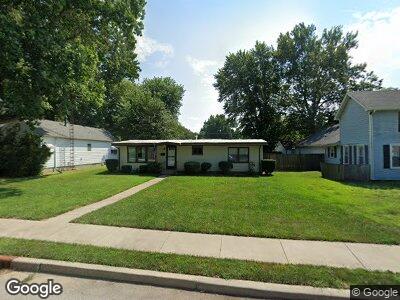
310 W Walnut St Unit 1 Chatham, IL 62629
Estimated Value: $88,645 - $172,000
--
Bed
--
Bath
--
Sq Ft
6,055
Sq Ft Lot
About This Home
This home is located at 310 W Walnut St Unit 1, Chatham, IL 62629 and is currently estimated at $138,911. 310 W Walnut St Unit 1 is a home located in Sangamon County with nearby schools including Chatham Elementary School, Glenwood Middle School, and Glenwood Intermediate School.
Ownership History
Date
Name
Owned For
Owner Type
Purchase Details
Closed on
Sep 15, 2021
Sold by
Cecilia Ann Schrage Declaration Of Trust
Bought by
Starnes Justin
Current Estimated Value
Home Financials for this Owner
Home Financials are based on the most recent Mortgage that was taken out on this home.
Original Mortgage
$119,053
Outstanding Balance
$109,974
Interest Rate
3.13%
Mortgage Type
FHA
Estimated Equity
$28,937
Purchase Details
Closed on
Sep 23, 2010
Create a Home Valuation Report for This Property
The Home Valuation Report is an in-depth analysis detailing your home's value as well as a comparison with similar homes in the area
Home Values in the Area
Average Home Value in this Area
Purchase History
| Date | Buyer | Sale Price | Title Company |
|---|---|---|---|
| Starnes Justin | $121,250 | Zelle Title | |
| -- | -- | -- |
Source: Public Records
Mortgage History
| Date | Status | Borrower | Loan Amount |
|---|---|---|---|
| Open | Starnes Justin | $119,053 | |
| Closed | Starnes Justin | $10,000 |
Source: Public Records
Tax History Compared to Growth
Tax History
| Year | Tax Paid | Tax Assessment Tax Assessment Total Assessment is a certain percentage of the fair market value that is determined by local assessors to be the total taxable value of land and additions on the property. | Land | Improvement |
|---|---|---|---|---|
| 2024 | $2,039 | $28,428 | $3,510 | $24,918 |
| 2023 | $1,965 | $26,162 | $3,230 | $22,932 |
| 2022 | $1,934 | $25,197 | $3,111 | $22,086 |
| 2021 | $540 | $24,776 | $3,059 | $21,717 |
| 2020 | $540 | $24,171 | $2,984 | $21,187 |
| 2019 | $532 | $24,142 | $2,980 | $21,162 |
| 2018 | $525 | $23,858 | $2,945 | $20,913 |
| 2017 | $947 | $23,598 | $2,913 | $20,685 |
| 2016 | $527 | $23,111 | $2,853 | $20,258 |
| 2015 | $536 | $22,886 | $2,825 | $20,061 |
| 2014 | $540 | $22,626 | $2,793 | $19,833 |
| 2013 | $538 | $22,278 | $2,750 | $19,528 |
Source: Public Records
Map
Nearby Homes
- 413 W Chestnut St Unit 1
- 314 W Locust St
- 46 Bonniebrook Rd Unit 1
- 94 Downing Dr Unit 1
- 180 Teal Dr Unit 1
- 415 S State St Unit 1
- 305 Plover Dr Unit 1
- 0 State Route 4
- 513 Richmond Dr
- 2 Charleston Ct
- 42 Buckingham Rd Unit 1
- 424 Wintergreen Dr
- 413 Hodges Ct
- 405 Hodges Ct
- 900 Monarch Dr
- 915 Mesa Dr
- 799 Titan Ct
- 304 Podres Ln
- 125 Kodiak Dr
- 205 Winter Park Dr
- 310 W Walnut St Unit 1
- 308 W Walnut St Unit 1
- 312 W Walnut St
- 304 W Walnut St
- 300 W Walnut St Unit 1
- 309 W Mulberry St Unit 1
- 313 W Walnut St Unit 1
- 400 W Walnut St Unit 1
- 202 N College St Unit 1
- 309 W Walnut St Unit 1
- 305 W Mulberry St
- 401 W Mulberry St Unit 1
- 301 W Mulberry St Unit 1
- 405 W Walnut St Unit 1
- 408 W Walnut St
- 317 W Walnut St Unit 1
- 303 W Walnut St Unit 1
- 266 W Walnut St
- 405 W Mulberry St Unit 1
- 212 W Walnut St Unit 1