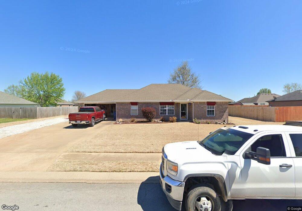
310 Washburn Dr Pea Ridge, AR 72751
Estimated Value: $254,000 - $285,000
--
Bed
2
Baths
1,248
Sq Ft
$216/Sq Ft
Est. Value
About This Home
This home is located at 310 Washburn Dr, Pea Ridge, AR 72751 and is currently estimated at $269,319, approximately $215 per square foot. 310 Washburn Dr is a home located in Benton County with nearby schools including Pea Ridge Intermediate School, Pea Ridge Primary School, and Pea Ridge Middle School.
Ownership History
Date
Name
Owned For
Owner Type
Purchase Details
Closed on
Nov 5, 2012
Sold by
Montrym Anthony and Montrym Patricia Lynn
Bought by
Montrym Anthony and Montrym Patricia Lynn
Current Estimated Value
Purchase Details
Closed on
Oct 2, 2012
Sold by
Montrym Anthony and Montrym Patricia Lynn
Bought by
Montrym Anthony and Montrym Patricia Lynn
Purchase Details
Closed on
Dec 14, 2011
Sold by
Montrym Anthony and Montrym Patricia Lynne
Bought by
Montrym Anthony and Montrym Patricia Lynne
Purchase Details
Closed on
Mar 10, 2006
Sold by
Lazenby William A
Bought by
Montrym Anthony and Montrym Patricia Lynne
Home Financials for this Owner
Home Financials are based on the most recent Mortgage that was taken out on this home.
Original Mortgage
$119,076
Outstanding Balance
$67,456
Interest Rate
6.21%
Mortgage Type
VA
Estimated Equity
$201,863
Create a Home Valuation Report for This Property
The Home Valuation Report is an in-depth analysis detailing your home's value as well as a comparison with similar homes in the area
Home Values in the Area
Average Home Value in this Area
Purchase History
| Date | Buyer | Sale Price | Title Company |
|---|---|---|---|
| Montrym Anthony | -- | None Available | |
| Montrym Anthony | -- | None Available | |
| Montrym Anthony | -- | None Available | |
| Montrym Anthony | $118,000 | Stewart Title Of Arkansas |
Source: Public Records
Mortgage History
| Date | Status | Borrower | Loan Amount |
|---|---|---|---|
| Open | Montrym Anthony | $119,076 |
Source: Public Records
Tax History Compared to Growth
Tax History
| Year | Tax Paid | Tax Assessment Tax Assessment Total Assessment is a certain percentage of the fair market value that is determined by local assessors to be the total taxable value of land and additions on the property. | Land | Improvement |
|---|---|---|---|---|
| 2025 | $1,252 | $46,423 | $6,400 | $40,023 |
| 2024 | $1,177 | $46,423 | $6,400 | $40,023 |
| 2023 | $1,070 | $29,840 | $5,600 | $24,240 |
| 2022 | $641 | $29,840 | $5,600 | $24,240 |
| 2021 | $631 | $29,840 | $5,600 | $24,240 |
| 2020 | $665 | $22,160 | $2,800 | $19,360 |
| 2019 | $665 | $22,160 | $2,800 | $19,360 |
| 2018 | $690 | $22,160 | $2,800 | $19,360 |
| 2017 | $623 | $22,160 | $2,800 | $19,360 |
| 2016 | $623 | $22,160 | $2,800 | $19,360 |
| 2015 | $966 | $16,970 | $4,000 | $12,970 |
| 2014 | $616 | $16,970 | $4,000 | $12,970 |
Source: Public Records
Map
Nearby Homes