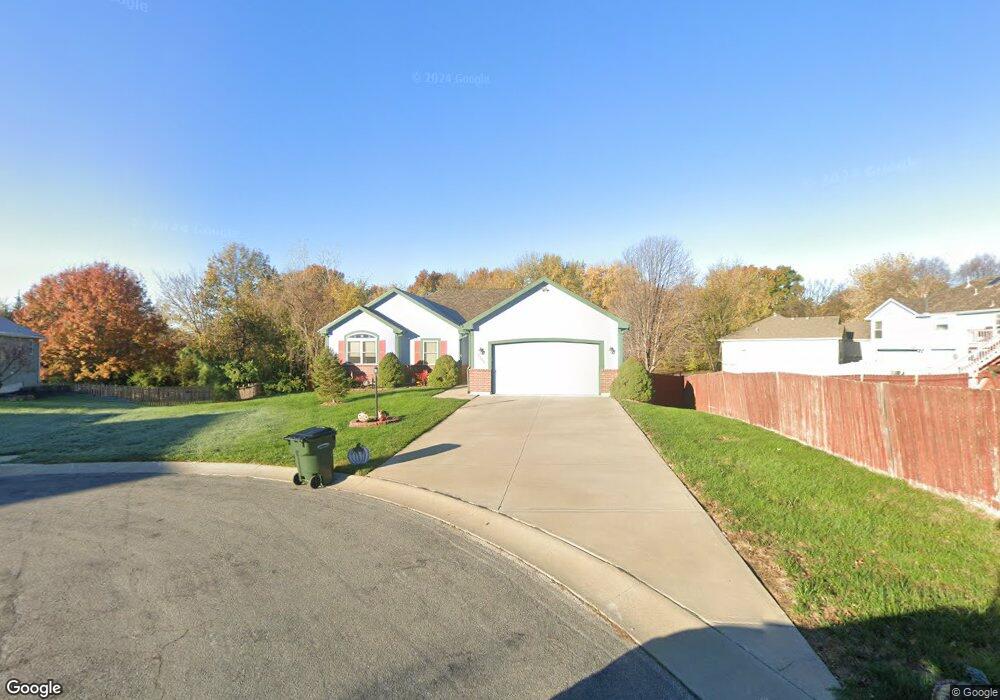
3100 Fox Hill St Leavenworth, KS 66048
Estimated Value: $349,000 - $401,753
3
Beds
3
Baths
1,910
Sq Ft
$200/Sq Ft
Est. Value
About This Home
This home is located at 3100 Fox Hill St, Leavenworth, KS 66048 and is currently estimated at $382,688, approximately $200 per square foot. 3100 Fox Hill St is a home located in Leavenworth County with nearby schools including Henry Leavenworth, Richard Warren Middle School, and Leavenworth Senior High School.
Ownership History
Date
Name
Owned For
Owner Type
Purchase Details
Closed on
Nov 1, 2002
Bought by
Low Rodney D and Low Elizabeth D
Current Estimated Value
Home Financials for this Owner
Home Financials are based on the most recent Mortgage that was taken out on this home.
Original Mortgage
$179,000
Outstanding Balance
$135,522
Interest Rate
6.13%
Mortgage Type
New Conventional
Estimated Equity
$247,166
Create a Home Valuation Report for This Property
The Home Valuation Report is an in-depth analysis detailing your home's value as well as a comparison with similar homes in the area
Home Values in the Area
Average Home Value in this Area
Purchase History
| Date | Buyer | Sale Price | Title Company |
|---|---|---|---|
| Low Rodney D | $35,000 | -- |
Source: Public Records
Mortgage History
| Date | Status | Borrower | Loan Amount |
|---|---|---|---|
| Open | Low Rodney D | $179,000 | |
| Closed | Low Rodney D | $9,285 |
Source: Public Records
Tax History Compared to Growth
Tax History
| Year | Tax Paid | Tax Assessment Tax Assessment Total Assessment is a certain percentage of the fair market value that is determined by local assessors to be the total taxable value of land and additions on the property. | Land | Improvement |
|---|---|---|---|---|
| 2025 | $5,146 | $44,626 | $3,756 | $40,870 |
| 2024 | $5,146 | $43,242 | $3,756 | $39,486 |
| 2023 | $5,146 | $42,815 | $3,756 | $39,059 |
| 2022 | $4,686 | $40,595 | $4,172 | $36,423 |
| 2021 | $4,686 | $36,685 | $4,172 | $32,513 |
| 2020 | $4,518 | $35,115 | $4,172 | $30,943 |
| 2019 | $4,319 | $33,266 | $4,172 | $29,094 |
| 2018 | $4,268 | $32,614 | $4,172 | $28,442 |
| 2017 | $4,197 | $31,774 | $4,172 | $27,602 |
| 2016 | $4,205 | $31,774 | $4,172 | $27,602 |
| 2015 | $4,180 | $31,774 | $4,172 | $27,602 |
| 2014 | $4,072 | $31,102 | $4,172 | $26,930 |
Source: Public Records
Map
Nearby Homes
- 1204 Wildwood St
- 1316 Vilas St
- 1525 Gatewood St
- 911 Limit St
- 2021 Vilas St
- 2017 Vilas St
- 1036 Vilas St
- 901 Limit St
- 1601 Holman St
- 840 Limit St
- 108 Woodmoor Ct Unit Lot 100
- 00000 Limit St
- 2104 Limit St
- 1621 Vilas St
- 2704 Garland St
- 3804 Garland Ave
- 4301 Ironwood Dr
- 1023 Ironwood Ct
- 4421 Grand Ct
- 2516 Kensington Place
- 1219 Wildwood St
- 3110 Fox Hill St
- 1215 Wildwood St
- 1223 Wildwood St
- 3109 Fox Hill St
- 3101 Fox Hill St
- 1209 Wildwood St
- 1227 Wildwood St
- 1306 Independence Ct
- 1218 Wildwood St
- 1205 Wildwood St
- 1314 Revolutionary Ct
- 1307 Independence Ct
- 1214 Wildwood St
- 1222 Wildwood St
- 3106 New Lawrence Rd
- 1226 Wildwood St
- 1310 Independence Ct
- 3100 New Lawrence Rd
- 1210 Wildwood St