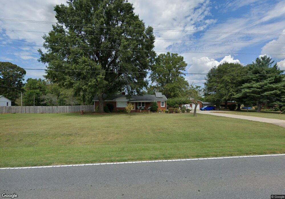
3100 W Highway 27 Lincolnton, NC 28092
Estimated Value: $242,000 - $376,000
3
Beds
1
Bath
1,600
Sq Ft
$187/Sq Ft
Est. Value
About This Home
This home is located at 3100 W Highway 27, Lincolnton, NC 28092 and is currently estimated at $298,470, approximately $186 per square foot. 3100 W Highway 27 is a home located in Lincoln County with nearby schools including Norris S. Childers Elementary School, West Lincoln Middle, and West Lincoln High School.
Ownership History
Date
Name
Owned For
Owner Type
Purchase Details
Closed on
Nov 30, 2016
Sold by
Gilbert Marvin Brian
Bought by
Gilbert Stouff Kenda
Current Estimated Value
Purchase Details
Closed on
Nov 5, 2014
Sold by
Gilbert Marvin L
Bought by
Cleckner Sara G and Cleckner Ii Chad W
Purchase Details
Closed on
Sep 17, 2007
Sold by
Gilbert Marvin L and Gilbert Ellen C
Bought by
Gilbert Marvin L and Liv Ellen C Gilbert
Create a Home Valuation Report for This Property
The Home Valuation Report is an in-depth analysis detailing your home's value as well as a comparison with similar homes in the area
Home Values in the Area
Average Home Value in this Area
Purchase History
| Date | Buyer | Sale Price | Title Company |
|---|---|---|---|
| Gilbert Stouff Kenda | $60,000 | None Available | |
| Cleckner Sara G | -- | None Available | |
| Gilbert Marvin L | -- | None Available | |
| Marvin L Gilbert | -- | None Available |
Source: Public Records
Tax History Compared to Growth
Tax History
| Year | Tax Paid | Tax Assessment Tax Assessment Total Assessment is a certain percentage of the fair market value that is determined by local assessors to be the total taxable value of land and additions on the property. | Land | Improvement |
|---|---|---|---|---|
| 2025 | $1,490 | $212,781 | $32,475 | $180,306 |
| 2024 | $1,470 | $212,781 | $32,475 | $180,306 |
| 2023 | $1,465 | $212,781 | $32,475 | $180,306 |
| 2022 | $1,057 | $124,855 | $25,589 | $99,266 |
| 2021 | $1,057 | $124,855 | $25,589 | $99,266 |
| 2020 | $917 | $124,855 | $25,589 | $99,266 |
| 2019 | $917 | $124,855 | $25,589 | $99,266 |
| 2018 | $835 | $100,116 | $22,502 | $77,614 |
| 2017 | $591 | $80,531 | $22,502 | $58,029 |
| 2016 | $591 | $80,531 | $22,502 | $58,029 |
| 2015 | $663 | $80,531 | $22,502 | $58,029 |
| 2014 | $693 | $86,780 | $23,917 | $62,863 |
Source: Public Records
Map
Nearby Homes
- 142 Alf Hoover Rd
- 3300 Paul Heavner Ln
- 940 Guy Heavner Rd
- 3987 W Highway 27
- 2508 Rock Dam Rd
- 1000 Creekside Dr
- 00 Wilson Ct Unit 15
- 00 Wilson Ct Unit 13
- 00 Wilson Ct Unit 12
- 3817 Spike Ln
- 000 Flag Ln Unit 53
- 1643 Flag Ln
- 4773 Westwinds Rd
- 1495 Leonards Fork Church Rd
- 1084 Lyndsey Brook Ct
- 938 Lyndsey Brook Ct
- 1074 Lyndsey Brook Ct
- 1551 J Rhyne Reep Rd
- 508 Shoal Rd
- 2383 N Carolina 182
- 3084 W Highway 27
- 3101 W Highway 27
- 143 Gilbert Rd
- 3056 W Highway 27
- 3056 N Carolina 27
- 3137 W Highway 27
- 181 Gilbert Rd
- 318 Gilbert Estates Ln
- 5853 W Hwy 27
- 3051 W Highway 27
- 125 Garrett Trail
- 3306 Paul Elmore Rd
- 3306 Paul Elmore Rd Unit 1
- 3302 Paul Elmore Rd Unit 2
- 3027 W Highway 27
- 3783 Harmon Rd
- 3297 Paul Elmore Rd
- 204 Gilbert Rd
- 3293 Paul Elmore Rd
- 229 Gilbert Rd