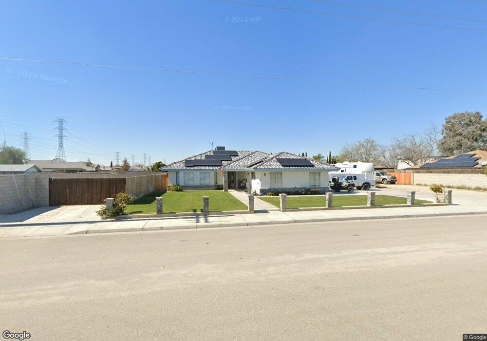
3101 Heath Rd Bakersfield, CA 93314
Estimated Value: $513,000 - $635,000
3
Beds
2
Baths
1,645
Sq Ft
$340/Sq Ft
Est. Value
About This Home
This home is located at 3101 Heath Rd, Bakersfield, CA 93314 and is currently estimated at $559,032, approximately $339 per square foot. 3101 Heath Rd is a home located in Kern County with nearby schools including Independence Elementary School, Freedom Middle School, and Frontier High School.
Ownership History
Date
Name
Owned For
Owner Type
Purchase Details
Closed on
Sep 13, 2019
Sold by
Merrell Leroy Clay and Merrell Living Trust
Bought by
Green Kevin and Abshire Christina
Current Estimated Value
Home Financials for this Owner
Home Financials are based on the most recent Mortgage that was taken out on this home.
Original Mortgage
$387,375
Interest Rate
3.75%
Purchase Details
Closed on
Nov 19, 1996
Sold by
Merrell John and Merrell Irene
Bought by
Merrell Johnnie Thomas
Create a Home Valuation Report for This Property
The Home Valuation Report is an in-depth analysis detailing your home's value as well as a comparison with similar homes in the area
Home Values in the Area
Average Home Value in this Area
Purchase History
| Date | Buyer | Sale Price | Title Company |
|---|---|---|---|
| Green Kevin | $375,000 | Placer Title Company | |
| Merrell Johnnie Thomas | -- | -- |
Source: Public Records
Mortgage History
| Date | Status | Borrower | Loan Amount |
|---|---|---|---|
| Previous Owner | Green Kevin | $387,375 |
Source: Public Records
Tax History Compared to Growth
Tax History
| Year | Tax Paid | Tax Assessment Tax Assessment Total Assessment is a certain percentage of the fair market value that is determined by local assessors to be the total taxable value of land and additions on the property. | Land | Improvement |
|---|---|---|---|---|
| 2025 | $5,645 | $442,585 | $174,981 | $267,604 |
| 2024 | $5,513 | $433,908 | $171,550 | $262,358 |
| 2023 | $5,513 | $425,401 | $168,187 | $257,214 |
| 2022 | $5,402 | $417,061 | $164,890 | $252,171 |
| 2021 | $4,928 | $378,884 | $161,657 | $217,227 |
| 2020 | $4,843 | $375,000 | $160,000 | $215,000 |
| 2019 | $3,181 | $239,521 | $42,039 | $197,482 |
| 2018 | $3,097 | $230,221 | $40,407 | $189,814 |
| 2017 | $3,036 | $225,708 | $39,615 | $186,093 |
| 2016 | $2,766 | $221,284 | $38,839 | $182,445 |
| 2015 | $2,718 | $217,961 | $38,256 | $179,705 |
| 2014 | $2,656 | $213,692 | $37,507 | $176,185 |
Source: Public Records
Map
Nearby Homes
- 3128 Cavalcade Way
- 16617 Stone Mill Ct
- 16716 Brookview Ct
- 2539 Marva Marie Ct
- 16741 Pinecrest Ct
- 15915 Quintero Place
- 15527 Avanti Dr
- 15726 Saint Clement Way
- 15510 Carparzo Dr
- 15820 Quintero Place
- 16009 La Strada Ct
- 16612 Bellewood Place
- 16725 Bellewood Place
- 15525 Calabria Ct
- 4104 Woodcastle Way
- 15414 Quintero Place
- 15626 Sammie Ave
- 16602 Northfield Way
- 16727 Brookview Ct
- 14924 Wayne Lee Ct
- 3117 Heath Rd
- 16200 Salmon Bay Ct
- 16120 Unruh Ave
- 16138 Unruh Ave
- 3143 Heath Rd
- 16203 Coastal Ct
- 16201 Salmon Bay Ct
- 16222 Salmon Bay Ct
- 16089 Shellie Marie Ave
- 16225 Coastal Ct
- 16223 Salmon Bay Ct
- 16248 Salmon Bay Ct
- 16202 Coastal Ct
- 16251 Coastal Ct
- 16249 Salmon Bay Ct
- 16084 Shellie Marie Ave
- 16224 Coastal Ct
- 15947 Shellie Marie Ave
- 16026 Shellie Marie Ave
- 16248 Coastal Ct