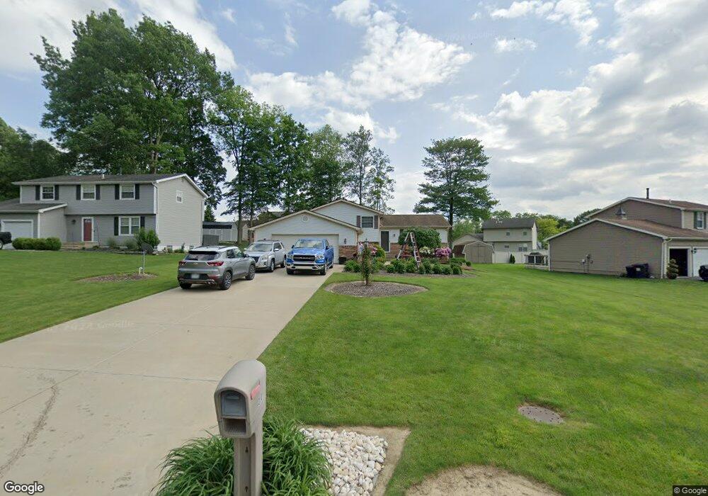
3101 Meanderwood Dr Canfield, OH 44406
Austintown NeighborhoodEstimated Value: $240,000 - $266,000
3
Beds
2
Baths
1,620
Sq Ft
$154/Sq Ft
Est. Value
About This Home
This home is located at 3101 Meanderwood Dr, Canfield, OH 44406 and is currently estimated at $249,449, approximately $153 per square foot. 3101 Meanderwood Dr is a home located in Mahoning County with nearby schools including Austintown Elementary School, Austintown Intermediate School, and Austintown Middle School.
Ownership History
Date
Name
Owned For
Owner Type
Purchase Details
Closed on
Aug 26, 2008
Sold by
Hornyak Joseph T
Bought by
Zetts John A
Current Estimated Value
Home Financials for this Owner
Home Financials are based on the most recent Mortgage that was taken out on this home.
Original Mortgage
$104,400
Outstanding Balance
$68,739
Interest Rate
6.31%
Mortgage Type
New Conventional
Estimated Equity
$180,710
Purchase Details
Closed on
Sep 25, 2004
Sold by
Hollabaugh Orie D
Bought by
Hornyak Joseph T
Home Financials for this Owner
Home Financials are based on the most recent Mortgage that was taken out on this home.
Original Mortgage
$108,700
Interest Rate
4.75%
Mortgage Type
Purchase Money Mortgage
Purchase Details
Closed on
Jun 4, 1990
Bought by
Hollabaugh Orie D
Create a Home Valuation Report for This Property
The Home Valuation Report is an in-depth analysis detailing your home's value as well as a comparison with similar homes in the area
Home Values in the Area
Average Home Value in this Area
Purchase History
| Date | Buyer | Sale Price | Title Company |
|---|---|---|---|
| Zetts John A | $130,500 | Attorney | |
| Hornyak Joseph T | $135,900 | -- | |
| Hollabaugh Orie D | $67,900 | -- |
Source: Public Records
Mortgage History
| Date | Status | Borrower | Loan Amount |
|---|---|---|---|
| Open | Zetts John A | $104,400 | |
| Previous Owner | Hornyak Joseph T | $108,700 | |
| Closed | Hornyak Joseph T | $27,200 |
Source: Public Records
Tax History Compared to Growth
Tax History
| Year | Tax Paid | Tax Assessment Tax Assessment Total Assessment is a certain percentage of the fair market value that is determined by local assessors to be the total taxable value of land and additions on the property. | Land | Improvement |
|---|---|---|---|---|
| 2024 | $2,945 | $64,340 | $9,830 | $54,510 |
| 2023 | $2,899 | $64,340 | $9,830 | $54,510 |
| 2022 | $2,864 | $50,980 | $9,830 | $41,150 |
| 2021 | $2,866 | $50,980 | $9,830 | $41,150 |
| 2020 | $2,878 | $50,980 | $9,830 | $41,150 |
| 2019 | $2,807 | $45,300 | $9,830 | $35,470 |
| 2018 | $2,700 | $45,300 | $9,830 | $35,470 |
| 2017 | $2,697 | $45,300 | $9,830 | $35,470 |
| 2016 | $2,463 | $40,960 | $9,830 | $31,130 |
| 2015 | $2,388 | $40,960 | $9,830 | $31,130 |
| 2014 | $2,399 | $40,960 | $9,830 | $31,130 |
| 2013 | $2,373 | $40,960 | $9,830 | $31,130 |
Source: Public Records
Map
Nearby Homes
- 7017 Kirk Rd
- 7054 Berry Blossom Dr
- 3189 Meanderwood Dr
- 6856 Berry Blossom Dr
- 3013 Whispering Pines Dr
- 8148 Gibson Rd
- 6488 S Timberidge Dr
- 6947 Winterpark Ave
- 6581 Country Ridge Ave
- 0 Grayson Dr
- 0 Lake Wobegon Dr Unit 5104965
- 0 Lake Wobegon Dr Unit 5104960
- 0 Lake Wobegon Dr Unit 5104948
- 0 Lake Wobegon Dr Unit 5104946
- 0 Fairview Rd
- 301 Timber Run Dr
- 6370 Fairview Rd
- 2792 S Canfield Niles Rd
- 191 Saybrook Dr
- 3270 S Canfield Niles Rd
- 3105 Meanderwood Dr
- 3473 Meanderwood Dr
- 3109 Meanderwood Dr
- 6950 Slippery Rock Dr
- 6946 Slippery Rock Dr
- 3455 Meanderwood Dr
- 6940 Slippery Rock Dr
- 3100 Meanderwood Dr
- 3113 Meanderwood Dr
- 6932 Slippery Rock Dr
- 3104 Meanderwood Dr
- 3472 Meanderwood Dr
- 3108 Meanderwood Dr
- 6924 Slippery Rock Dr
- 3464 Meanderwood Dr
- 3117 Meanderwood Dr
- 3468 Meanderwood Dr
- 3461 Meanderwood Dr
- 3112 Meanderwood Dr
- 3460 Meanderwood Dr