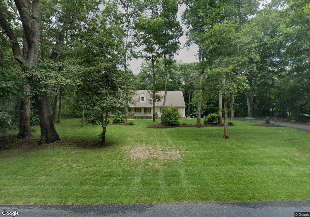
31013 S Shell Bridge Rd Laurel, DE 19956
Estimated Value: $314,110 - $515,000
3
Beds
--
Bath
1,960
Sq Ft
$223/Sq Ft
Est. Value
About This Home
This home is located at 31013 S Shell Bridge Rd, Laurel, DE 19956 and is currently estimated at $438,028, approximately $223 per square foot. 31013 S Shell Bridge Rd is a home located in Sussex County with nearby schools including North Laurel Elementary School, Laurel Elementary School, and Laurel Intermediate Middle School.
Ownership History
Date
Name
Owned For
Owner Type
Purchase Details
Closed on
Feb 28, 2025
Sold by
Whaley John S and Patricia Bowden Key Revocable Trust
Bought by
Patricia Bowden Key Revocable Trust and Key
Current Estimated Value
Purchase Details
Closed on
Apr 20, 2017
Sold by
Key Norman G and Key Patricia B
Bought by
Bowden-Key Patricia
Purchase Details
Closed on
Jul 17, 1990
Bought by
Key Norman G and Key Patricia B
Create a Home Valuation Report for This Property
The Home Valuation Report is an in-depth analysis detailing your home's value as well as a comparison with similar homes in the area
Home Values in the Area
Average Home Value in this Area
Purchase History
| Date | Buyer | Sale Price | Title Company |
|---|---|---|---|
| Patricia Bowden Key Revocable Trust | -- | None Listed On Document | |
| Bowden-Key Patricia | -- | -- | |
| Key Norman G | $10,000 | -- |
Source: Public Records
Tax History
| Year | Tax Paid | Tax Assessment Tax Assessment Total Assessment is a certain percentage of the fair market value that is determined by local assessors to be the total taxable value of land and additions on the property. | Land | Improvement |
|---|---|---|---|---|
| 2025 | $544 | $30,450 | $1,000 | $29,450 |
| 2024 | $1,071 | $30,450 | $1,000 | $29,450 |
| 2023 | $1,293 | $30,450 | $1,000 | $29,450 |
| 2022 | $1,055 | $30,450 | $1,000 | $29,450 |
| 2021 | $1,542 | $30,450 | $1,000 | $29,450 |
| 2020 | $1,580 | $30,450 | $1,000 | $29,450 |
| 2019 | $1,585 | $30,450 | $1,000 | $29,450 |
| 2018 | $1,730 | $30,450 | $0 | $0 |
| 2017 | $1,677 | $30,450 | $0 | $0 |
| 2016 | $1,306 | $30,450 | $0 | $0 |
| 2015 | $1,065 | $30,450 | $0 | $0 |
| 2014 | $893 | $30,450 | $0 | $0 |
Source: Public Records
Map
Nearby Homes
- 7857 Holly Branch Dr
- 31348 Mount Pleasant Rd
- 8617 Portsville Rd
- 7132 Airport Rd
- 31568 Mount Pleasant Rd
- 8807 Woodland Ferry Rd
- 7539 Broad Creek Cir
- 108 Crockett Ave
- 6503 Pleasant Dr
- 1176 W 6th St
- 1154 W 6th St
- 32725 Tussock Dr
- 32733 Tussock Dr
- 32427 Mount Pleasant Rd
- 6474 Pleasant Dr
- 32722 Tussock Dr
- 405 Park Ln
- 9269 Sharptown Rd
- 30804 River Rd
- 30772 River Rd
- Building Lot Road 492a
- 30987 S Shell Bridge Rd
- 31041 S Shell Bridge Rd
- 7914 Holly Branch Dr
- 30967 S Shell Bridge Rd
- 31059 S Shell Bridge Rd
- 7870 Holly Branch Dr
- 7770 Holly Branch Dr
- 31062 S Shell Bridge Rd
- 7852 Holly Branch Dr
- 31081 S Shell Bridge Rd
- 30950 S Shell Bridge Rd
- 7790 Holly Branch Dr
- 31036 Dogwood Dr
- 7885 Holly Branch Dr
- 7810 Holly Branch Dr
- LOT 47 Broad Creek Estates
- 7773 Holly Branch Dr
- 7847 Holly Branch Dr
- 31088 S Shell Bridge Rd
Your Personal Tour Guide
Ask me questions while you tour the home.