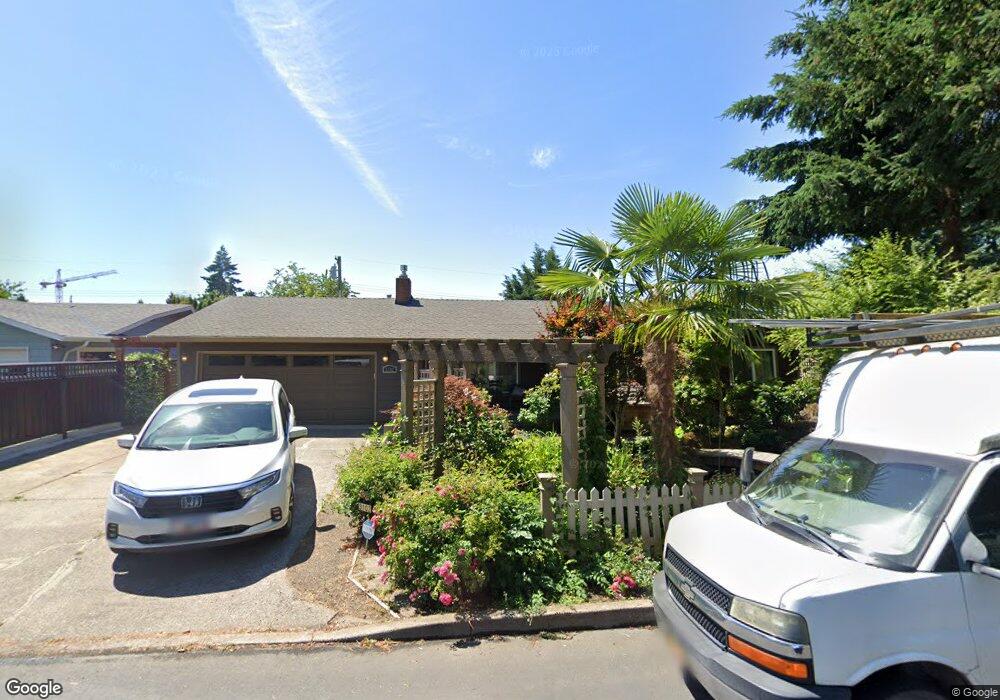
3102 16th Place Forest Grove, OR 97116
Estimated Value: $498,000 - $634,000
3
Beds
3
Baths
2,179
Sq Ft
$256/Sq Ft
Est. Value
About This Home
This home is located at 3102 16th Place, Forest Grove, OR 97116 and is currently estimated at $558,481, approximately $256 per square foot. 3102 16th Place is a home located in Washington County with nearby schools including Joseph Gale Elementary School, Neil Armstrong Middle School, and Tom McCall Upper Elementary School.
Ownership History
Date
Name
Owned For
Owner Type
Purchase Details
Closed on
Mar 17, 2022
Sold by
Claire Loranger Trust
Bought by
Loranger Rockford B and Loranger Christina N
Current Estimated Value
Purchase Details
Closed on
Jun 30, 2005
Sold by
Loranger Leo V and Loranger Claire J
Bought by
Loranger Rockford B and Loranger Christina N
Purchase Details
Closed on
May 14, 1999
Sold by
Loranger Raymond and Loranger Rebecca Anne
Bought by
Loranger Leo V and Loranger Claire J
Home Financials for this Owner
Home Financials are based on the most recent Mortgage that was taken out on this home.
Original Mortgage
$90,000
Interest Rate
6.92%
Purchase Details
Closed on
Mar 16, 1999
Sold by
Braukman Homes
Bought by
Loranger Raymond
Home Financials for this Owner
Home Financials are based on the most recent Mortgage that was taken out on this home.
Original Mortgage
$90,000
Interest Rate
6.92%
Create a Home Valuation Report for This Property
The Home Valuation Report is an in-depth analysis detailing your home's value as well as a comparison with similar homes in the area
Home Values in the Area
Average Home Value in this Area
Purchase History
| Date | Buyer | Sale Price | Title Company |
|---|---|---|---|
| Loranger Rockford B | $86,000 | None Listed On Document | |
| Loranger Rockford B | $160,000 | -- | |
| Loranger Leo V | $155,000 | Chicago Title Insurance Co | |
| Loranger Raymond | $62,900 | Fidelity National Title Co |
Source: Public Records
Mortgage History
| Date | Status | Borrower | Loan Amount |
|---|---|---|---|
| Previous Owner | Loranger Leo V | $90,000 | |
| Closed | Loranger Rockford B | $0 |
Source: Public Records
Tax History Compared to Growth
Tax History
| Year | Tax Paid | Tax Assessment Tax Assessment Total Assessment is a certain percentage of the fair market value that is determined by local assessors to be the total taxable value of land and additions on the property. | Land | Improvement |
|---|---|---|---|---|
| 2026 | $4,795 | $269,250 | -- | -- |
| 2025 | $4,795 | $261,410 | -- | -- |
| 2024 | $4,626 | $253,800 | -- | -- |
| 2023 | $4,626 | $246,410 | $0 | $0 |
| 2022 | $4,045 | $246,410 | $0 | $0 |
| 2021 | $3,992 | $232,280 | $0 | $0 |
| 2020 | $3,971 | $225,520 | $0 | $0 |
| 2019 | $3,882 | $218,960 | $0 | $0 |
| 2018 | $3,763 | $212,590 | $0 | $0 |
| 2017 | $3,647 | $206,400 | $0 | $0 |
| 2016 | $3,544 | $200,390 | $0 | $0 |
| 2015 | $3,408 | $194,560 | $0 | $0 |
| 2014 | $3,392 | $188,900 | $0 | $0 |
Source: Public Records
Map
Nearby Homes
- 1615 Kingwood St
- 3128 Brittany Dr
- 3213 Maple Place
- 2902 19th Ave
- 2743 15th Place
- 2815 18th Ave
- 2824 19th Ave
- 0 Crescent Dr
- 3404 19th Ave Unit 103
- 3404 19th Ave Unit 215
- 1822 Hawthorne St
- 1813 Filbert St
- 1118 Hampton Ct
- 1119 Hawthorne St
- 2828 22nd Ave Unit 3
- 2828 22nd Ave Unit 5
- 0 Kingwood St
- 2366 Kingwood St
- 2323 19th Ave
- 1835 Tamarack Ct
- 3040 16th Place
- 3108 16th Place
- 3047 Brittany Dr
- 3103 Brittany Dr
- 3116 16th Place
- 3032 16th Place
- 3101 16th Place
- 3035 Brittany Dr
- 3041 16th Place
- 3109 16th Place
- 3119 Brittany Dr
- 3046 Brittany Dr
- 3124 16th Place
- 3033 16th Place
- 3117 16th Place
- 3050 Brittany Dr
- 3110 Brittany Dr
- 3125 16th Place
- 3027 16th Place
- 3118 Brittany Dr