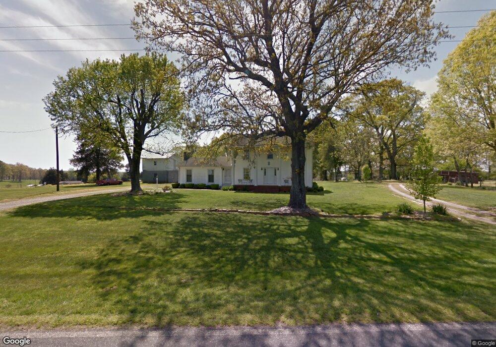
3109 Old Mountain Rd Stony Point, NC 28678
Estimated Value: $313,000 - $1,419,737
3
Beds
1
Bath
3,024
Sq Ft
$286/Sq Ft
Est. Value
About This Home
This home is located at 3109 Old Mountain Rd, Stony Point, NC 28678 and is currently estimated at $866,369, approximately $286 per square foot. 3109 Old Mountain Rd is a home located in Iredell County with nearby schools including Sharon Elementary School, West Iredell Middle School, and West Iredell High School.
Ownership History
Date
Name
Owned For
Owner Type
Purchase Details
Closed on
Jun 1, 1984
Current Estimated Value
Purchase Details
Closed on
Aug 22, 1938
Purchase Details
Closed on
Sep 21, 1936
Create a Home Valuation Report for This Property
The Home Valuation Report is an in-depth analysis detailing your home's value as well as a comparison with similar homes in the area
Home Values in the Area
Average Home Value in this Area
Purchase History
| Date | Buyer | Sale Price | Title Company |
|---|---|---|---|
| -- | -- | -- | |
| -- | -- | -- | |
| -- | -- | -- |
Source: Public Records
Tax History Compared to Growth
Tax History
| Year | Tax Paid | Tax Assessment Tax Assessment Total Assessment is a certain percentage of the fair market value that is determined by local assessors to be the total taxable value of land and additions on the property. | Land | Improvement |
|---|---|---|---|---|
| 2024 | $1,865 | $295,780 | $0 | $0 |
| 2023 | $1,865 | $245,090 | $0 | $0 |
| 2022 | $1,242 | $178,840 | $0 | $0 |
| 2021 | $1,234 | $178,840 | $0 | $0 |
| 2020 | $1,234 | $178,840 | $0 | $0 |
| 2019 | $1,181 | $178,840 | $0 | $0 |
| 2018 | $1,072 | $161,960 | $0 | $0 |
| 2017 | $1,072 | $714,610 | $645,380 | $69,230 |
| 2016 | $1,072 | $714,610 | $645,380 | $69,230 |
| 2015 | $1,059 | $714,610 | $645,380 | $69,230 |
| 2014 | $970 | $715,630 | $645,380 | $70,250 |
Source: Public Records
Map
Nearby Homes
- 329 Lindsey Farm Rd
- TBD County Line Rd
- 490 County Line Rd
- 65 Shotwell Patterson Ln
- 48 Jeannes Ct
- 568 Drumstand Rd
- 51 Rosemont Dr
- 163 Primrose Dr
- 200 Vista Pointe Dr
- 1457 Smith Farm Rd
- 4723 Old Mountain Rd
- 115 Cherry Blossom Ln Unit 3
- 0 Old Mountain Rd Unit CAR4304814
- 112 Robinette Ln
- 136 Ridge Run Dr
- 113 Robinette Ln
- 4501 Taylorsville Hwy
- 100 Springs Ct
- 137 Proust Rd
- 290 Mill Hill Ct
- 3133 Old Mountain Rd
- 131 Grain Dr
- 119 Grain Dr
- 113 Grain Dr
- 119 Cain Rd
- 125 Cain Rd
- 125 Cain Rd Unit 2
- 122 Grain Dr
- 114 Grain Dr
- 133 Cain Rd
- 111 Burning Ln
- 110 Burning Ln Unit 34
- 453 Lindsey Farm Rd
- 421 Lindsey Farm Rd
- 139 Cain Rd
- 181 Pressly Farm Rd Unit 189
- 118 Grain Dr Unit 24
- 116 Burning Ln
- 117 Burning Ln
- 145 Cain Rd