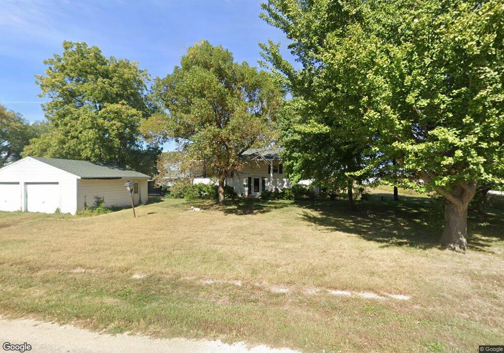
311 Clay St Farragut, IA 51639
Estimated Value: $171,000 - $193,700
4
Beds
3
Baths
1,400
Sq Ft
$129/Sq Ft
Est. Value
About This Home
This home is located at 311 Clay St, Farragut, IA 51639 and is currently estimated at $179,925, approximately $128 per square foot. 311 Clay St is a home located in Fremont County with nearby schools including Shenandoah Elementary School, Shenandoah Middle School, and Shenandoah High School.
Ownership History
Date
Name
Owned For
Owner Type
Purchase Details
Closed on
Aug 25, 2006
Sold by
Bengston Emily B and Bengston Carl V
Bought by
Bengtson Emily B
Current Estimated Value
Home Financials for this Owner
Home Financials are based on the most recent Mortgage that was taken out on this home.
Original Mortgage
$172,500
Outstanding Balance
$102,663
Interest Rate
6.6%
Mortgage Type
Reverse Mortgage Home Equity Conversion Mortgage
Estimated Equity
$77,262
Create a Home Valuation Report for This Property
The Home Valuation Report is an in-depth analysis detailing your home's value as well as a comparison with similar homes in the area
Home Values in the Area
Average Home Value in this Area
Purchase History
| Date | Buyer | Sale Price | Title Company |
|---|---|---|---|
| Bengtson Emily B | -- | -- |
Source: Public Records
Mortgage History
| Date | Status | Borrower | Loan Amount |
|---|---|---|---|
| Open | Bengtson Emily B | $172,500 |
Source: Public Records
Tax History Compared to Growth
Tax History
| Year | Tax Paid | Tax Assessment Tax Assessment Total Assessment is a certain percentage of the fair market value that is determined by local assessors to be the total taxable value of land and additions on the property. | Land | Improvement |
|---|---|---|---|---|
| 2025 | $2,964 | $164,800 | $10,250 | $154,550 |
| 2024 | $2,964 | $168,520 | $10,250 | $158,270 |
| 2023 | $2,526 | $168,520 | $10,250 | $158,270 |
| 2022 | $2,210 | $135,990 | $12,290 | $123,700 |
| 2021 | $2,210 | $126,860 | $11,470 | $115,390 |
| 2020 | $2,000 | $113,280 | $11,470 | $101,810 |
| 2019 | $2,236 | $115,200 | $0 | $0 |
| 2018 | $2,044 | $115,200 | $0 | $0 |
| 2017 | $2,044 | $103,780 | $0 | $0 |
| 2016 | $2,090 | $103,780 | $0 | $0 |
| 2015 | $2,090 | $103,780 | $0 | $0 |
| 2014 | $2,108 | $103,780 | $0 | $0 |
Source: Public Records
Map
Nearby Homes
- 2035 355th Ave
- 3307 State Highway 2
- 803 Edith Ave
- 709 Edith Ave
- 509 Kearney Ave
- 1026 State Highway 2
- 0 U S 59
- 3906 Co Rd J26
- 00 U S 59
- 1400 Maple St
- 24 Applewood Dr
- 14 Country Club Ln
- 1206 Maple St
- 1410 S Elm St
- 21 Mayridge Dr
- 1104 S Elm St
- 9 Country Club Ln
- 12 Mayridge Dr
- 0 Walnut St Unit 11276604
- 706 Maple St