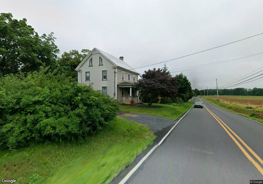
311 Cowpath Rd Souderton, PA 18964
Estimated Value: $489,000 - $496,592
6
Beds
1
Bath
1,780
Sq Ft
$277/Sq Ft
Est. Value
About This Home
This home is located at 311 Cowpath Rd, Souderton, PA 18964 and is currently estimated at $492,796, approximately $276 per square foot. 311 Cowpath Rd is a home located in Montgomery County with nearby schools including West Broad Street Elementary School, Indian Crest Middle School, and Souderton Area Senior High School.
Ownership History
Date
Name
Owned For
Owner Type
Purchase Details
Closed on
May 22, 2024
Sold by
Halteman Eva F and Halteman Arlene F
Bought by
Moyer Gary L
Current Estimated Value
Home Financials for this Owner
Home Financials are based on the most recent Mortgage that was taken out on this home.
Original Mortgage
$140,000
Outstanding Balance
$138,037
Interest Rate
6.88%
Mortgage Type
New Conventional
Estimated Equity
$354,759
Purchase Details
Closed on
Apr 28, 1997
Sold by
Halteman Richard F and Halteman Arlene F
Bought by
Ceteno N V
Create a Home Valuation Report for This Property
The Home Valuation Report is an in-depth analysis detailing your home's value as well as a comparison with similar homes in the area
Home Values in the Area
Average Home Value in this Area
Purchase History
| Date | Buyer | Sale Price | Title Company |
|---|---|---|---|
| Moyer Gary L | $475,000 | None Listed On Document | |
| Ceteno N V | $800,000 | -- |
Source: Public Records
Mortgage History
| Date | Status | Borrower | Loan Amount |
|---|---|---|---|
| Open | Moyer Gary L | $140,000 |
Source: Public Records
Tax History Compared to Growth
Tax History
| Year | Tax Paid | Tax Assessment Tax Assessment Total Assessment is a certain percentage of the fair market value that is determined by local assessors to be the total taxable value of land and additions on the property. | Land | Improvement |
|---|---|---|---|---|
| 2025 | $9,420 | $234,560 | $141,330 | $93,230 |
| 2024 | $9,420 | $234,560 | $141,330 | $93,230 |
| 2023 | $8,989 | $234,560 | $141,330 | $93,230 |
| 2022 | $8,714 | $234,560 | $141,330 | $93,230 |
| 2021 | $8,531 | $234,560 | $141,330 | $93,230 |
| 2020 | $8,415 | $234,560 | $141,330 | $93,230 |
| 2019 | $7,681 | $234,560 | $141,330 | $93,230 |
| 2018 | $8,314 | $234,560 | $141,330 | $93,230 |
| 2017 | $8,105 | $234,560 | $141,330 | $93,230 |
| 2016 | $8,013 | $234,560 | $141,330 | $93,230 |
| 2015 | $7,796 | $234,560 | $141,330 | $93,230 |
| 2014 | $7,796 | $234,560 | $141,330 | $93,230 |
Source: Public Records
Map
Nearby Homes
- 124 Hollybush Cir
- 35 Chancery Ct Unit 35
- 44 Diamond St
- 554 Harleysville Pike
- 51 Cambridge Ct Unit 51
- 44 Adams Ave
- 478 Smokepipe Rd
- 110 Washington Ave
- 3443 Devlin Way
- 227 Ridge Ave
- 314 Harleysville Pike
- 17 N 2nd St
- 316 Penn Ave
- 208 E Broad St
- Arcadia Plan at Glenwood Chase
- Sebastian Plan at Glenwood Chase
- Arcadia Plan at Retreat at Boyertown Farms
- Caldwell Plan at Glenwood Chase
- Magnolia Plan at Glenwood Chase
- Harrison Plan at Glenwood Chase
- 296 Westminster Ln
- 298 Westminster Ln
- 294 Westminster Ln
- 300 Westminster Ln
- 292 Westminster Ln
- 307 Devon Ct Unit 12
- 305 Devon Ct Unit 13
- 303 Devon Ct Unit 14
- 301 Devon Ct Unit 15
- 290 Westminster Ln
- 295 Westminster Ln Unit 53
- 293 Westminster Ln Unit 54
- 296 Kingsfield Dr Unit 52
- 288 Westminster Ln
- 289 Westminster Ln Unit 55
- 297 Kingsfield Dr Unit 17
- 294 Kingsfield Dr Unit 51
- 286 Westminster Ln Unit 4
- 295 Kingsfield Dr Unit 18
- 287 Westminster Ln