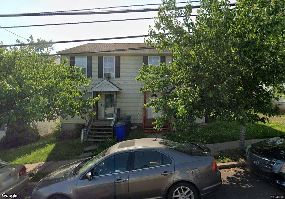
311 Grant St Pottstown, PA 19464
Washington-Rosedale NeighborhoodEstimated Value: $216,000 - $286,068
3
Beds
2
Baths
1,296
Sq Ft
$201/Sq Ft
Est. Value
About This Home
This home is located at 311 Grant St, Pottstown, PA 19464 and is currently estimated at $260,767, approximately $201 per square foot. 311 Grant St is a home located in Montgomery County with nearby schools including Pottstown Middle School, Pottstown Senior High School, and Saint Aloysius Parish School.
Ownership History
Date
Name
Owned For
Owner Type
Purchase Details
Closed on
Feb 2, 2009
Sold by
Benfield Darci and Hunte Samuel F
Bought by
Hunte Samuel F
Current Estimated Value
Home Financials for this Owner
Home Financials are based on the most recent Mortgage that was taken out on this home.
Original Mortgage
$147,893
Outstanding Balance
$92,985
Interest Rate
5%
Estimated Equity
$167,782
Purchase Details
Closed on
Apr 26, 2005
Sold by
Not Provided
Bought by
Hunte Samuel F and Benfield Darci L
Home Financials for this Owner
Home Financials are based on the most recent Mortgage that was taken out on this home.
Original Mortgage
$143,000
Interest Rate
5.95%
Mortgage Type
New Conventional
Purchase Details
Closed on
Apr 15, 2005
Sold by
Not Provided
Bought by
Hunte Samuel F and Benfield Darci L
Home Financials for this Owner
Home Financials are based on the most recent Mortgage that was taken out on this home.
Original Mortgage
$143,000
Interest Rate
5.95%
Mortgage Type
New Conventional
Purchase Details
Closed on
Oct 6, 2004
Sold by
Kratz Robert S and Decampli Robert
Bought by
Kratz Robert S and Decampli Robert
Create a Home Valuation Report for This Property
The Home Valuation Report is an in-depth analysis detailing your home's value as well as a comparison with similar homes in the area
Home Values in the Area
Average Home Value in this Area
Purchase History
| Date | Buyer | Sale Price | Title Company |
|---|---|---|---|
| Hunte Samuel F | -- | None Available | |
| Hunte Samuel F | $143,000 | T A Title Insurance Co | |
| Hunte Samuel F | $143,000 | T A Title Insurance Co | |
| Kratz Robert S | -- | -- |
Source: Public Records
Mortgage History
| Date | Status | Borrower | Loan Amount |
|---|---|---|---|
| Open | Hunte Samuel F | $147,893 | |
| Closed | Hunte Samuel F | $143,000 | |
| Closed | Hunte Samuel F | $143,000 |
Source: Public Records
Tax History Compared to Growth
Tax History
| Year | Tax Paid | Tax Assessment Tax Assessment Total Assessment is a certain percentage of the fair market value that is determined by local assessors to be the total taxable value of land and additions on the property. | Land | Improvement |
|---|---|---|---|---|
| 2025 | $5,470 | $89,120 | $24,210 | $64,910 |
| 2024 | $5,470 | $89,120 | $24,210 | $64,910 |
| 2023 | $5,396 | $89,120 | $24,210 | $64,910 |
| 2022 | $5,367 | $89,120 | $24,210 | $64,910 |
| 2021 | $5,305 | $89,120 | $24,210 | $64,910 |
| 2020 | $5,213 | $89,120 | $24,210 | $64,910 |
| 2019 | $5,093 | $89,120 | $24,210 | $64,910 |
| 2018 | $3,621 | $89,120 | $24,210 | $64,910 |
| 2017 | $4,763 | $89,120 | $24,210 | $64,910 |
| 2016 | $4,728 | $89,120 | $24,210 | $64,910 |
| 2015 | $4,698 | $89,120 | $24,210 | $64,910 |
| 2014 | $4,698 | $89,120 | $24,210 | $64,910 |
Source: Public Records
Map
Nearby Homes
- 648 Lincoln Ave
- 725 Lincoln Ave
- 651 Walnut St
- 570 Jefferson Ave
- 627 Chestnut St
- 564 Walnut St
- 511 Beech St
- 506 Lincoln Ave
- 526 Chestnut St
- 639 E High St
- 407 Jefferson Ave
- 762 E High St
- 406 Jefferson Ave
- 418 Walnut St
- 399 Lincoln Ave
- 866 E High St
- 175 N Franklin St
- 764 Queen St
- 869 Queen St
- 535 N Franklin St
- 309 Grant St
- 307 Grant St
- 305 Grant St
- 317 Grant St
- 303 Grant St
- 647 Lincoln Ave
- 645 Lincoln Ave
- 321 Grant St Unit 2022
- 643 Lincoln Ave
- 641 Lincoln Ave
- 325 Grant St
- 703 Lincoln Ave
- 327 Grant St
- 639 Lincoln Ave
- 318 Grant St
- 666 Jefferson Ave Unit 17
- 320 Grant St
- 329 Grant St Unit 25
- 664 Jefferson Ave Unit 16
- 322 Grant St