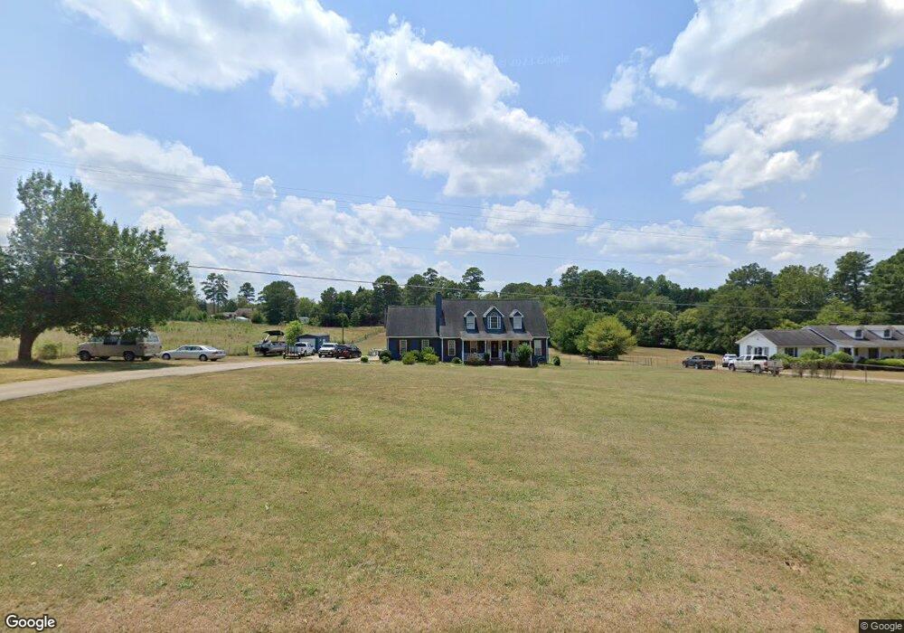
311 Hobson Rd Anderson, SC 29621
Estimated Value: $286,000 - $326,872
3
Beds
--
Bath
1,862
Sq Ft
$163/Sq Ft
Est. Value
About This Home
This home is located at 311 Hobson Rd, Anderson, SC 29621 and is currently estimated at $302,968, approximately $162 per square foot. 311 Hobson Rd is a home located in Anderson County with nearby schools including Concord Elementary School, McCants Middle School, and T.L. Hanna High School.
Ownership History
Date
Name
Owned For
Owner Type
Purchase Details
Closed on
Aug 24, 2018
Sold by
Dukes Deborah C
Bought by
White Michael Keith and White Kristin Denelle
Current Estimated Value
Home Financials for this Owner
Home Financials are based on the most recent Mortgage that was taken out on this home.
Original Mortgage
$157,500
Outstanding Balance
$136,782
Interest Rate
4.5%
Mortgage Type
New Conventional
Estimated Equity
$166,186
Purchase Details
Closed on
Jun 6, 2018
Sold by
Dukes Daniel W
Bought by
Dukes Deborah C
Create a Home Valuation Report for This Property
The Home Valuation Report is an in-depth analysis detailing your home's value as well as a comparison with similar homes in the area
Home Values in the Area
Average Home Value in this Area
Purchase History
| Date | Buyer | Sale Price | Title Company |
|---|---|---|---|
| White Michael Keith | $175,000 | None Available | |
| Dukes Deborah C | -- | None Available |
Source: Public Records
Mortgage History
| Date | Status | Borrower | Loan Amount |
|---|---|---|---|
| Open | White Michael Keith | $157,500 |
Source: Public Records
Tax History Compared to Growth
Tax History
| Year | Tax Paid | Tax Assessment Tax Assessment Total Assessment is a certain percentage of the fair market value that is determined by local assessors to be the total taxable value of land and additions on the property. | Land | Improvement |
|---|---|---|---|---|
| 2024 | $1,006 | $8,620 | $2,030 | $6,590 |
| 2023 | $1,006 | $8,620 | $2,030 | $6,590 |
| 2022 | $975 | $8,620 | $2,030 | $6,590 |
| 2021 | $872 | $7,020 | $1,410 | $5,610 |
| 2020 | $864 | $7,020 | $1,410 | $5,610 |
| 2019 | $3,447 | $10,530 | $2,120 | $8,410 |
| 2018 | $878 | $7,020 | $1,410 | $5,610 |
| 2017 | -- | $7,020 | $1,410 | $5,610 |
| 2016 | $842 | $6,870 | $1,500 | $5,370 |
| 2015 | $860 | $6,870 | $1,500 | $5,370 |
| 2014 | $855 | $6,870 | $1,500 | $5,370 |
Source: Public Records
Map
Nearby Homes
- 124 Kingsgate Way
- 122 Kingsgate Way
- 115 Kingsgate Way
- Hobson E West Pkwy
- 101 Henry Dr
- 112 Briar Creek Ln
- 803 Kings Rd
- 805 Weathered Oak Way
- 803 Weathered Oak Way
- 1002 Whirlaway Cir
- 1015 Whirlaway Cir
- 1016 Whirlaway Cir
- 115 McPhail Farms Cir
- 124 Reed Place
- 305 Edgebrook Dr
- 141 Olde Towne Dr
- 104 Tinsley Dr
- 224 Obannon Ct
- 161 Bradley Park
- 124 Bradley Park
- 313 Hobson Rd
- 315 Hobson Rd
- 310 Hobson Rd
- 317 Hobson Rd
- 308 Hobson Rd
- 108 Partridge Ln
- 106 Partridge Ln
- 312 Hobson Rd
- 110 Partridge Ln
- 104 Partridge Ln
- 303 Hobson Rd
- 303 Hobson Rd
- 306 Hobson Rd
- 102 Partridge Ln
- 107 Brookwood Ct
- 112 Partridge Ln
- 105 Brookwood Ct
- 103 Brookwood Ct
- 100 Partridge Ln
- 105 Partridge Ln