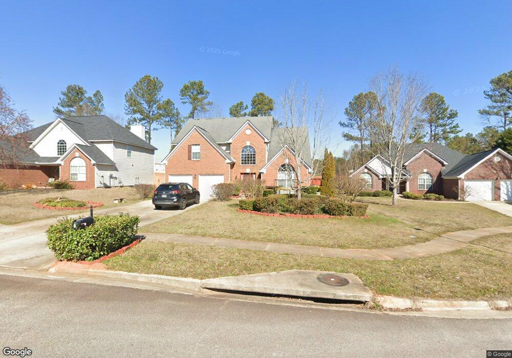
311 Randall Ct Locust Grove, GA 30248
Estimated Value: $366,017 - $412,000
5
Beds
3
Baths
2,924
Sq Ft
$131/Sq Ft
Est. Value
About This Home
This home is located at 311 Randall Ct, Locust Grove, GA 30248 and is currently estimated at $384,254, approximately $131 per square foot. 311 Randall Ct is a home located in Henry County with nearby schools including Bethlehem Elementary School, Luella Middle School, and Luella High School.
Ownership History
Date
Name
Owned For
Owner Type
Purchase Details
Closed on
May 13, 2008
Sold by
Us Bank Na
Bought by
Edwards Radcliffe and Spence Rosie
Current Estimated Value
Home Financials for this Owner
Home Financials are based on the most recent Mortgage that was taken out on this home.
Original Mortgage
$123,200
Outstanding Balance
$77,859
Interest Rate
5.84%
Mortgage Type
FHA
Estimated Equity
$306,395
Purchase Details
Closed on
Sep 4, 2007
Sold by
Baker Vivienne and Baker Oliver
Bought by
Us Bk Na
Purchase Details
Closed on
Jul 20, 2006
Sold by
Kester Chris L
Bought by
Baker Oliver and Baker Vivienne
Home Financials for this Owner
Home Financials are based on the most recent Mortgage that was taken out on this home.
Original Mortgage
$171,000
Interest Rate
9.75%
Mortgage Type
New Conventional
Create a Home Valuation Report for This Property
The Home Valuation Report is an in-depth analysis detailing your home's value as well as a comparison with similar homes in the area
Home Values in the Area
Average Home Value in this Area
Purchase History
| Date | Buyer | Sale Price | Title Company |
|---|---|---|---|
| Edwards Radcliffe | $154,000 | -- | |
| Us Bk Na | -- | -- | |
| Baker Oliver | $190,000 | -- |
Source: Public Records
Mortgage History
| Date | Status | Borrower | Loan Amount |
|---|---|---|---|
| Open | Edwards Radcliffe | $123,200 | |
| Previous Owner | Baker Oliver | $171,000 |
Source: Public Records
Tax History Compared to Growth
Tax History
| Year | Tax Paid | Tax Assessment Tax Assessment Total Assessment is a certain percentage of the fair market value that is determined by local assessors to be the total taxable value of land and additions on the property. | Land | Improvement |
|---|---|---|---|---|
| 2024 | $5,708 | $141,880 | $16,000 | $125,880 |
| 2023 | $5,498 | $141,480 | $14,800 | $126,680 |
| 2022 | $4,714 | $121,040 | $14,800 | $106,240 |
| 2021 | $3,525 | $90,040 | $14,800 | $75,240 |
| 2020 | $3,402 | $86,840 | $10,000 | $76,840 |
| 2019 | $3,051 | $77,680 | $10,000 | $67,680 |
| 2018 | $2,834 | $72,040 | $8,000 | $64,040 |
| 2016 | $2,670 | $67,760 | $8,000 | $59,760 |
| 2015 | $2,573 | $63,280 | $8,000 | $55,280 |
| 2014 | $2,607 | $63,360 | $8,000 | $55,360 |
Source: Public Records
Map
Nearby Homes
- 412 Eglington Trail
- 1360 Luella Rd
- 112 Leveret Rd
- 2320 Mcintosh Dr
- 315 Grand Traverse Way
- 1429 Kentmire Ct
- 400 Chaleur Way
- 308 Naples Dr
- 300 Naples Dr
- 1171 Bodega Loop
- 2356 Mcintosh Dr
- 2439 Mcintosh Dr
- 3157 Highway 155
- 2428 Mcintosh Dr
- 973 Buckhorn Bend
- 956 Buckhorn Bend
- 436 Lothbury Ave
- 279 Linford Dr
- 305 Randall Ct
- 317 Randall Ct
- 0 Randall Ct Unit 7539050
- 0 Randall Ct Unit 7388940
- 0 Randall Ct Unit 7329423
- 0 Randall Ct Unit 7137549
- 0 Randall Ct Unit 7256161
- 0 Randall Ct Unit 7142660
- 0 Randall Ct Unit 8252774
- 0 Randall Ct Unit 8056432
- 0 Randall Ct
- 301 Randall Ct
- 321 Randall Ct
- 308 Randall Ct
- 304 Randall Ct
- 304 Randall Ct
- 312 Randall Ct
- 320 Randall Ct
- 300 Randall Ct
- 316 Randall Ct