Estimated Value: $418,000 - $482,000
6
Beds
3
Baths
2,770
Sq Ft
$164/Sq Ft
Est. Value
About This Home
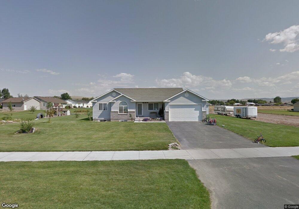
This home is located at 3110 Barnes Way, Iona, ID 83427 and is currently estimated at $454,166, approximately $163 per square foot. 3110 Barnes Way is a home located in Bonneville County with nearby schools including Iona Elementary School, Rocky Mountain Middle School, and Bonneville High School.
Ownership History
Date
Name
Owned For
Owner Type
Purchase Details
Closed on
Apr 18, 2018
Sold by
Waterman Timothy and Waterman Penney
Bought by
Waterman Timothy
Current Estimated Value
Home Financials for this Owner
Home Financials are based on the most recent Mortgage that was taken out on this home.
Original Mortgage
$180,000
Outstanding Balance
$154,869
Interest Rate
4.46%
Mortgage Type
New Conventional
Estimated Equity
$299,297
Create a Home Valuation Report for This Property
The Home Valuation Report is an in-depth analysis detailing your home's value as well as a comparison with similar homes in the area
Home Values in the Area
Average Home Value in this Area
Purchase History
| Date | Buyer | Sale Price | Title Company |
|---|---|---|---|
| Waterman Timothy | -- | First American Title Co |
Source: Public Records
Mortgage History
| Date | Status | Borrower | Loan Amount |
|---|---|---|---|
| Open | Waterman Timothy | $180,000 |
Source: Public Records
Tax History
| Year | Tax Paid | Tax Assessment Tax Assessment Total Assessment is a certain percentage of the fair market value that is determined by local assessors to be the total taxable value of land and additions on the property. | Land | Improvement |
|---|---|---|---|---|
| 2025 | $1,964 | $525,500 | $94,055 | $431,445 |
| 2024 | $2,034 | $483,334 | $59,537 | $423,797 |
| 2023 | $1,730 | $398,207 | $59,537 | $338,670 |
| 2022 | $2,191 | $370,058 | $51,778 | $318,280 |
| 2021 | $1,966 | $269,128 | $51,778 | $217,350 |
| 2019 | $1,966 | $227,673 | $38,063 | $189,610 |
| 2018 | $1,593 | $229,551 | $34,641 | $194,910 |
| 2017 | $2,898 | $199,827 | $28,867 | $170,960 |
| 2016 | $2,940 | $185,917 | $28,867 | $157,050 |
| 2015 | $1,440 | $177,681 | $27,431 | $150,250 |
| 2014 | $28,144 | $177,681 | $27,431 | $150,250 |
| 2013 | $1,211 | $141,500 | $27,430 | $114,070 |
Source: Public Records
Map
Nearby Homes
- 3171 Barnes Way
- 5289 E Free Ave
- 4676 Weigel Cir
- 3528 N Elim Ln
- 5311 E Dutson
- 5113 Ryanne Way
- 5136 Ryanne Way
- 5082 Nelson Dr
- 5317 E Buchanan Ave
- 5380 E Buchanan Ave
- 4372 E Arcadia Ave
- 4307 E Marlin Ave
- 4343 E Arcadia Ave
- 4311 E Arcadia Ave
- 5571 E Iona Rd
- 4019 Baldwin Ave
- 4150 N Main St
- 5031 E Dutson Dr
- 3720 Barcelona Ave
- 4441 Tarrell Cir
- 4915 Denning Ave
- 4890 Camas Creek Cir
- 4910 Camas Creek Cir
- 3068 Barnes Way
- 3107 Barnes Way
- 3139 N Barnes Way
- 3139 Barnes Way
- 4935 Denning Ave
- 4932 Camas Creek Cir
- 3075 Barnes Way
- 3069 Sawmill Cir
- 3036 N Barnes Way
- 3036 Barnes Way
- 4959 Denning Ave
- 4893 Camas Creek Cir
- 3203 Barnes Way
- 4950 Camas Creek Cir
- 3100 Alder Cir
- 3041 Barnes Way
- 3070 Lilac Cir
Your Personal Tour Guide
Ask me questions while you tour the home.