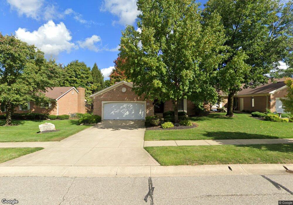
3110 Kingsmead Trace Unit 3110 Dublin, OH 43017
Estimated Value: $443,841 - $502,000
2
Beds
3
Baths
1,883
Sq Ft
$253/Sq Ft
Est. Value
About This Home
This home is located at 3110 Kingsmead Trace Unit 3110, Dublin, OH 43017 and is currently estimated at $476,710, approximately $253 per square foot. 3110 Kingsmead Trace Unit 3110 is a home located in Franklin County with nearby schools including Thomas Elementary School, John Sells Middle School, and Dublin Coffman High School.
Ownership History
Date
Name
Owned For
Owner Type
Purchase Details
Closed on
Jul 19, 2023
Sold by
Christine Xerogianes Trust
Bought by
Peltier Darlene Kay
Current Estimated Value
Purchase Details
Closed on
Aug 31, 2020
Sold by
Rothe James R and The James R Rothe Revocable Tr
Bought by
Xerogianes Christine
Purchase Details
Closed on
Jun 5, 2007
Sold by
Rothe James R and Rothe Jeanne L
Bought by
Rothe James R and The James R Rothe Revocable Tr
Purchase Details
Closed on
Jun 23, 2006
Sold by
Hord Dennis L and The Justyn P Desmond Living Tr
Bought by
Rothe James R
Home Financials for this Owner
Home Financials are based on the most recent Mortgage that was taken out on this home.
Original Mortgage
$213,600
Interest Rate
6.5%
Mortgage Type
Purchase Money Mortgage
Purchase Details
Closed on
Sep 11, 1995
Sold by
Raymond Barry Inc
Bought by
Justyn P Desmond
Create a Home Valuation Report for This Property
The Home Valuation Report is an in-depth analysis detailing your home's value as well as a comparison with similar homes in the area
Home Values in the Area
Average Home Value in this Area
Purchase History
| Date | Buyer | Sale Price | Title Company |
|---|---|---|---|
| Peltier Darlene Kay | $415,000 | Stewart Title | |
| Xerogianes Christine | $320,000 | Land & Mortgage Title Agency | |
| Rothe James R | -- | Attorney | |
| Rothe James R | $267,000 | Independent | |
| Justyn P Desmond | $205,800 | -- |
Source: Public Records
Mortgage History
| Date | Status | Borrower | Loan Amount |
|---|---|---|---|
| Previous Owner | Rothe James R | $213,600 |
Source: Public Records
Tax History Compared to Growth
Tax History
| Year | Tax Paid | Tax Assessment Tax Assessment Total Assessment is a certain percentage of the fair market value that is determined by local assessors to be the total taxable value of land and additions on the property. | Land | Improvement |
|---|---|---|---|---|
| 2024 | $8,088 | $133,110 | $23,280 | $109,830 |
| 2023 | $7,391 | $133,110 | $23,280 | $109,830 |
| 2022 | $6,715 | $113,400 | $25,200 | $88,200 |
| 2021 | $6,824 | $113,400 | $25,200 | $88,200 |
| 2020 | $7,528 | $113,400 | $25,200 | $88,200 |
| 2019 | $7,088 | $94,500 | $21,000 | $73,500 |
| 2018 | $6,157 | $94,500 | $21,000 | $73,500 |
| 2017 | $5,939 | $94,500 | $21,000 | $73,500 |
| 2016 | $5,308 | $71,720 | $12,710 | $59,010 |
| 2015 | $5,193 | $71,720 | $12,710 | $59,010 |
| 2014 | $5,198 | $71,720 | $12,710 | $59,010 |
| 2013 | $2,399 | $65,205 | $11,550 | $53,655 |
Source: Public Records
Map
Nearby Homes
- 5657 Barry Trace
- 5672 Barry Trace Unit 5672
- 3158 Kingsmead Trace Unit 3158
- 5850 Meadowhurst Way
- 5753 Newgate Rd Unit 5753
- 5735 Newbank Cir Unit 303
- 3119 Rivermill Dr Unit 24
- 6040 Thatcher Dr
- 2970 Black Kettle Trail
- 2744 Greystone Dr Unit E
- 3087 Strathaven Ct
- 5646 Dorsey Dr
- 2622 Trottersway Dr
- 2585 Trottersway Dr Unit 2585
- 2579 Trotterslane Dr
- 5322 Darlington Rd Unit E
- 2560 Trotterslane Dr
- 3660 Rivervail Dr
- 2491 Calais Way
- 3263 Scioto Ridge Rd
- 3108 Kingsmead Trace Unit 3108
- 3120 Kingsmead Trace Unit 3120
- 3106 Kingsmead Trace
- 3122 Kingsmead Trace Unit 3122
- 3111 Barry Trace Ct Unit 3111
- 3109 Kingsmead Trace Unit 3109
- 3109 Barry Trace Ct Unit 3109
- 3107 Barry Trace Ct Unit 3107
- 3111 Kingsmead Trace
- 3121 Barry Trace Ct Unit 3121
- 3119 Kingsmead Tr
- 3119 Kingsmead Trace Unit 3119
- 5655 Barry Trace Unit 5655
- 3121 Kingsmead Trace Unit 3121
- 3128 Kingsmead Trace Unit 3128
- 5686 Barry Trace
- 5674 Barry Trace
- 3130 Kingsmead Trace Unit 3130
- 3130 Kingsmead Trace Unit HAYDEN FALLS
- 3127 Barry Trace Ct