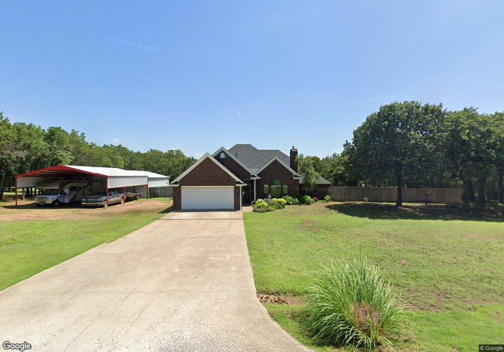
3110 Whipporwill Ln Duncan, OK 73533
Estimated Value: $202,000 - $288,000
4
Beds
3
Baths
1,876
Sq Ft
$138/Sq Ft
Est. Value
About This Home
This home is located at 3110 Whipporwill Ln, Duncan, OK 73533 and is currently estimated at $259,166, approximately $138 per square foot. 3110 Whipporwill Ln is a home located in Stephens County with nearby schools including Marlow Elementary School, Marlow Middle School, and Marlow High School.
Ownership History
Date
Name
Owned For
Owner Type
Purchase Details
Closed on
May 25, 2000
Sold by
Myers Stephen R
Bought by
Myers Stephen R and Myers Cynthia I
Current Estimated Value
Purchase Details
Closed on
Jun 5, 1998
Sold by
Johnston Tony Lee
Purchase Details
Closed on
Feb 9, 1995
Sold by
Johnston Belinda Carol
Purchase Details
Closed on
Sep 11, 1991
Sold by
Oklahoma National Bank
Create a Home Valuation Report for This Property
The Home Valuation Report is an in-depth analysis detailing your home's value as well as a comparison with similar homes in the area
Home Values in the Area
Average Home Value in this Area
Purchase History
| Date | Buyer | Sale Price | Title Company |
|---|---|---|---|
| Myers Stephen R | -- | -- | |
| -- | $110,000 | -- | |
| -- | -- | -- | |
| -- | $5,000 | -- |
Source: Public Records
Tax History Compared to Growth
Tax History
| Year | Tax Paid | Tax Assessment Tax Assessment Total Assessment is a certain percentage of the fair market value that is determined by local assessors to be the total taxable value of land and additions on the property. | Land | Improvement |
|---|---|---|---|---|
| 2025 | $1,857 | $19,245 | $2,135 | $17,110 |
| 2024 | $1,857 | $18,684 | $2,135 | $16,549 |
| 2023 | $1,800 | $18,684 | $2,135 | $16,549 |
| 2022 | $1,703 | $18,140 | $2,135 | $16,005 |
| 2021 | $1,453 | $17,098 | $2,135 | $14,963 |
| 2020 | $1,718 | $19,378 | $2,135 | $17,243 |
| 2019 | $1,750 | $19,829 | $2,135 | $17,694 |
| 2018 | $1,683 | $19,829 | $2,135 | $17,694 |
| 2017 | $1,629 | $19,251 | $2,135 | $17,116 |
| 2016 | $1,578 | $18,146 | $2,135 | $16,011 |
| 2015 | $1,103 | $17,964 | $2,135 | $15,829 |
| 2014 | $1,103 | $17,440 | $2,135 | $15,305 |
Source: Public Records
Map
Nearby Homes
- 280785 Scissortail Dr
- ???? Gatlin
- 4179 W Gatlin Rd
- 0 N 44th St
- 161616 N Highway 81
- 1060 W Osage Rd
- 1100 W Osage Rd
- E Gatlin Rd Unit Marlow OK 73055
- 279389 State Highway 7
- 280979 Shamrock Rd
- 1015 1015 W Camelback
- 0 Clear Springs Dr
- 3412 Fox Hollow Rd
- 3005 W Foxboro
- 2814 2814 Springdale Ln
- 1209 Bent Tree St
- 3505 Spencer Rd
- 4590 N 5th St
- 1205 1205 Timbercreek Dr
- 0 N 5th St
- 3020 Whipporwill Ln
- 3120 Whipporwill Ln
- 3125 Whipporwill Ln
- 3025 Whipporwill Ln
- 3010 Whippoorwill Ln
- 246 Rr 2
- 7004 Red Robin Rd
- 3015 Whipporwill Ln
- 280725 Whippoorwill Ln
- 2920 Whipporwill Ln
- 3110 Scissortail Dr
- 3120 Scissortail Dr
- 2925 Whippoorwill Ln
- 280875 Scissortail Dr
- 3010 Scissortail Dr
- 7010 Red Robin Rd
- 7105 Red Robin Rd
- 7015 Red Robin Rd
- 2915 Whipporwill Ln
- 2920 Scissortail Dr