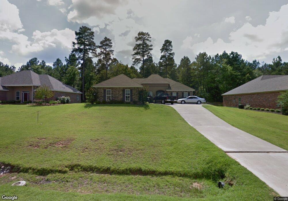
3111 Bourbon St Ruston, LA 71270
Estimated Value: $322,822 - $351,000
3
Beds
3
Baths
2,398
Sq Ft
$140/Sq Ft
Est. Value
About This Home
This home is located at 3111 Bourbon St, Ruston, LA 71270 and is currently estimated at $335,456, approximately $139 per square foot. 3111 Bourbon St is a home located in Lincoln Parish with nearby schools including Hillcrest Elementary School, Ruston Elementary School, and Ruston Junior High School.
Ownership History
Date
Name
Owned For
Owner Type
Purchase Details
Closed on
May 5, 2008
Sold by
Witt Dalals Jedidah and Witt Paige Holman
Bought by
Borkowski Dennis J and Borkowski Terrie Stives
Current Estimated Value
Home Financials for this Owner
Home Financials are based on the most recent Mortgage that was taken out on this home.
Original Mortgage
$177,450
Outstanding Balance
$112,143
Interest Rate
5.84%
Mortgage Type
New Conventional
Estimated Equity
$223,313
Purchase Details
Closed on
Jun 25, 2007
Sold by
The French Quarters Of Lincoln Llc
Bought by
Witt Dallas Jedidah and Witt Paige Holman
Create a Home Valuation Report for This Property
The Home Valuation Report is an in-depth analysis detailing your home's value as well as a comparison with similar homes in the area
Purchase History
| Date | Buyer | Sale Price | Title Company |
|---|---|---|---|
| Borkowski Dennis J | $225,000 | None Available | |
| Witt Dallas Jedidah | $32,500 | None Available |
Source: Public Records
Mortgage History
| Date | Status | Borrower | Loan Amount |
|---|---|---|---|
| Open | Borkowski Dennis J | $177,450 |
Source: Public Records
Tax History Compared to Growth
Tax History
| Year | Tax Paid | Tax Assessment Tax Assessment Total Assessment is a certain percentage of the fair market value that is determined by local assessors to be the total taxable value of land and additions on the property. | Land | Improvement |
|---|---|---|---|---|
| 2024 | $2,407 | $28,203 | $4,030 | $24,173 |
| 2023 | $2,186 | $24,601 | $3,120 | $21,481 |
| 2022 | $2,197 | $24,601 | $3,120 | $21,481 |
| 2021 | $2,034 | $24,601 | $3,120 | $21,481 |
| 2020 | $1,942 | $23,361 | $3,120 | $20,241 |
| 2019 | $1,971 | $24,272 | $3,120 | $21,152 |
| 2018 | $1,917 | $24,272 | $3,120 | $21,152 |
| 2017 | $1,922 | $24,272 | $3,120 | $21,152 |
| 2016 | $1,915 | $0 | $0 | $0 |
| 2015 | $1,854 | $21,585 | $3,120 | $18,465 |
| 2013 | $1,883 | $21,585 | $3,120 | $18,465 |
Source: Public Records
Map
Nearby Homes
- 1709 Rampart Dr
- 3114 Canal St
- 0 English Turn
- 1001 Chase Ln
- 2420 Highway 33
- 704 Hundred Oaks Dr
- 1729 Farmerville Hwy
- 0 Louisiana 33
- 3001 Belcara Dr
- 2104 Greenbriar Dr
- 509 E Kentucky Ave
- 503 E Kentucky Ave
- 2408 Rhody Dr
- 402 E Kentucky Ave
- 910 Laura Ln
- 1727 Trade Dr
- 145 Timber Ridge Cir
- 128 Marlou Cir
- 294 Moody Rd
- 521 Audubon Dr
- 3203 Bourbon St
- 3109 Bourbon St
- Lot #26 Bourbon St
- 3207 Bourbon St
- 3105 Bourbon St
- 1602 Decatur Dr
- 1603 Decatur Dr
- 3211 Bourbon St
- 1603 Esplanade Ave
- 3101 Bourbon St
- 1606 Decatur Dr
- 1607 Decatur Dr
- 3309 Canal St
- 1607 Esplanade Ave
- 3307 Canal St
- 1608 Decatur Dr
- 3009 Bourbon St
- 1609 Decatur Dr
- 3213 Bourbon St
- 1609 Esplanade Ave