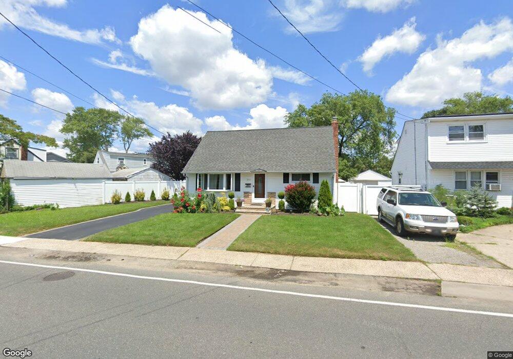
3111 Brower Ave Oceanside, NY 11572
Estimated Value: $615,000 - $679,389
4
Beds
1
Bath
1,109
Sq Ft
$584/Sq Ft
Est. Value
About This Home
This home is located at 3111 Brower Ave, Oceanside, NY 11572 and is currently estimated at $647,195, approximately $583 per square foot. 3111 Brower Ave is a home located in Nassau County with nearby schools including Oaks Elementary School - School 3, Oceanside Middle School, and Oceanside High School.
Ownership History
Date
Name
Owned For
Owner Type
Purchase Details
Closed on
Dec 17, 2019
Sold by
Cascavita Nelson and Lyon Charles
Bought by
Cascavita Nelson
Current Estimated Value
Purchase Details
Closed on
Dec 10, 2013
Sold by
Shaddock Kathleen A and Shaddock Lawrence
Bought by
Cascavita Nelson and Lyon Charles
Home Financials for this Owner
Home Financials are based on the most recent Mortgage that was taken out on this home.
Original Mortgage
$100,000
Interest Rate
4.47%
Mortgage Type
Purchase Money Mortgage
Purchase Details
Closed on
Feb 7, 2005
Sold by
Shaddock Kathleen
Create a Home Valuation Report for This Property
The Home Valuation Report is an in-depth analysis detailing your home's value as well as a comparison with similar homes in the area
Home Values in the Area
Average Home Value in this Area
Purchase History
| Date | Buyer | Sale Price | Title Company |
|---|---|---|---|
| Cascavita Nelson | -- | Fidelity National Title | |
| Cascavita Nelson | $250,000 | -- | |
| -- | -- | -- |
Source: Public Records
Mortgage History
| Date | Status | Borrower | Loan Amount |
|---|---|---|---|
| Previous Owner | Cascavita Nelson | $100,000 |
Source: Public Records
Tax History Compared to Growth
Tax History
| Year | Tax Paid | Tax Assessment Tax Assessment Total Assessment is a certain percentage of the fair market value that is determined by local assessors to be the total taxable value of land and additions on the property. | Land | Improvement |
|---|---|---|---|---|
| 2025 | $10,080 | $398 | $202 | $196 |
| 2024 | $3,169 | $398 | $202 | $196 |
| 2023 | $8,743 | $398 | $202 | $196 |
| 2022 | $8,743 | $398 | $202 | $196 |
| 2021 | $11,482 | $384 | $195 | $189 |
| 2020 | $8,160 | $511 | $510 | $1 |
| 2019 | $7,438 | $511 | $510 | $1 |
| 2018 | $6,955 | $511 | $0 | $0 |
| 2017 | $3,766 | $511 | $433 | $78 |
| 2016 | $6,105 | $511 | $433 | $78 |
| 2015 | $2,977 | $681 | $577 | $104 |
| 2014 | $2,977 | $681 | $577 | $104 |
| 2013 | $2,148 | $681 | $577 | $104 |
Source: Public Records
Map
Nearby Homes
- 3354 Knight St
- 25 Sunnybrook Dr E
- 3328 Woodward St
- 3309 Balsam St
- 2941 Moreland Ave
- 385 Oceanside Pkwy
- 484 Chelsea Rd
- 2860 Lenox Rd
- 515 Chelsea Rd
- 613 Smith Place
- 3432 Bayfield Blvd
- 3420 Woodward St
- 31 Arthur St
- 3309 Skillman Ave
- 653 Arthur St
- 647 Lincoln St
- 646 Lincoln St
- 528 Carpenter Ave
- 3487 Anchor Place
- 3483 Frederick St
- 3115 Brower Ave
- 3051 Fortesque Ave
- 3047 Fortesque Ave
- 3095 Brower Ave
- 3121 Brower Ave
- 3041 Fortesque Ave
- 3255 Harold St
- 3261 Harold St
- 3125 Brower Ave
- 456 Ayers Place
- 3267 Harold St
- 452 Ayers Place
- 462 Ayers Place
- 3031 Fortesque Ave
- 3131 Brower Ave
- 3134 Brower Ave
- 466 Ayers Place
- 3040 Fortesque Ave
- 3050 Fortesque Ave
- 3273 Harold St